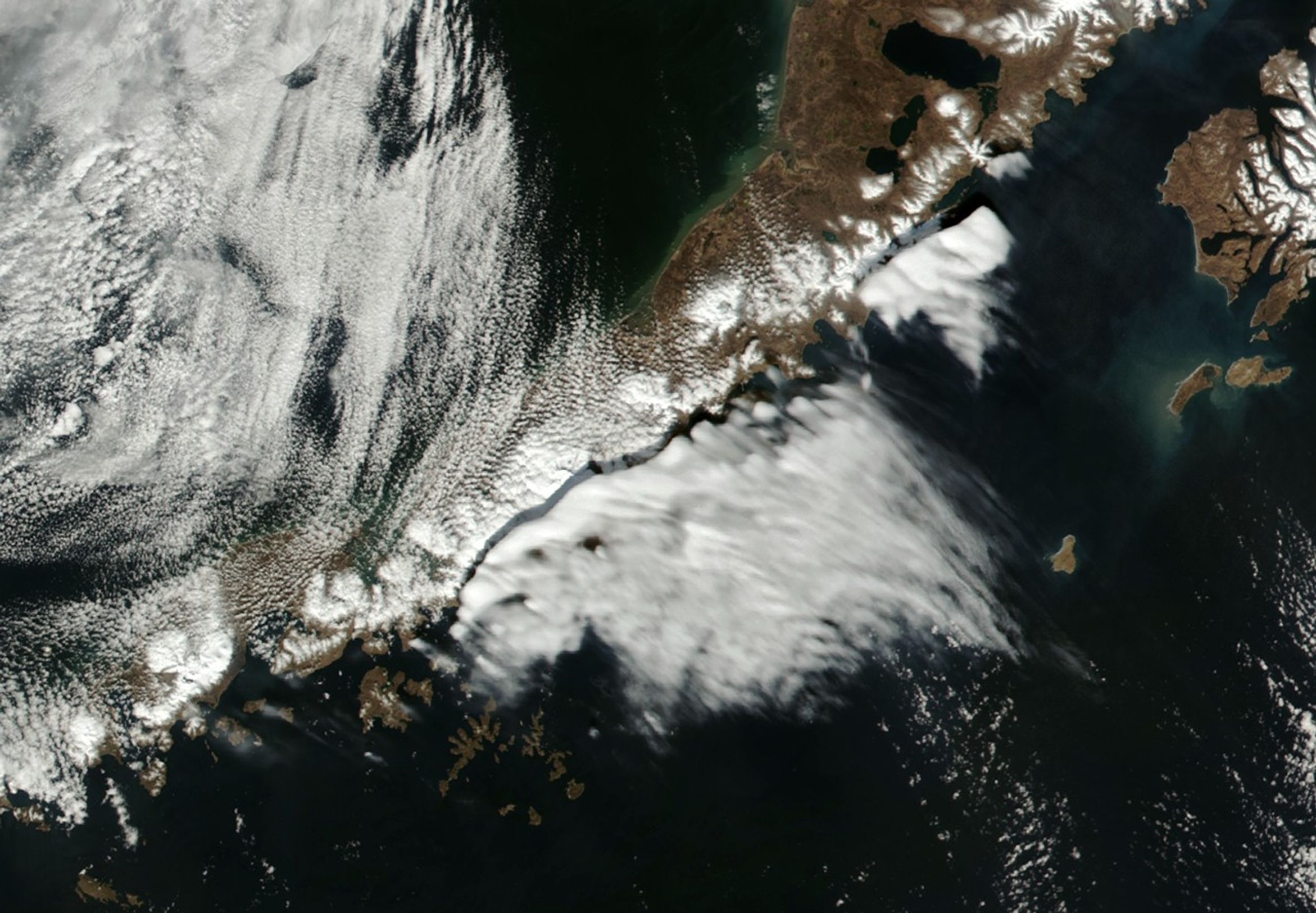


Standing wave clouds developed along the Alaska Peninsula in spring 2025, casting striking shadows across the surfaces below. The well-defined clouds built throughout the day on April 7 as rugged terrain lofted and cooled winds blowing out of the north.
The VIIRS (Visible Infrared Imaging Radiometer Suite) on the NOAA-21, Suomi NPP, and NOAA-20 satellites captured this series of images between 2:40 and 3:30 p.m. local time (22:40 and 23:30 Universal Time) on April 7. The animation help illustrates how these “topographically anchored” clouds stayed relatively stable and stationary, said Scott Lindstrom, a remote sensing expert at the University of Wisconsin-Madison’s Space Science and Engineering Center. Lindstrom was alerted to these clouds by staff at the National Weather Service Forecast Office in Juneau, Alaska.
Wave clouds form when prevailing winds encounter a topographic barrier, such as a mountain range. The air is forced to flow up and over the mountains, causing it to cool and any water vapor it contains to condense, forming clouds. The clouds may appear to hover in the sky even though wind is racing through them.
Atmospheric sounding data and ground observations collected that day showed strong, low-level winds blowing over the Bering Sea from the north, Lindstrom wrote in a blog post detailing the phenomenon. Around the time of the images, measurements also revealed a stable inversion layer from approximately 1,000 to 2,000 meters in altitude, above most of the peaks on the peninsula. As a result, he said, the conditions were right for standing wave clouds to form downwind of the ridge crests.
In the hours before the VIIRS sensors acquired the images above, the GOES-18 satellite, operated by the National Oceanic and Atmospheric Administration (NOAA), observed the wave cloud developing its well-defined northern edge. From a geostationary orbit, this satellite continuously monitors Earth’s Western Hemisphere.
However, because GOES orbits over the equator, it has an oblique view of higher latitudes. From its perspective, the clouds looked like they were located farther north over the Alaska Peninsula than they likely were, Lindstrom said, and their shadows were not visible. The case highlights the importance of the complementary nadir (straight-down) observations acquired by polar orbiters, he added, which include NOAA’s Joint Polar Satellite System and NASA’s Aqua, Terra, and PACE.
References & Resources
- CIMSS Satellite Blog (2025, April 8) Standing wave south of the Aleutian Islands. Accessed April 11, 2025.
- Mount Washington Observatory A Closer Look at Lenticular Clouds. Accessed April 11, 2025.
- NASA Earth Observatory (2014, June 7) The Aleutian Islands. Accessed April 11, 2025.
NASA Earth Observatory images by Michala Garrison, using VIIRS data from NASA EOSDIS LANCE, GIBS/Worldview, Suomi National Polar-orbiting Partnership, and the Joint Polar Satellite System (JPSS). Story by Lindsey Doermann.