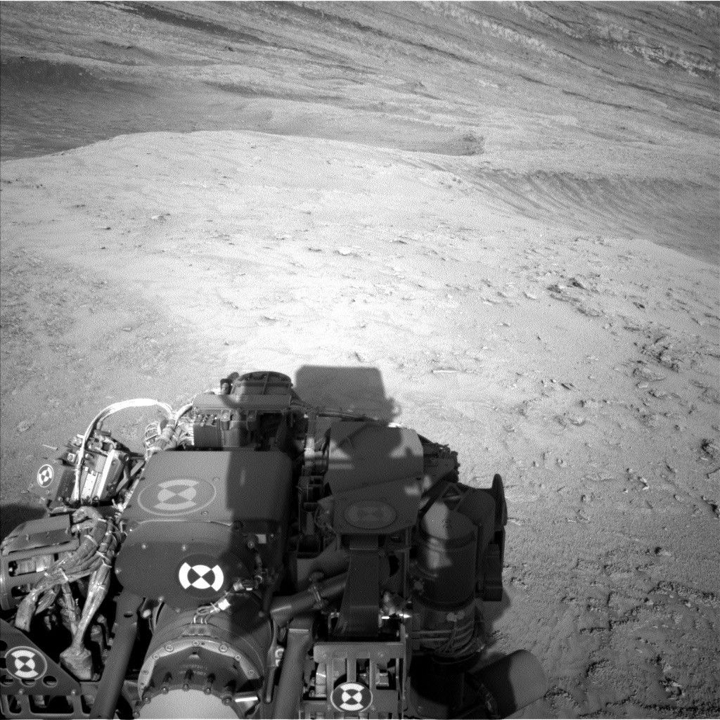
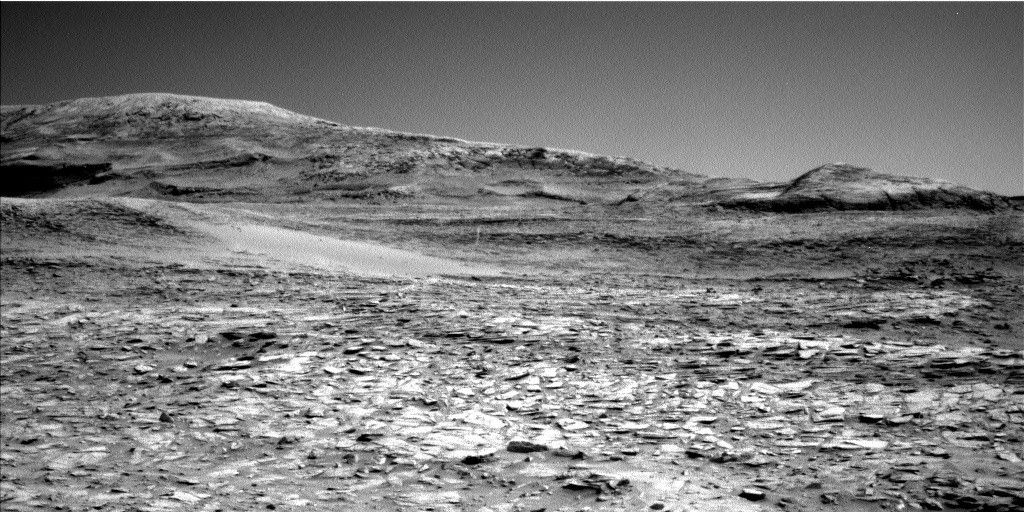
As the blog for sols 3807-3809 noted, we have cleared the canyon! The accompanying Left Navcam image shows the view back down the canyon, showing all those tricky rocks we had to climb over. You can even spot some wheel tracks further back down if you peer vey closely. We don't exactly have free-wheeling territory up ahead in our drive direction, but it is a little flatter. This hopefully will give us better views of the path ahead and reduce slippage as we drive, so that we can drive for longer than we have been recently – today, the RPs planned a 25 metre drive, much more ambitious than recent drives! We also will hopefully have a higher rate of passing our "SRAP" test (this stands for Stability Risk Assessment Process and is the way we evaluate rover stability) up here than we did last week as we climbed the canyon. If we fail SRAP, we cannot use the arm instruments MAHLI and APXS – and for me, as a scientist on the APXS team, that’s always disappointing.
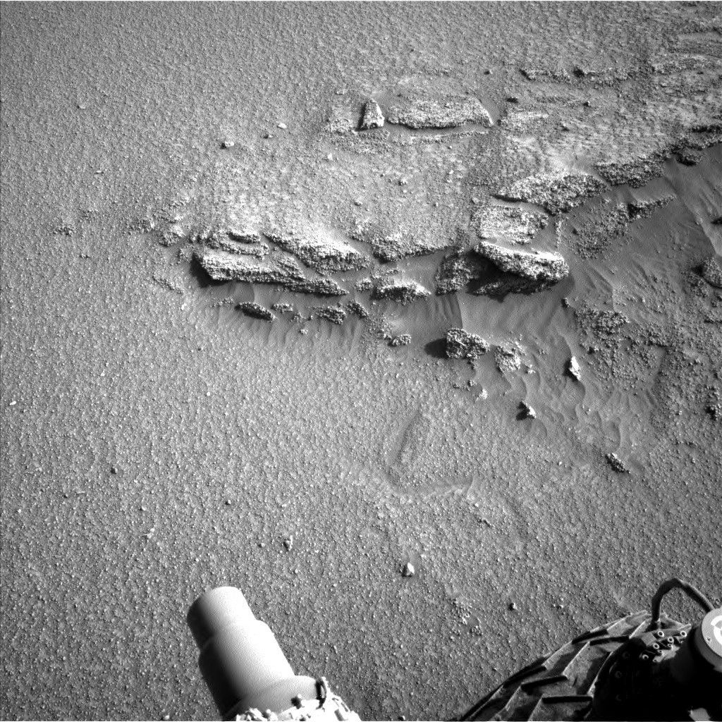
Fortunately, our weekend drive was successful – it took us where we had planned to go, ending with some solid workspace and safely parked to allow us to take the arm out for contact science. This bedrock has strong laminations apparent along its side and a flat top (seen here in this Left Navcam image of the workspace). The flat top is smooth enough for brushing, so we will DRT "Anortosito Repartimento" before taking MAHLI images, analyzing with APXS and getting a Mastcam multispectral image, all centred on the same spot for maximum science return.
ChemCam will use its LIBS instrument to look at an interesting fracture face, which looks like an upturned smile in the workspace image. "Galeras" is centred on the far right corner of the fracture, where the fracture is thickest. ChemCam will also take a long distance image ("LD RMI") looking much further afield to "Gediz Vallis ridge." These LD RMI can acquire a lot of detail from a great distance, helping to inform discussions about future science campaigns and potential drive directions.
Mastcam will take two mosaics close to the rover, a smaller mosaic looking at a laminated target ("Vichada") to the right of the workspace, and a larger mosaic covering the main block in our workspace (including the ChemCam and APXS/MAHLI targets) and the way that sand has gathered in a trough feature around the block.
Further afield, Mastcam will get an observation of the stratigraphy of the Chenapau butte and some interesting wind scour patterns just beyond today’s workspace.
ENV continue to monitor environmental conditions in Gale. In addition to our routine DAN and REMS measurements, Mastcam will acquire three tau measurements, which help to constrain the amount of dust in the atmosphere. Navcam will take a "dust devil" movie, in the hopes of catching a wind vortex in action.
Written by Catherine O'Connell-Cooper, Planetary Geologist at University of New Brunswick


