![Satellite image of a town centers the image surrounded by gridded roads and farmland in dark green and brown. Diagonally from the bottom left into the town a faint discoloration of the landscape is visible which becomes pronounced when it intersects the town where the green yards and fields are discolored significantly with light brown dust and debris from the destruction. The town is zoomed in on via in a square superimposed over the lower right of the image.](https://science.nasa.gov/wp-content/uploads/2023/06/greenfieldiowa-tornado-oli-20240525.jpg)
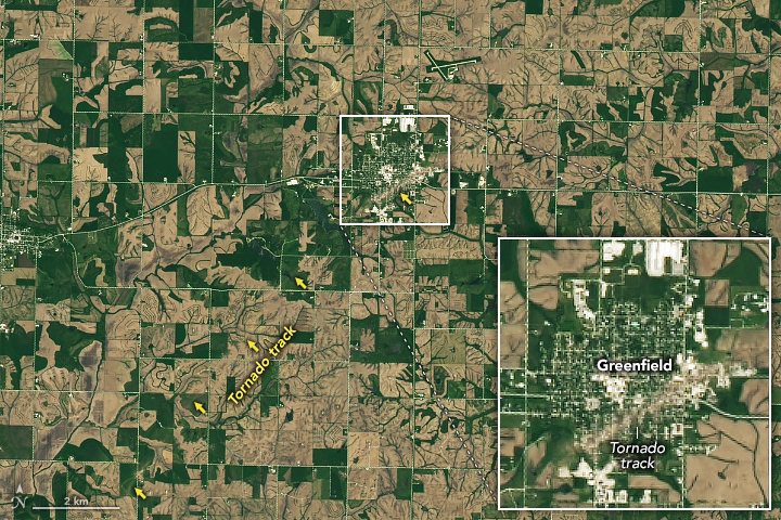
Tornado Damage in Greenfield
The destructive tornado destroyed homes, downed wind turbines and power lines, snapped trees, and shredded roofs. View the full story
Image Credit: NASA Earth Observatory / Michala Garrison
- X
https://science.nasa.gov/image-detail/greenfieldiowa-tornado-oli-20240525/
TakenMay 25, 2024
Image CreditNASA Earth Observatory / Michala Garrison
Size720x480px