Due to the lapse in federal government funding, NASA is not updating this website.

Suggested Searches

GeoXO

Geostationary Extended Observations (GeoXO) is a collaborative NOAA and NASA program that will provide continuous imagery and data on Earth’s atmosphere, land and ocean for operational forecasts and warnings. NASA will build and launch the GeoXO satellites and NOAA will operate them.
Future Mission

Recent Articles

Latest News

Related Mission

GOES Series Satellites

The information GeoXO supplies will improve short-term forecasting and warning of severe weather and hazards that threaten the security and well-being of everyone in the Western Hemisphere. The GeoXO mission will continue and expand the critical observations provided by the GOES-R Series.

Mission Type

Earth Orbiter

launch

Multiple Starting 2032

destination

Geostationary Orbit

Target

Earth
Banner with GeoXO logo type and the Mission Emblem shown with the earth in center and the stylized logo type for GEOXO across the center surrounded by a chrome border with the full spellout of the mission acronym being Geostationary Extended Observations.

OVERVIEW

GeoXO will provide advanced imagery and atmospheric measurements of Earth’s Western Hemisphere and real-time mapping of lightning activity. GeoXO will support short-term forecasts and warnings of extreme weather and environmental hazards. The first GeoXO launch is planned for 2032, as the GOES-R Series nears the end of its operational lifetime. The GeoXO mission will maintain and advance NOAA’s geostationary Earth observations through 2055.

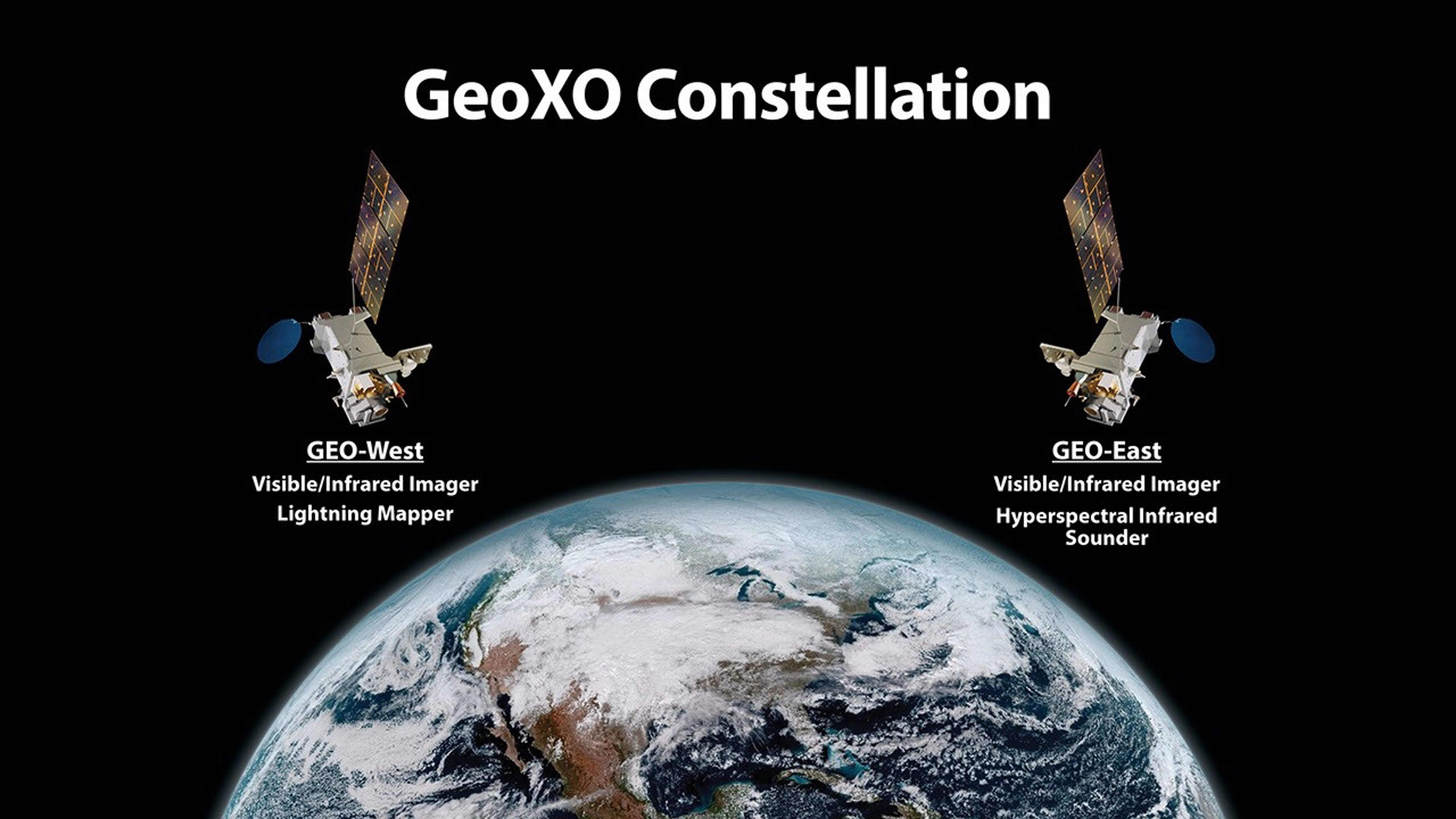
.Image showing 2 satellites above the earth labelled GEO East and GEO West.
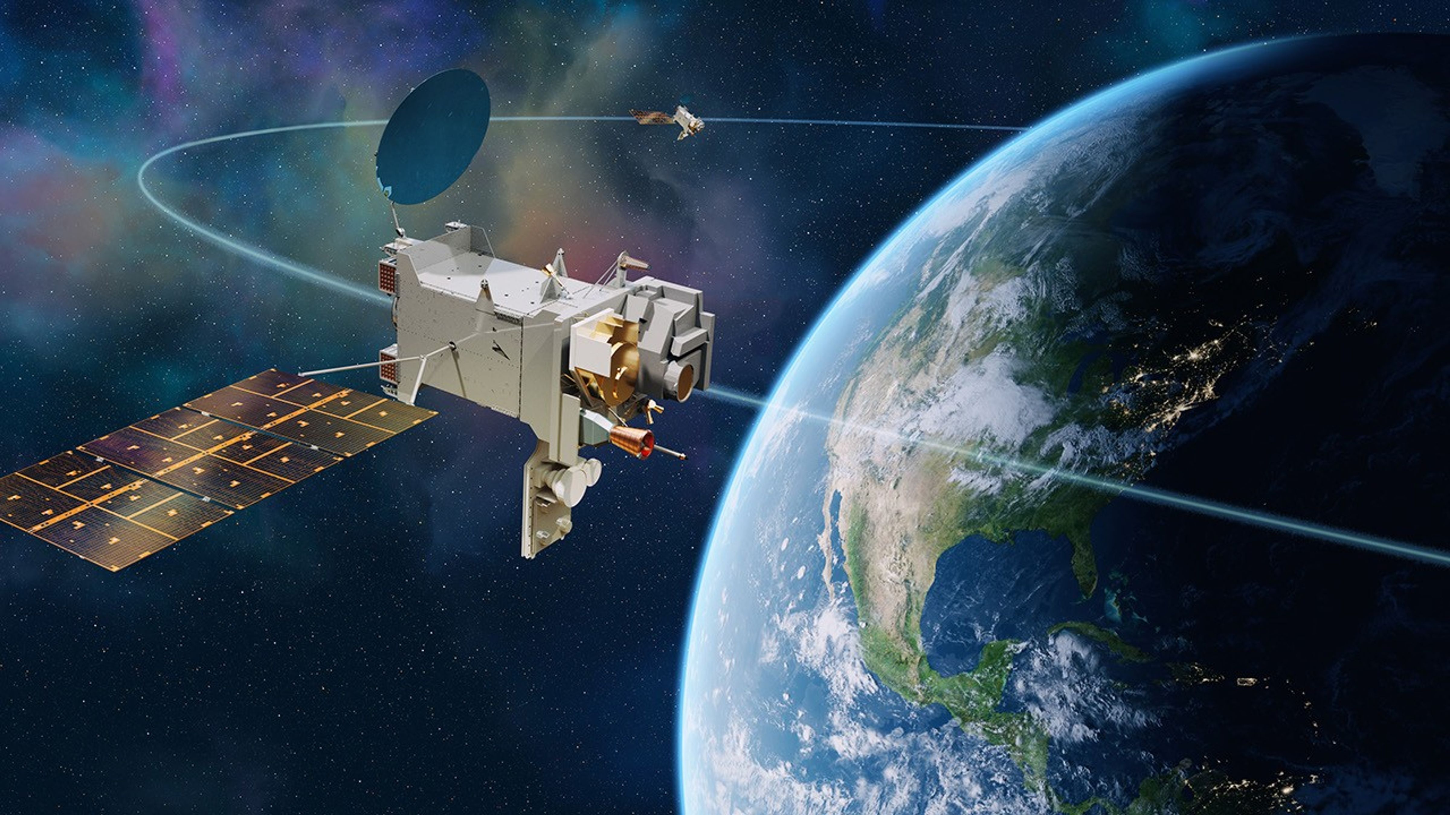
NOAA is planning a two-satellite GeoXO operational constellation. The GEO-East satellite will carry an imager and sounder, while GEO-West will carry an imager and a lightning mapper.
NOAA/Lockheed Martin

Instruments and Capabilities

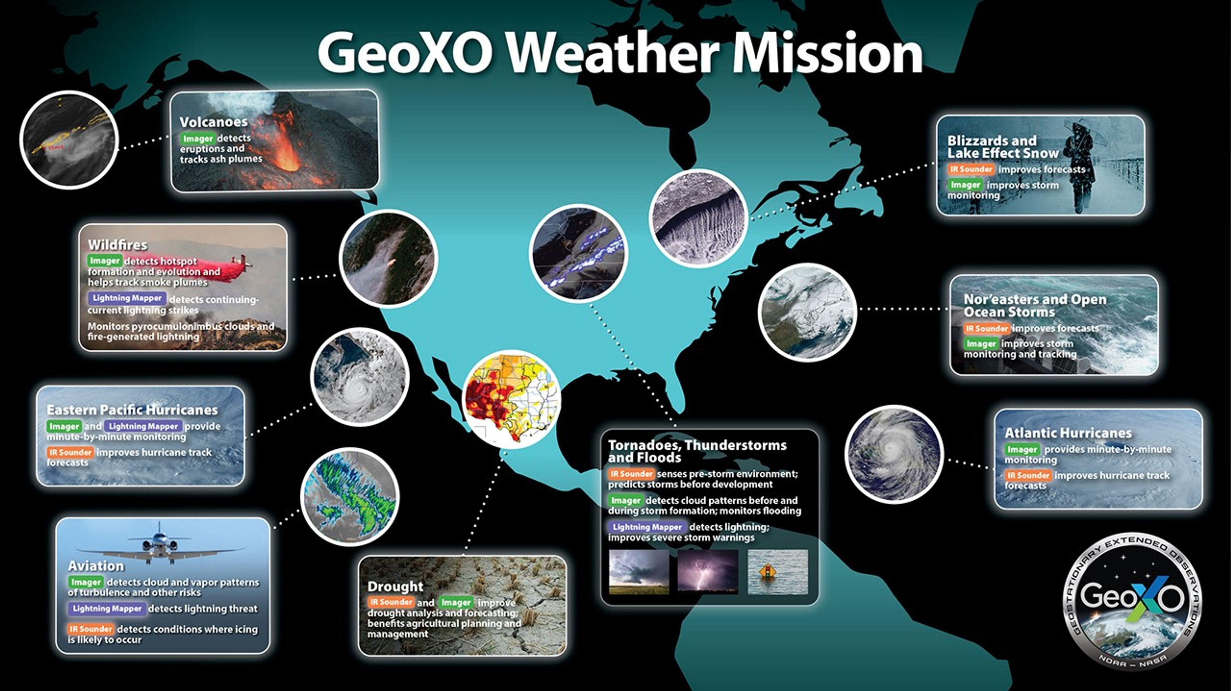
A composite of multiple inset images over an image of north and south america. Each image represents and instrument or aspect of the GEOXO mission.
New technology and scientific advancements will improve observations for weather forecasting. Data from GeoXO will contribute to forecast models and drive short-term weather forecasts and severe weather warnings. GeoXO will also detect and monitor environmental hazards like wildfires, smoke, dust, volcanic ash, drought, and flooding, providing advance warning to decision makers and improving lead times for public alerts. GeoXO’s advanced capabilities will help address the evolving needs of NOAA’s data users. NOAA plans for GeoXO to improve on GOES-R’s visible/infrared imagery and continue its lightning mapping capabilities. NOAA also plans for GeoXO to include hyperspectral sounding. See the instrument descriptions and links below for more information.
NOAA

Planned GeoXO Observations

Visible and Infrared Imagery: Real-time, high-resolution visible and infrared imagery for monitoring Earth’s weather, oceans, and environment.

Lightning Mapping: Lightning detection to analyze severe storms, predict the intensity of hurricanes, respond to wildfires, estimate precipitation, and mitigate aviation hazards.

Hyperspectral Infrared Sounding: Real-time information about the vertical distribution of atmospheric moisture, winds and temperature for better numerical weather prediction and forecasts for short-term severe weather.

GeoXO News Feed

Contacts / Media

Concept art of NOAA's GeoXO weather satellite consellation showing 2 satellites orbiting the earth
Concept art of NOAA's GeoXO weather satellite consellation
NOAA/Lockheed Martin