Suggested Searches

A picture of the United States with state and national borders superimposed. There is also an air temperature gradient superimposed on the map ranging from negative 25 degrees C to 25 degrees C. The color gradient goes from dark blue to white at 0 and then to dark red where blue is cold and red is hot. The Midwest is medium to dark blue and aside from the west coast and coastal southern states the majority of the United States is in the white color temperature region.

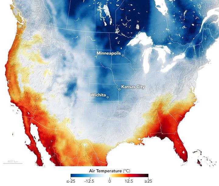
Cold and Snow Wallop the U.S.

The first major, widespread winter storm of 2025 delivered snow, ice, and frigid temperatures to a large swath of the country.

Download