


.png?w=1024)


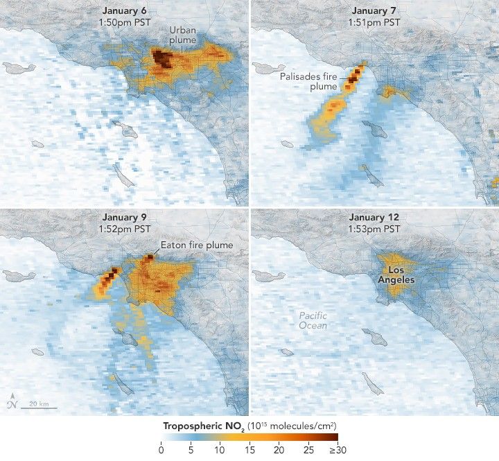
Unhealthy Skies over Los Angeles County
A series of images captured by NASA’s TEMPO sensor show the shifting location of nitrogen dioxide as destructive fires raged and smoke plumes streamed over the region.
- X
https://science.nasa.gov/image-detail/amf-c88a7e6d-c395-4dae-84d3-30051332f199/
Size720x665px
