Earth
Your home. Our mission.
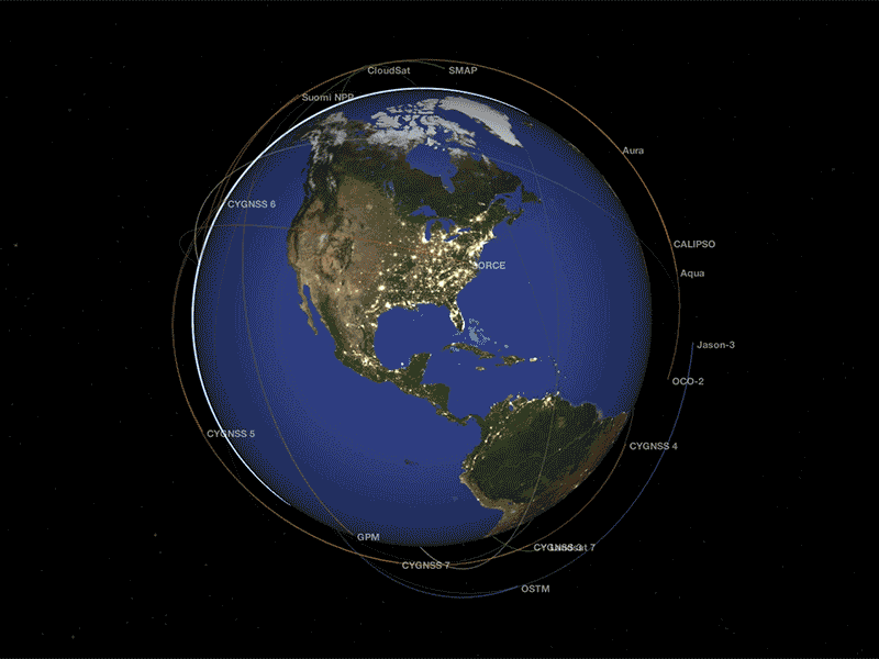
NASA is an exploration agency, and one of our missions is to know our home. We develop novel tools and techniques for understanding how our planet works -- for the benefit of humanity and for insights we need to explore other moons and planets. NASA's Earth Science Division operates more than 20 satellites in orbit, sponsors hundreds of research programs and studies, and funds opportunities to put data to use for societal needs. We develop new ways to observe the oceans, land cover, ice, atmosphere, and life, and we measure how changes in one drive changes in others over the short and long term. While listening to and collaborating with industry leaders, international partners, academic institutions, and other users of our data, we drive innovations and deliver science to help inform decisions that benefit the nation and the world.
Recent News and Articles

.png?w=3840&h=1846&fit=clip&crop=faces%2Cfocalpoint)
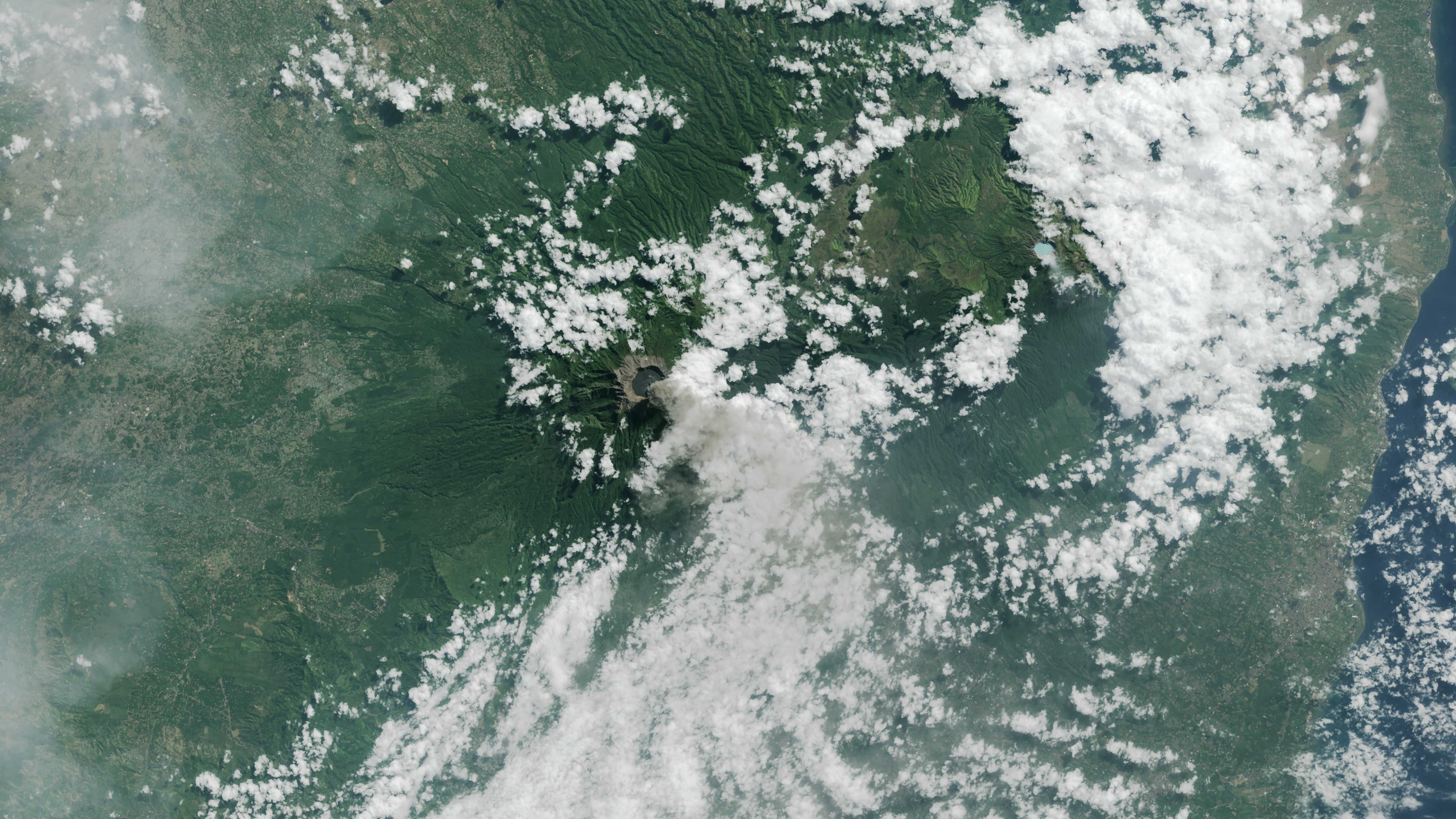
Earth Observatory Image of the Day

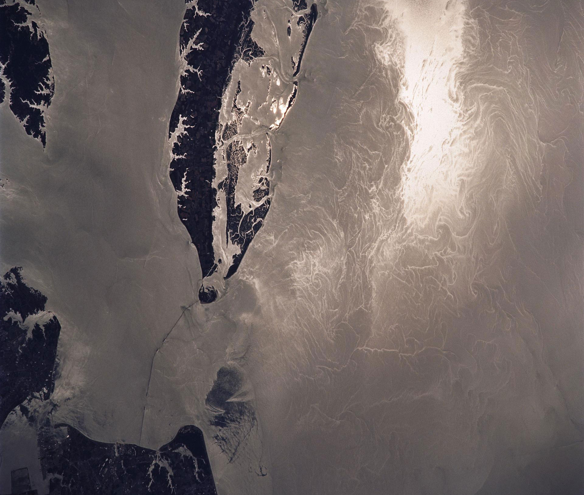
Marshy, sandy terrain and an impassable inlet helped colonial forces repel British forces during a pivotal battle on the barrier…

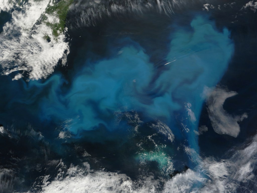
Phytoplankton added a milky blue hue to the waters of the Black Sea and nearby waterways in spring and summer…
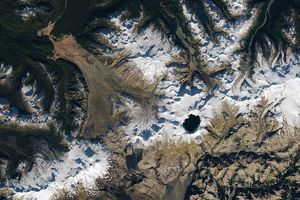
Apollo astronauts previewed their roles as lunar field geologists in Alaska’s Valley of Ten Thousand Smokes.
How NASA Uses Light to Detect Waste From Mines
Tens of thousands of abandoned mines threaten waterways across the American West, but identifying which sites urgently need cleanup is slow and expensive. Now, NASA’s EMIT instrument can analyze the unique light signatures of mine waste from space to help focus remediation efforts where they're needed most.
Access Earth DataScience in Action for Society
Learn how NASA’s studies of Earth bring benefits to the nation and world.


SWOT Mission Unlocks a New View of Our Waterways
Using data from the SWOT (Surface Water and Ocean Topography) mission, jointly developed by the NASA/JPL and the Centre National d'Études Spatiales with contributions from the Canadian Space Agency and the United Kingdom Space Agency, scientists can now measure rivers continuously and across the entire globe for the first time in human history.
From the Mississippi River to the Amazon, these observations reveal how rivers flow, how they change over time, and how they support ecosystems, economies, and communities worldwide like never before.
NASA’s Hurricane Science, Tech, Data Help American Communities
NASA's cutting-edge research, technology, and tools bolster the nation’s readiness and response to severe weather.
Read Article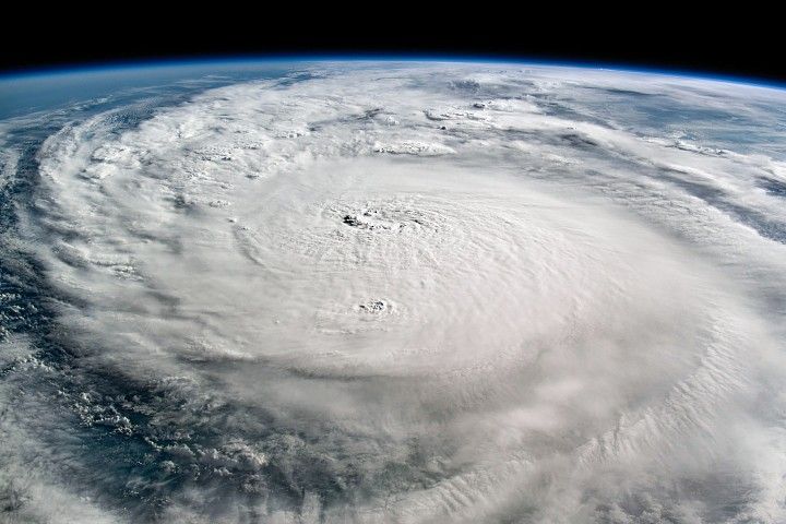
Sensing the Seas
For more than forty years, NASA has found unique ways to study the surface layers of the ocean from the tropics to the poles. With three new missions since 2020 – PACE, SWOT, and Sentinel 6-Michael Freilich – we are now ushering in a new era of ocean studies.

NASA’s PACE Mission Reveals a Year of Terrestrial Data on Plant Health
NASA, French SWOT Satellite Offers Big View of Small Ocean Features
Next-Generation Water Satellite Maps Seafloor From Space
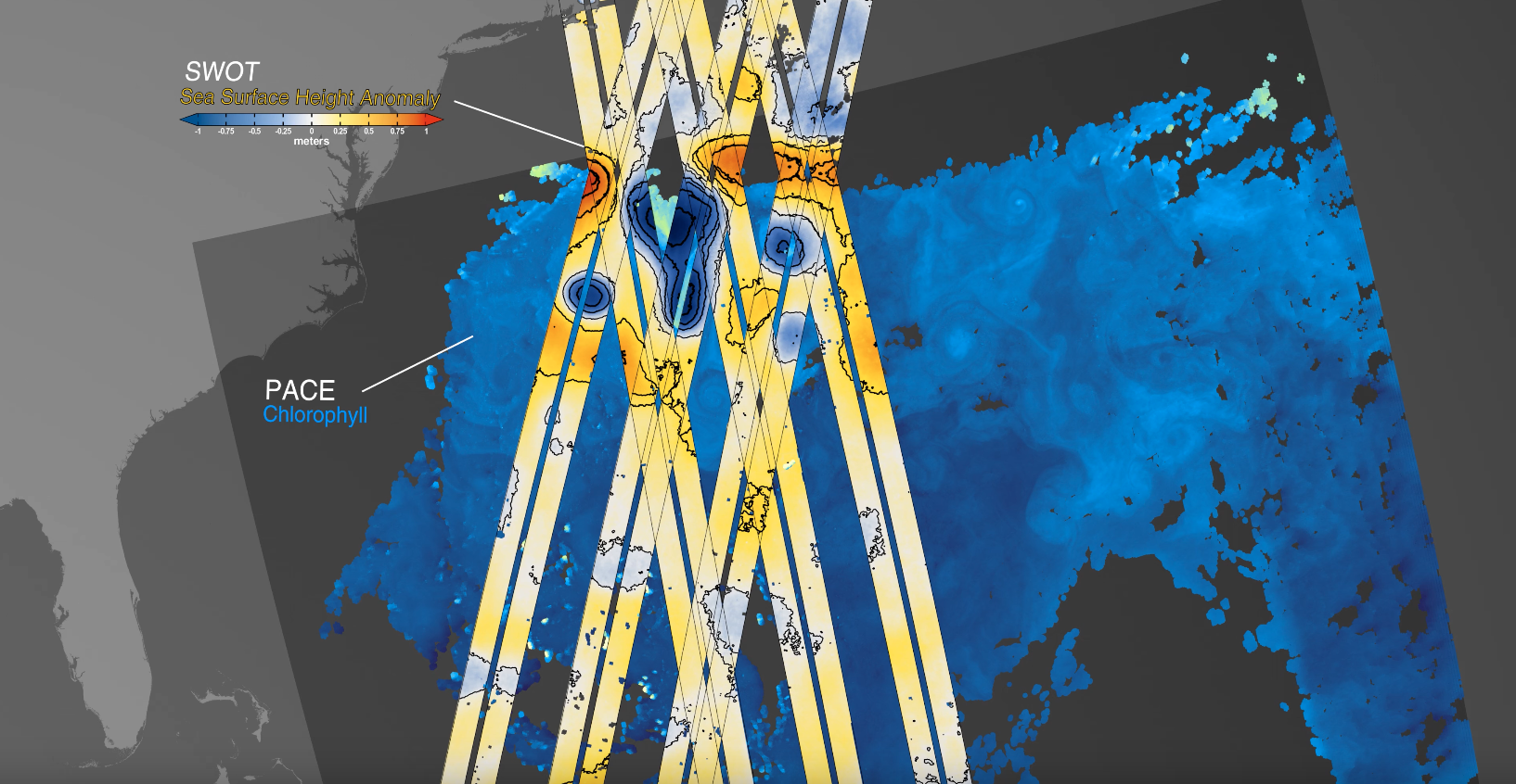
NASA’s PACE, US-European SWOT Satellites Offer Combined Look at Ocean

NASA Analysis Shows Irreversible Sea Level Rise for Pacific Islands

Earth Information Center
For more than 50 years, NASA satellites have provided data on Earth's land, water, air, temperature, and climate. NASA's Earth Information Center allows visitors to see how our planet is changing in six key areas: sea level rise and coastal impacts, health and air quality, wildfires, greenhouse gases, sustainable energy, and agriculture.
Explore