


.png?w=1024)


Wildfire Maps Help Firefighters in Real Time
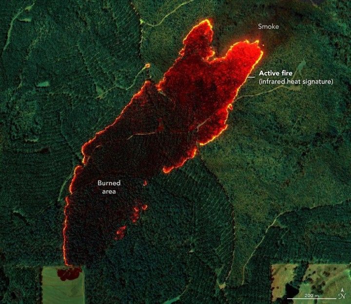
Detailed fire maps, produced in minutes with data from a NASA airborne sensor, enabled firefighters in Alabama to limit the spread of wildfires and save buildings.
Image Credit: NASA Earth Observatory/ Lauren Dauphin
- X
https://science.nasa.gov/image-detail/amf-1af54be9-6017-4e06-b913-dfb0f82f4d02/
Image CreditNASA Earth Observatory/ Lauren Dauphin
Size720x625px
