


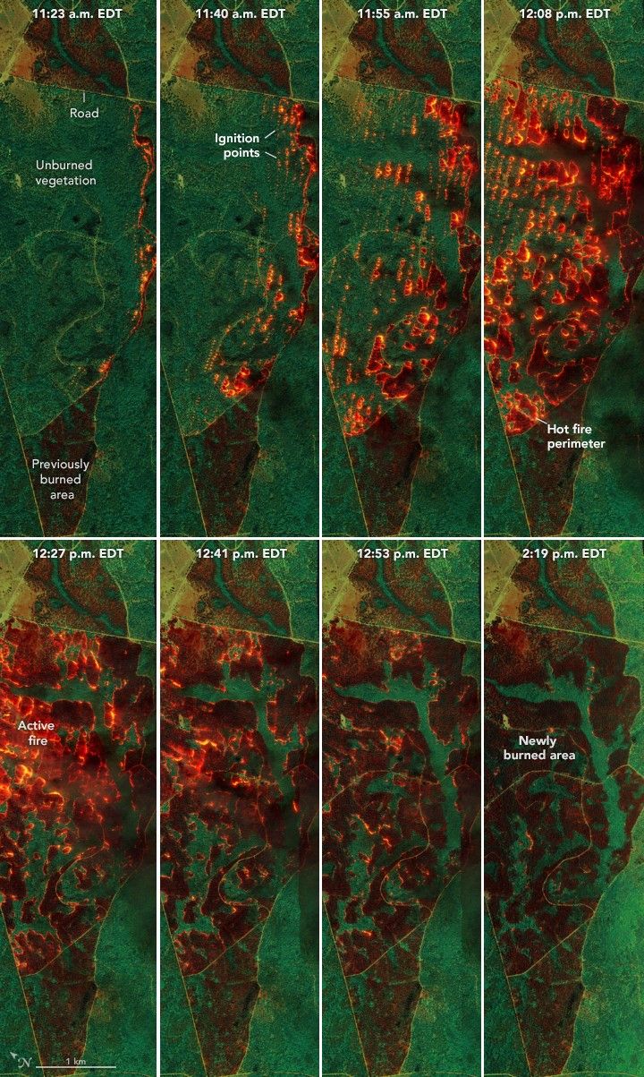
Mapping Fire’s Spread in a Georgia Pine Burn
NASA airborne technology revealed the progression of a controlled fire at Fort Stewart-Hunter Army Airfield.
- X
https://science.nasa.gov/image-detail/amf-1cb98006-0385-4f1e-894c-0d220dd0e384/
Size720x1203px
