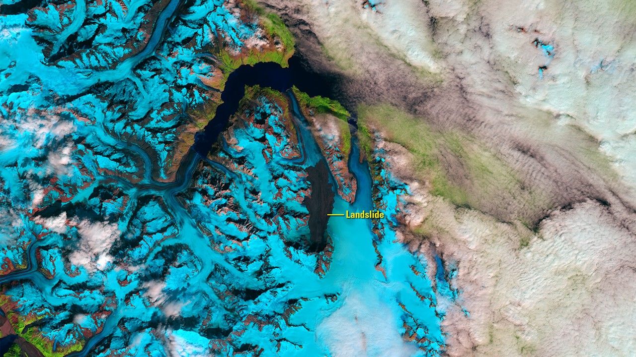
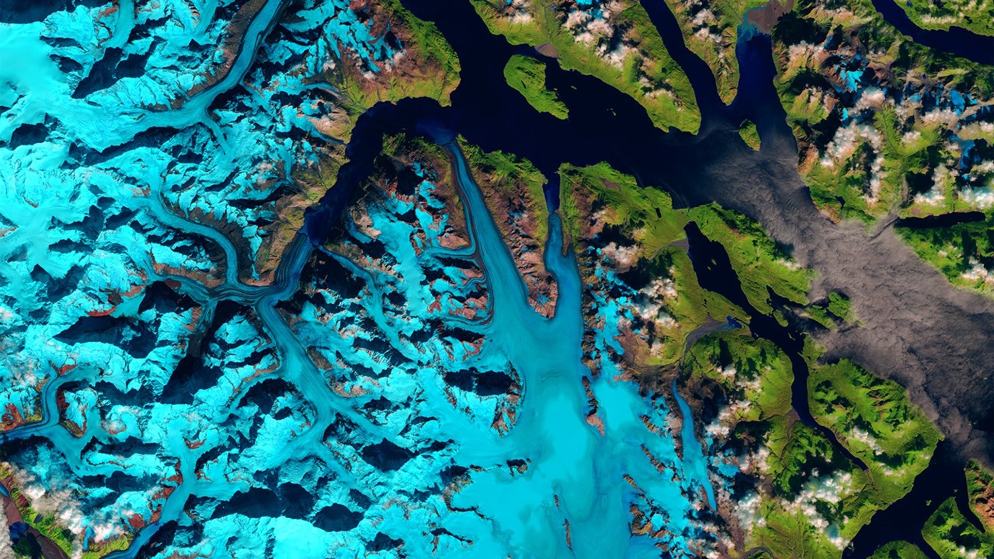
Due to the lapse in federal government funding, NASA is not updating this website.

Suggested Searches

1 min read

Landslide in Glacier Bay National Park and Preserve, Alaska

before
after
On June 28, 2016, a 4,000-foot-high mountainside in Glacier Bay National Park and Preserve collapsed, dropping rocky debris equivalent to 60 million mid-size SUVs onto nearby Lamplugh Glacier. Seismologists estimated that the material tumbled down the mountain for nearly one minute and then continued to slide along the glacier for another 6 miles. The southeast corner of Alaska, where this event took place, is geologically active and considered a hotspot for such landslides.   Images taken by the Operational Land Imager onboard Landsat 8. Source: U.S. Geological Survey (USGS) Landsat Missions Gallery; U.S. Department of the Interior / USGS and NASA.

Before and After

Landslide in Glacier Bay National Park and Preserve, Alaska

September 13, 2015 - August 7, 2016

On June 28, 2016, a 4,000-foot-high mountainside in Glacier Bay National Park and Preserve collapsed, dropping rocky debris equivalent to 60 million mid-size SUVs onto nearby Lamplugh Glacier. Seismologists estimated that the material tumbled down the mountain for nearly one minute and then continued to slide along the glacier for another 6 miles. The southeast corner of Alaska, where this event took place, is geologically active and considered a hotspot for such landslides. Images taken by the Operational Land Imager onboard Landsat 8. Source: U.S. Geological Survey (USGS) Landsat Missions Gallery; U.S. Department of the Interior / USGS and NASA.

Downloads

Image 1

JPEG

(2 MB)

Image 2

JPEG

(2 MB)