


Description
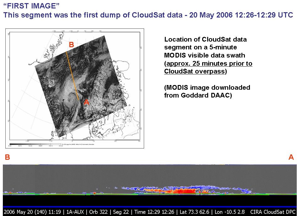
Figure 1
CloudSat's first image, of a warm front storm over the Norwegian Sea, was obtained on May 20, 2006. In this horizontal cross-section of clouds, warm air is seen rising over colder air as the satellite travels from right to left. The red colors are indicative of highly reflective particles such as water droplets (or rain) or larger ice crystals (or snow), while the blue indicates thinner clouds (such as cirrus). The flat green/blue lines across the bottom represent the ground signal. The vertical scale on the CloudSat Cloud Profiling Radar image is approximately 30 kilometers (19 miles). The blue line below the Cloud Profiling Radar image indicates that the data were taken over water. The inset image shows the CloudSat track relative to a Moderate Resolution Imaging Spectroradiometer (MODIS) infrared image taken at nearly the same time.


