


Morganza Floodway, 1973
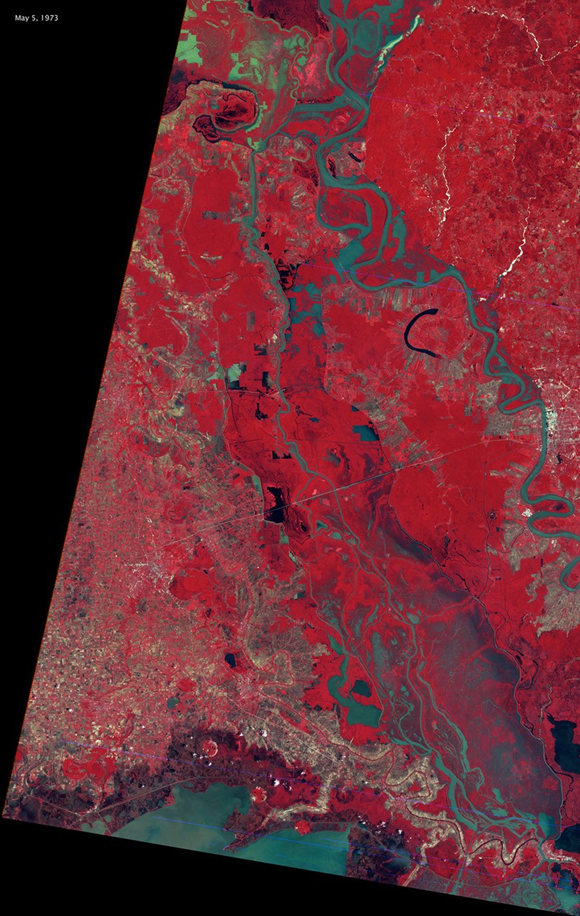
This false-color Landsat 1 image from May 5, 1973, captures the only time the Morganza Floodway has been opened prior to 2011. The greenish-brown areas show flood waters diverted from the Mississippi River through the emergency floodway, while red areas indicate vegetation tall enough to stand above the water. This historic use of the floodway helped reduce dangerous water levels in the main river channel.
Image Credit: NASA/Earth Observatory
- X
https://science.nasa.gov/image-detail/amf-53349496-c7c4-4128-9ca1-2ef8c8e176ed/
Image CreditNASA/Earth Observatory
Size1952x3080px
