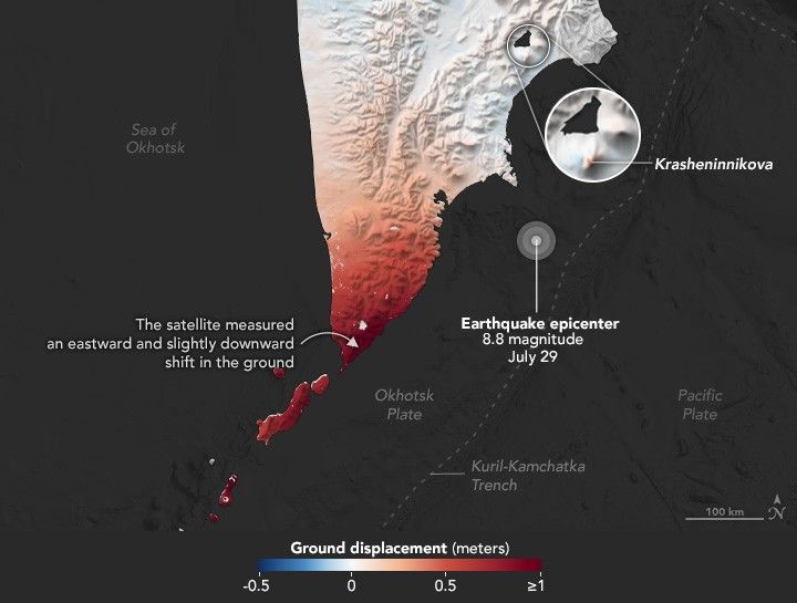
Mapping Kamchatka Earthquake Displacement
A group of satellites with interferometric synthetic aperture radar makes it possible for geologists to detect how much and where land surfaces shift due to earthquakes.
- X
https://science.nasa.gov/image-detail/amf-2a8b7887-3230-4dbc-a9f0-ae0ff506b3ce/
Size720x545px