


![Request for Information – Potential [Placeholder for Prize]](https://assets.science.nasa.gov/dynamicimage/assets/science/psd/solar/2023/09/s/solarsystem_0.jpg?w=1024)


Description
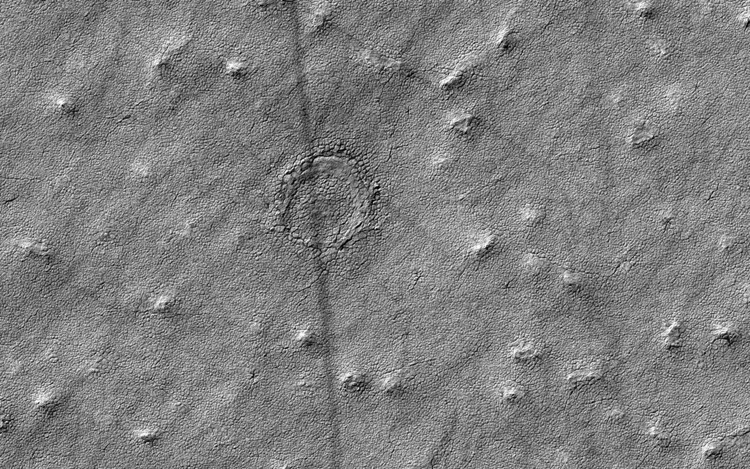
Map Projected Browse Image
Click on the image for larger version
This image was acquired to take a closer look at a circular feature that might be an impact structure on the South Polar layered deposits.
Measuring the sizes and frequency of impact craters provides a constraint on the age of the landscape. However, craters in icy terrain are modified by processes that flatten and change them in such a manner that it is hard to say for sure if it had an impact origin.
The map is projected here at a scale of 50 centimeters (19.7 inches) per pixel. [The original image scale is 49.8 centimeters (19.6 inches) per pixel (with 2 x 2 binning); objects on the order of 150 centimeters (59 inches) across are resolved.] North is up.
The University of Arizona, Tucson, operates HiRISE, which was built by Ball Aerospace & Technologies Corp., Boulder, Colo. NASA's Jet Propulsion Laboratory, a division of Caltech in Pasadena, California, manages the Mars Reconnaissance Orbiter Project for NASA's Science Mission Directorate, Washington.


