![Request for Information – Potential [Placeholder for Prize]](https://assets.science.nasa.gov/dynamicimage/assets/science/missions/a-step/FFR_Earth_Background_20251120%20.png?w=1024)


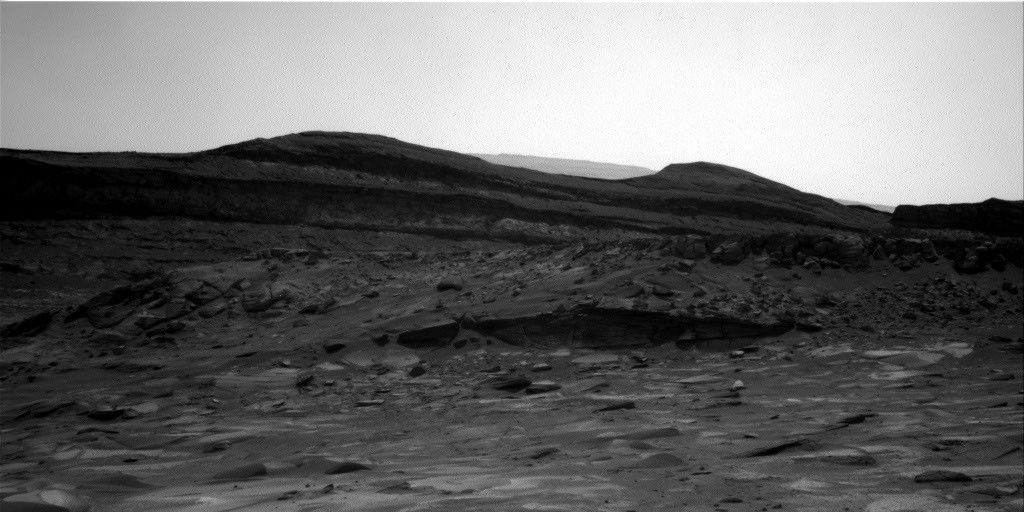
Last evening (June 27) between 8pm and 9pm PDT, Curiosity drove approximately 34 meters to the east to position herself just north of a large field of ripples on her way closer to ascending the iron oxide-bearing Vera Rubin Ridge. As Curiosity progresses towards the east, scientists back on Earth continue to look for opportunities to both gaze ahead towards interesting locations on the ridge itself, in addition to looking at the local rocks and sediment surrounding the rover. As we approach the lower units of Vera Rubin Ridge, our measurements of the "typical" rock that surrounds the rover will be vital to helping scientists understand how and why the ridge is different than the other units that have been investigated thus far in Gale Crater. Are we going to observe a very sharp transition in the composition and textures of rocks as we cross the threshold between the underlying mudstones of the Murray formation and the lowermost units of Vera Rubin Ridge? Or, alternatively, are we going to see a very subtle transition that might have gone unnoticed if not for the methodical measurements made upon approaching the ridge? Only time will tell, but we are making sure that we have the information necessary to definitively understand the nature of this transition.
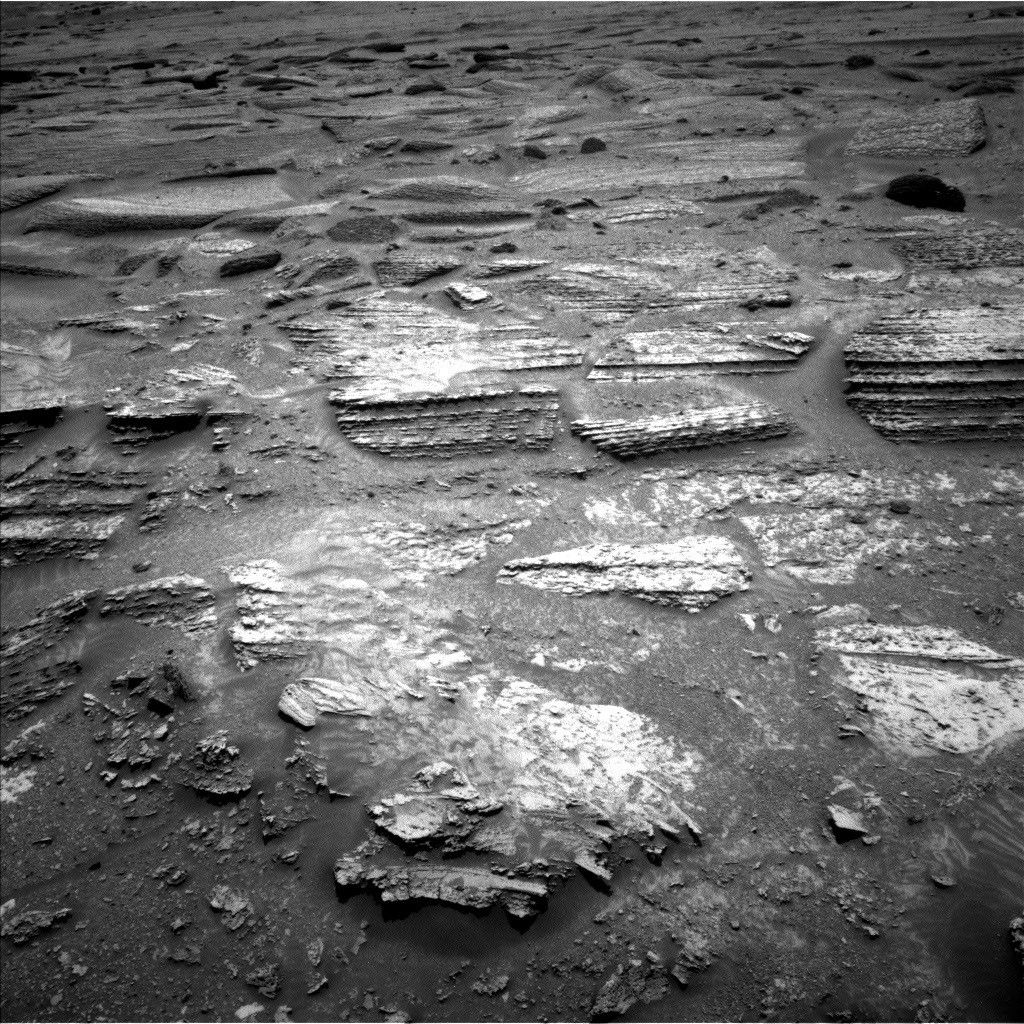
Our science plan for the next two days begins with firing the ChemCam laser at a bedrock target right in front of Curiosity known as "Cat Sized Island". The rock is almost a meter in length (more of a bobcat size than a standard house cat) and shows some interesting nodular textures that the science team wants to investigate further. Following this measurement, two different regions of Vera Rubin Ridge itself will be imaged using the ChemCam high-resolution Remote Micro-Imager (RMI). These measurements and observations will be followed up with color images collected by Mastcam for general documentation of the ridge, "Cat Sized Island," and the ChemCam target that was automatically analyzed after yesterday's drive.
Following these measurements, Curiosity will again take to the road and head further east northeast, positioning herself towards the northernmost tip of the nearby sand ripple patch. In the next few days, the plan is to turn Curiosity towards the east southeast around these ripples and towards the ideal location to begin the climb up Vera Rubin Ridge, which is still another ~275 meters distant.
The rover team is still operating under restricted planning conditions this week, which occurs when the offset in time between Earth and Mars prohibits the team from acquiring, downlinking, and analyzing the data collected by the rover with sufficient time to generate and uplink a science plan to the rover on a daily basis. In addition, with the Fourth of July holiday early next week, today's plan includes activities for three days on the Martian surface. Following Curiosity's drive, she will acquire her standard Navcam imagery surrounding the rover to allow Friday's science planning team to have a good view of the area accessible to the rover and the instruments. ChemCam will also acquire a LIBS analysis of an automatically selected target, and will also acquire passive spectra of several calibration targets onboard the deck of the rover. Lastly, MAHLI will image a tray on the rover deck that has been collecting windblown sand to help scientists better understand the properties of these particles and how the local winds are able to move materials. Curiosity will then turn in for the evening, but will wake up around 4:30am local time to image Deimos using the Mastcam instrument. The next morning, Curiosity will resume her science activities with a series of ChemCam passive observations of calibration targets on the deck of the rover, as well as Mastcam imaging of the rover deck to check on the hardware and monitor debris cover.
On the afternoon of the second day, Curiosity will acquire additional images that have become a familiar and consistent component of the rover's scientific investigation. The fixed and immovable Mars Descent Imager, or MARDI, will acquire a suite of images looking just below the rover's belly. MARDI acquired high-resolution video at four frames per second during Curiosity's descent to the Martian surface, and while its primary objective was completed the moment Curiosity landed safely on Mars, MARDI has since been used to perform surface science. MARDI routinely collects images of the ground immediately beneath the rover to characterize the physical properties of both rocks and sediment as the rover travels through Gale Crater. Because of its consistent viewing geometry and spatial resolution of approximately one millimeter per pixel, MARDI image acquisition has become a routine and integral component to our scientific investigation of the landscapes immediately surrounding Curiosity rover as she continues her journey up Mt. Sharp.
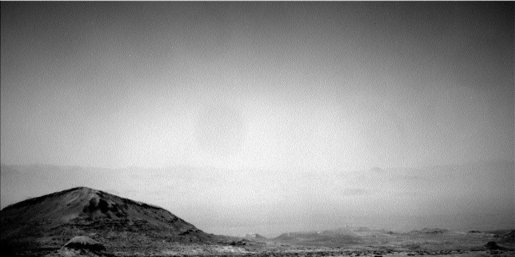
The third and final day of this observation plan will be dominated by environmental monitoring using both the Navcam and Mastcam instruments. First, Navcam will acquire several images to hunt for dust devils in Gale Crater. Then, Mastcam will acquire images of the rim of Gale Crater to investigate the amount of dust in the Martian atmosphere. Lastly, Navcam will point nearly straight up and acquire several images over several minutes to observe any possible clouds in the sky and their movement due to atmospheric winds. These observations will be used by scientists to improve our understanding of atmospheric processes on Mars and the specific atmospheric conditions present in Gale Crater.
Written by Mark Salvatore, Planetary Geologist at University of Michigan