Today was an exciting day of planning as Curiosity continued her ascent up Vera Rubin Ridge. The focus of the weekend plan was on carefully documenting the changes in stratigraphy as we leave the Murray bedrock. Fortunately, we are privy to a bevy of interesting targets and contrasting colors.
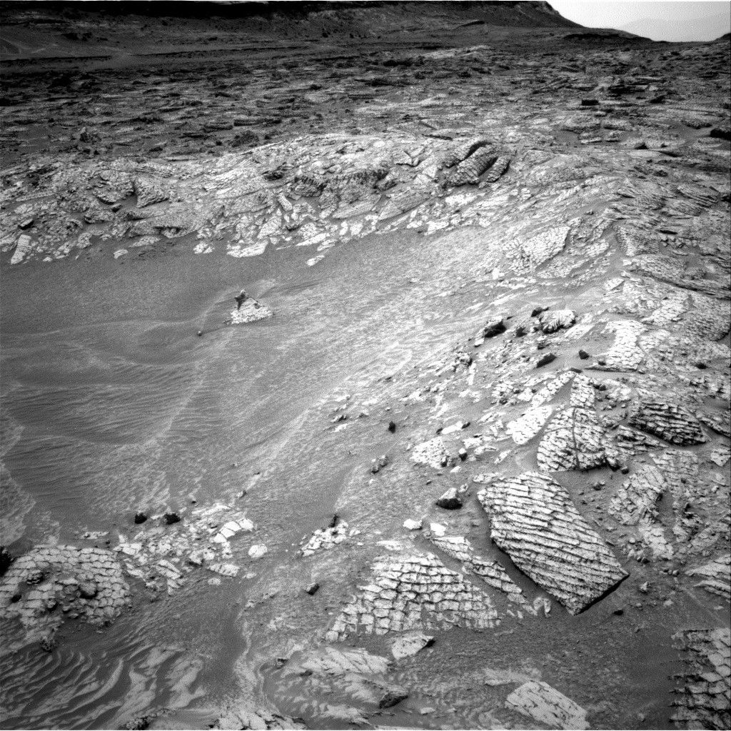
On the first sol of the plan, GEO concentrated on planning contact science with the rover arm and was eager to target purple (yes, not red, but purple) and tan facies of the exposed bedrock. As an atmospheric scientist, such an astounding set of contrasting tones catches even my attention. Many of the observations in the plan will be focused on determining the exact structure and composition of the purple rocks and how composition changes between purple and tan. "Sasanoa" is a tan, homogeneous target, and GEO planned MAHLI and APXS observations to assess grain size and composition. MAHLI and APXS will also target "Kemps Folly," which is a purple toned rock with fine banding. MAHLI alone will take a mosaic of "Mount Ephraim," which is a dark purple section of bedrock pictured in the bottom center of the above image, to assess sedimentary structures.
On the second sol (Sol 1812) ChemCam and Mastcam will complement the previous sol's contact science by observing both Sasanoa and Kemps Folly. ChemCam will then target the dark purple section of bedrock imaged by MAHLI, Mount Ephraim. Next, ChemCam will target "Mount Coe," which is a target that looks across the purple to tan colored bedrock contact to better characterize the composition in the transition between the bedrock tones. Mastcam will take stereo imaging of Mount Coe and "Two Brush Reef" to check for dips in the rock faces. Finally, Mastcam will image "Pettegrove Point" to further scout out Vera Rubin Ridge. After this, an approximately 5.5 m drive is planned to move further up Vera Rubin Ridge.
On the third sol (Sol 1813), the only GEO observation is an AEGIS automated ChemCam activity.
As ESTLK, my last day of operations consisted of planning an ENV morning imaging suite on the morning of Sol 1813, which will contain a Mastcam tau and LOS extinction measurement and two Navcam cloud movies, a supra-horizon movie and a zenith movie. Afternoon tau and LOS measurements will be repeated to check for diurnal variability in the amount of atmospheric dust. In addition, Navcam will make an LOS measurement for comparison to Mastcam values. REMS will fit in 24 extended, hour-long blocks, including four HRIM (High Resolution Interval Mode for humidity) measurements, and DAN will take the usual passive and post-drive active measurements.
Written by Joseph Battalio