![Request for Information – Potential [Placeholder for Prize]](https://assets.science.nasa.gov/dynamicimage/assets/science/psd/solar/2023/09/s/solarsystem_0.jpg?w=1024)


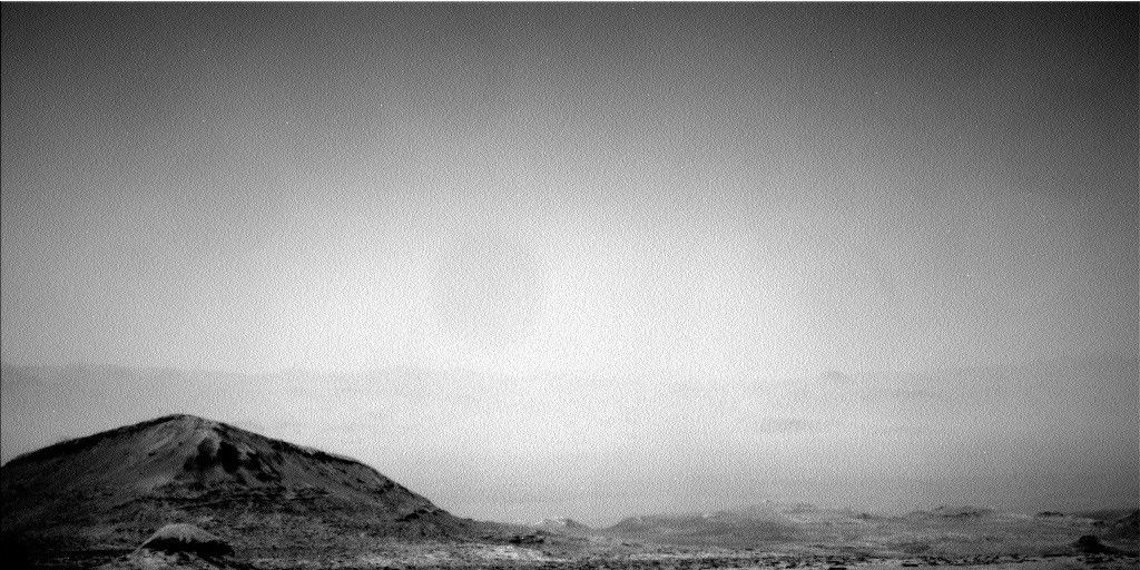
Clouds visible in a raw Mastcam image taken at about 4pm local true solar time on sol 2393.
Mars is steadily moving toward the cloudiest time of year at low latitudes, which occurs from about southern mid fall through mid winter. This means that right now, just over 40 Mars sols after fall equinox, we're expecting to see the cloud cover increasing, especially at the times of day when air temperatures are cooler. The image shows thin clouds, probably made of water ice, that are visible in a raw Mastcam image taken at about 4pm local true solar time on sol 2393.
In the previous plan, we added some Navcam cloud movies just after sunrise in Gale Crater. But in the current plan, we added a Navcam north-facing 'twilight' movie to look for clouds right after sunset. A nice side benefit is that we may be able to estimate the altitude of any clouds we observe, if we see them 'fade' during the movie. This is because the clouds will only appear bright if they're still receiving direct sunlight, and the time at which that ceases depends on how high they are above the surface. This is also a particularly good sol for taking north-facing cloud movies, because InSight - Curiosity's 'neighbor' a mere 600 kilometers to the north - will be taking some south-facing images at the same time. So in theory, both missions might see the same patch of clouds, provided they're high enough!
Other environmental activities in this plan include standard REMS, DAN passive, and afternoon cloud movies. We also added a Mastcam column opacity measurement and two dust devil activities: a 360° survey and a movie.
Down on the surface, CheMin will continue to analyze some of the sample taken from the "Kilmarie" target, which sits within more coherent bedrock, while the small remainder of the drill sample will be dumped onto the surface in a 'portion to exhaustion' activity. We also added repeat Mastcam imaging of the Kilmarie drill tailings, which we can compare with previous images to gain some idea of the wind strength and direction at our current location and season.
ChemCam will also be busy in this plan, with a long distance Remote Micro-Imager (RMI) mosaic of target "Pediment 2400a" as well as observations on some of the broken-up bedrock fragments around the rover, specifically "Delnabo 2," "Pitcaple," and "Dumyat 2," with Mastcam taking context images of the same three targets. The Mastcam ripple field mosaic couldn't be completed in today's plan, due to the arm being in the way, so the final images will now be taken in the plan that follows.
Written by Claire Newman, Atmospheric Scientist at Aeolis Research