


Laying Down with Smoke in the Valley, an Unexpected Camping Trip
By Ellen Gray / NEAR STANLEY, IDAHO /
Wednesday, July 24
We were ready to fly. We’d heard Tuesday evening that there were two seats open on the DC-8 for the communications team on Wednesday, but as often happens in the field, plans change. For the first science flight, requests for extra seats from the instrument teams came in after the morning briefing. Safety first, science second, and communications third. But rolling with the change of plans opens up new opportunities, and ours was leaving at 2 p.m.
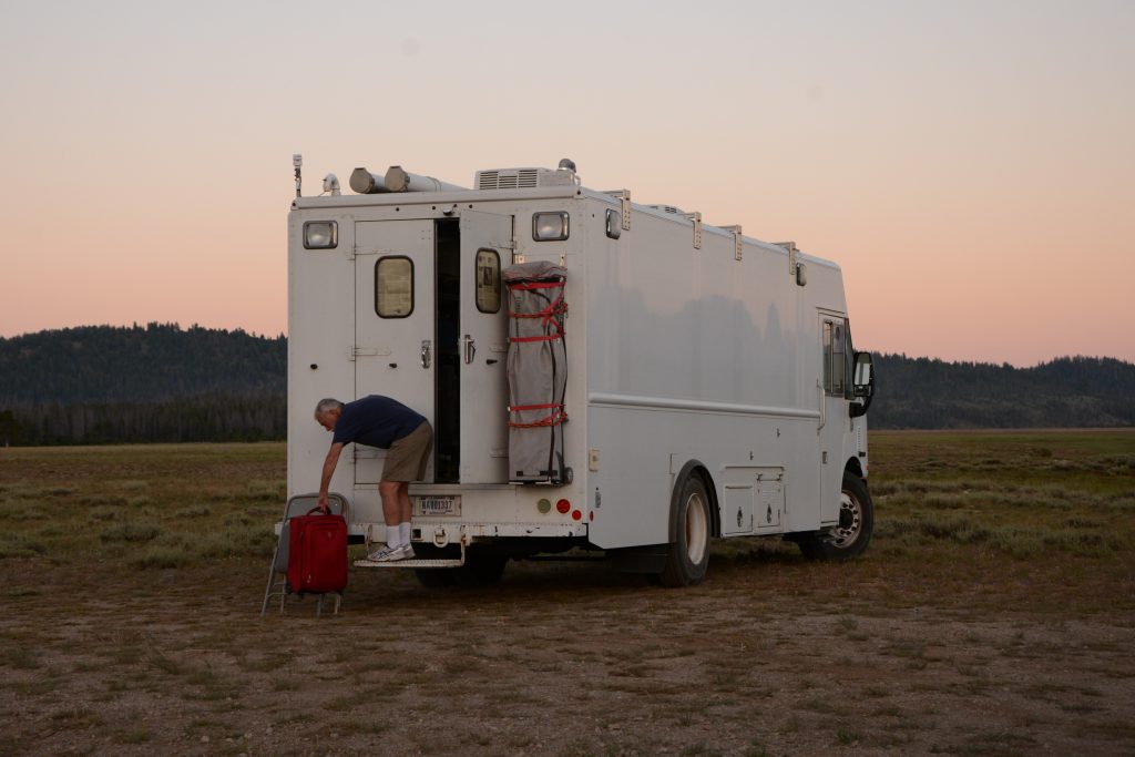
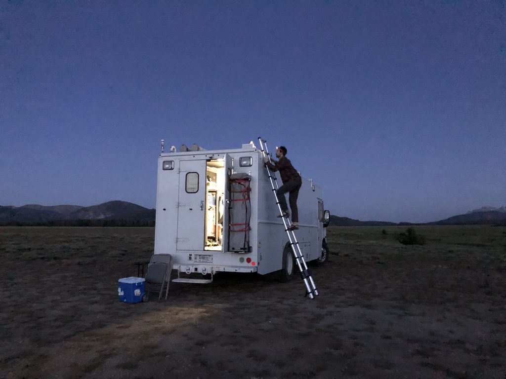
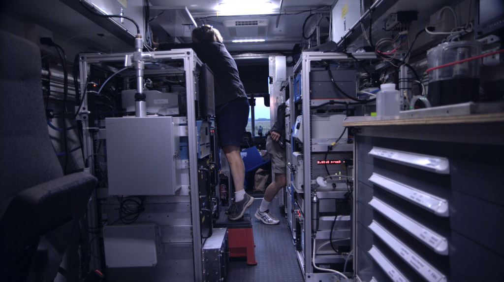
Out in the hangar parking lot, the NASA Langley Mobile Laboratory was getting ready to head into the Idaho wilderness. The van is big, boxy, and white. Unmarked, it looks like the kind of van movie FBI agents use for surveillance, but inside the equipment is designed to watch the sky. Specifically, the small team of five is looking at trace gases and aerosols from smoke plumes that will sink to valley floors during the night when temperatures cool.
The Langley Mobile Lab is one of two that will be deployed to take ground-level measurements during the FIREX-AQ field campaign. Ideally, the team parks the van downwind from a blazing fire whose smoke flows over the van site, said Bruce Anderson, the principle investigator for the NASA Langley Aerosol Research Group Experiment that runs the van. From their parking spot, they’ll watch the emissions evolve as the fire goes from hot and intense to smoldering and from hot daytime temperatures to cold nights and back to day.
With about two hours’ notice, Bruce graciously agreed to let us tag along. “Do you have camping gear?” he asked.
I had a sleeping bag I hadn’t expected to use during FIREX-AQ. None of us had meant to sleep anywhere but at our hotel. But this trip was too good to pass up. We reassured Bruce that we’d make do.
Landscape Shaped By Fire
Because of the van’s size, Bruce drove the long way on the major highways to Stanley, Idaho, a town in the middle of the Sawtooth National Recreational Area. We took the more direct and windier Highway 21 through the Boise and Challis National Forests.
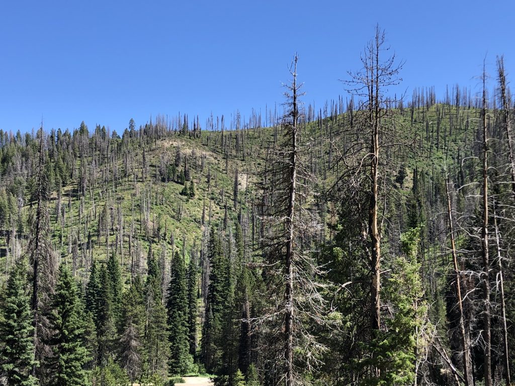
Boise is located on a plain, with brown hills dotted by shrubs dominating the landscape. As we drove northeast, the hills gave way to forests of lodgepole pines and subalpine firs. Fires’ mark on the landscape soon became clear.
Amid the green trees of the forest, we passed entire slopes of ghostly trees, burned pale and dead but still standing with bare branches. On some slopes, grasses and scrub had regrown. On others, smaller baby trees made up the understory. On still more, the burned ghost trees were interspersed with healthy green trees at the same height – likely grown to maturity after the fire. The marks of past fires were everywhere – and then we passed the blackened char of recently contained fires.
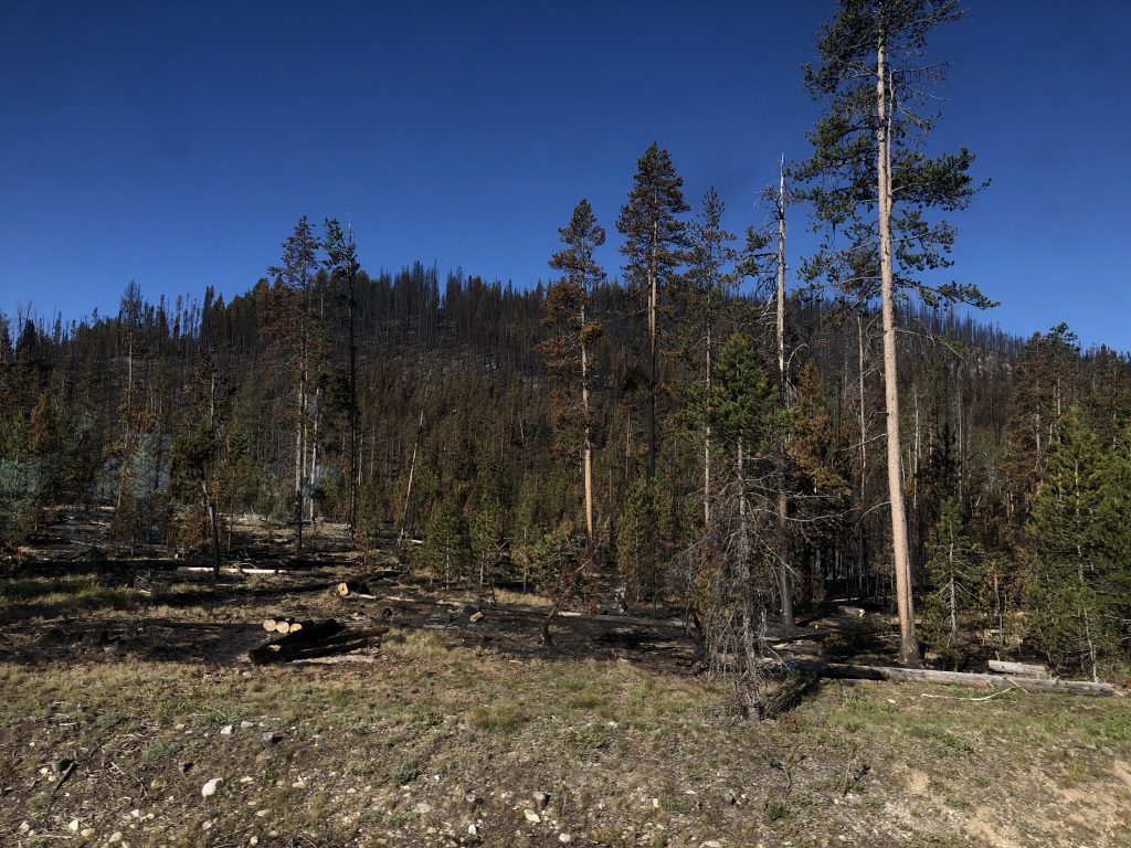
The Canyon Fire and the Vader Fire were both near the road, and while the flames were out where and when we saw them – each fire was 75-80% contained at that point – smoke was smoldering from a few hotspots on the ground. The Canyon Fire started from a lightning strike on July 14, a common cause for wildland fires. The Vader Fire’s cause is still unknown.
Nighttime Science
We met up with the team in Stanley at the end of Highway 21 around dinner time. It’s a tiny town with a tiny population of 63 that is the launching point for seasonal visitors to the Sawtooth’s and surrounding national forests. After three hours of driving with no reception, it’s also a welcome oasis of internet and cell service within the wilderness – essential for meeting up with the Mobile Lab caravan.
In addition to Bruce, Jackson Kaspari from the University of New Hampshire and Jiajue Chai from Brown University were driving an RV to make the camping a little easier. In a separate car were Kathleen Brunke from Christopher Newport University and Carolyn Jordan from the National Institute of Aerospace with tents and camping gear. They were all looking forward to being in the field for FIREX-AQ.
“It’s a little like science camp,” said Carolyn. “You get to go out with all these people who study the same thing you do.” She raised her hands in an excited pantomime of sharing data. “What did you get? Here’s what I got!”
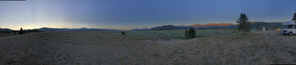
After dinner we headed out back the way we came a few miles down a long and wide valley with a stream running through it, and then off onto a lengthy gravel road to our campsite in the middle of the meadow.
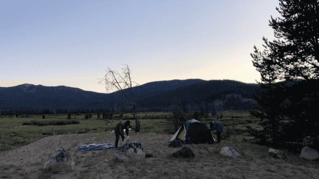
Off in the distance a plume of smoke from the Shady Fire to the north drifted by the nearby hills. Before sunset and after testing the wind direction, the scientists got to work setting up their instruments in the van – running the power generator, opening intake valves and hatches to the outside air, attaching filters to catch particulate aerosols. It was a clear night, and in the end not much smoke made its way to the middle of the valley where we were.
“It’s a little like fishing,” Bruce said. You do your best to find a good spot based on the information and weather, but sometimes the smoke doesn’t bite.
Earlier in the week, Sunday night to Monday morning, however, the Mobile Lab at the same site caught a lot of smoke from a fire near the highway. The smoke plume sank to the valley around midnight, and the team measured the height of the smoke particles with an infrared laser looking upward and bouncing off the particles back to the laser.
In the van, each researcher had an instrument measuring different aspects of the smoke and addressing different science questions. Carolyn’s instrument measured the scattering or absorption of light by smoke particles. The scattering tells her about the size and shape of the particles, and the absorption something about their chemical composition. Kathleen was collecting particulates in the air that she will take back to the lab to measure for heavy metals – evidence that bits of soil got burned and swept up into the smoke plume – and PM 2.5, the particulate matter size that can cause respiratory problems for people who breathe it in.
Jackson’s instrument collected air into hand-blown glass chambers filled with mist that serves as seed points to collect nitrite (NO2), nitrate (NO3), and sulfate (SO4) that then run through chromatography to determine their concentrations. Jiajue’s instrument collected air samples to measure for nitrogen oxides and nitrous and nitric acid. Nitrogen compounds are essential for determining the role ozone plays in the atmosphere. Ozone reacts readily with other gases in chains of chemical reactions that can ultimately process harmful gases like greenhouse gases out of the atmosphere. Jiajue also uses nitrogen and oxygen isotope ratios to “fingerprint” the fuel source of the air – whether the smoke came from vehicles, soils or burned vegetation.
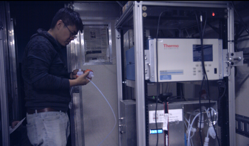
Bruce was a one-man show monitoring 14 instruments that doubled up some of the others’ measurements and also took measurements of major gases like carbon dioxide (CO2) and carbon monoxide (CO), whose ratio of one to the other can determine whether the smoke came from a hot intense fire (low CO) or smoldering fire (higher CO). Another instrument measures the mass of soot in the air, and others look at the optical properties of soot and various gases so that they can ultimately improve satellite interpretations of plume composition.
Together these individual measurements build a more complete understanding of how smoke particles and gases react and evolve in the atmosphere, what they say about their fuel sources, and ultimately how they affect the air quality people encounter downwind.
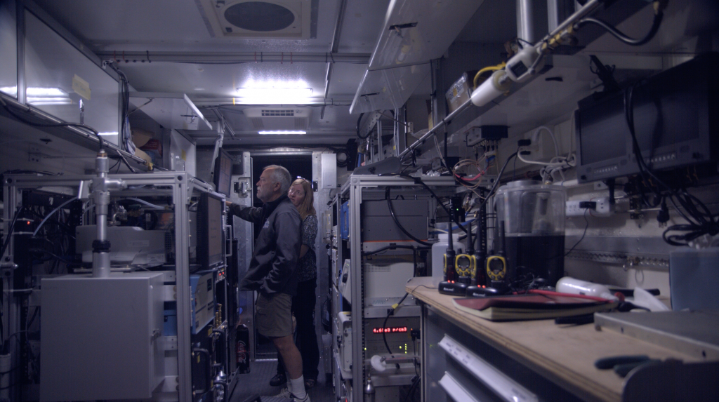
On a smoky night, the researchers barely sleep. While some of the instruments are fully automated, they often monitor them until past midnight, and Kathleen and Jiajue have to swap out filters and sample bottles every few hours.
The night we were out they got a reprieve, but Bruce stayed up most of the night anyway to monitor the instruments and make sure everything was running smoothly. Also, the cold made it difficult to sleep. While it was 95 degrees F in sunlight, the dry, cloudless Idaho night doesn’t hold moisture, and so temperatures dropped to below freezing, making the noisy, generator-heated van the warmest spot in camp. Those of us without proper camping gear, ended up sleeping in the car.
Despite the cold, we woke to a beautiful sunrise and to smoke plumes from the Shady Fire edging the valley. The Mobile Lab team packed up and headed back to Stanley for breakfast and to call in to the morning briefing on fire activity to find out where they were going next.
Join us on @NASAExpeditions Twitter and NASA Expeditions Facebook for more from FIREX-AQ.
