


December Puzzler
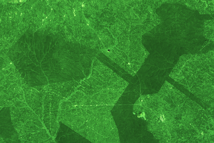
Every month on Earth Matters, we offer a puzzling satellite image. The December 2019 puzzler is above. Your challenge is to use the comments section to tell us what we are looking at, where it is, and why it is interesting.
How to answer. You can use a few words or several
paragraphs. You might simply tell us the location. Or you can dig deeper
and explain what satellite and instrument produced the image, what
spectral bands were used to create it, or what is compelling about some
obscure feature in the image. If you think something is interesting or
noteworthy, tell us about it.
The prize. We can’t offer prize money or a trip to
Mars, but we can promise you credit and glory. Well, maybe just credit.
Roughly one week after a puzzler image appears on this blog, we will
post an annotated and captioned version as our Image of the Day.
After we post the answer, we will acknowledge the first person to
correctly identify the image at the bottom of this blog post. We also
may recognize readers who offer the most interesting tidbits of
information about the geological, meteorological, or human processes
that have shaped the landscape. Please include your preferred name or
alias with your comment. If you work for or attend an institution that
you would like to recognize, please mention that as well.
Recent winners. If you’ve won the puzzler in the
past few months or if you work in geospatial imaging, please hold your
answer for at least a day to give less experienced readers a chance.
Releasing Comments. Savvy readers have solved some
puzzlers after a few minutes. To give more people a chance, we may wait
24 to 48 hours before posting comments.
Good luck!
See our “Peninsula of Pocosin” Image of the Day for the answer. Congratulations to Suryakant Verma and Sander Clement for being the first readers to identify the location and offer a detailed explanation for what makes the area interesting.