


Hurricane Resources for an Active Atlantic Season
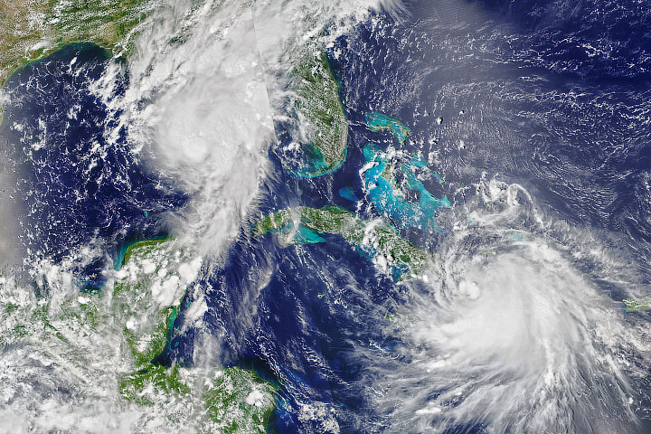
The 2020 Atlantic Hurricane season, which runs from June 1
to November 30, is off to an extremely active start. For the first time
in modern history, nine named storms formed in the basin before August 1. (The
historical average is two storms before August 1.) The National Hurricane
Center predicted 19 to 25 named Atlantic storms in 2020, with 7 to 11 of those
storms strong enough to be classified as hurricanes.
Accessing NASA data to track and research these events can sometimes feel like a maze. For a comprehensive starting point, Earthdata has a new Cyclones Data Pathfinder summarizing the data available for pre-assessing storms, making near real-time assessments, and conducting post-storm analysis. There is clear information on where to find and easily visualize those datasets.
In addition, you will find an article
in the “Learn” section of Earthdata that covers the improvements
made to hurricane forecasts and near real-time observations in recent years and
what future NASA missions might bring to the study of tropical storms. It also
examines some different satellite observations that can contribute to better
forecasting, such as sea surface temperatures (SST) and soil moisture measurements.
For the developers, the Earth Observatory Natural Event Tracker
(EONET) can be used to monitor tropical storms through an API that provides
up-to-date metadata for a variety of curated natural events. Use the
How-to Guide to find out more about how EONET can be used to track storms.
