Earth Visualization & Mapping
Filters

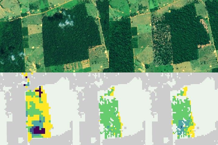
Scientists pioneered a new system that combines data from multiple Earth-observing satellites to identify forest clearing up to 100 days…

The glacier in southeastern Svalbard pulses with the changing seasons, speeding up and slowing its flow toward the sea.

Following a significant winter storm, frigid temperatures lingered in late January 2026 across a vast swath of the U.S.

Satellite-based maps show northern wildland fires becoming more frequent and widespread as temperatures rise and lightning reaches higher latitudes.

NASA’s Ames Research Center in Silicon Valley houses a unique laboratory: the Airborne Sensor Facility (ASF). The engineers at the…
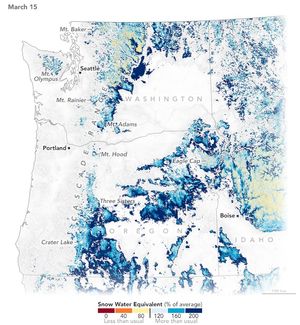
A warm and dry spring in the Pacific Northwest quickly depleted the seasonal snowpack, raising concern over summer water supplies…
We are kicking off 2025 with much to look forward to but also much to look back on.
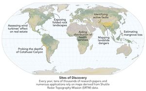
Elevation data collected during a space shuttle mission in 2000 continues to inform science and society in unexpected ways.

It took feats of engineering and deft piloting to map the planet’s topography, an achievement that continues to pay dividends…