


Powering Business

NASA is our nation’s engine of innovation in space, pioneering new technologies and measurements that enable American businesses to grow and our people to prosper. NASA Earth Science helps transform space-based observations into tools that drive economic growth, strengthen supply chains, and enhance national resilience. Industries — from agriculture and insurance to technology and public health — leverage our data and expertise to develop solutions that improve decision-making, optimize economic advantages and resources, and create jobs.
Why it matters
NASA works with industry to solve challenges. NASA Earth Science collaborations:
- Strengthen U.S. competitiveness by providing companies with world-class, open-source data — gathered via cutting-edge technology — to develop products and services.
- Enhance economic security by helping advance and stabilize key sectors, from food production and construction to insurance markets and asset management.
- Improve public safety and disaster preparedness by ensuring communities and officials have access to information when it matters most. For example, tools like NASA’s Fire Information for Resource Management System (FIRMS) provide near real-time data on wildfire activity across the U.S. and around the world, supporting risk management and operational planning.
Stats to Know:
- 74 percent of U.S. Fortune 100 companies have engaged with NASA Earth data.
- Users from U.S. Fortune 100 companies have downloaded more than 25 petabytes (25,000 terabytes) of data from NASA over the last 14 years — equivalent to streaming more than 8.3 million hours of HD video.
How NASA Helps U.S. Agriculture
NASA works with farmers like Dwane Roth of Kansas to help them track their use of a very precious and limited resource: water.
Watch on YouTubeWhat we do
Provide NASA Tech and Innovation
-
Enhancing Commercial Forecasting
The American weather company Tomorrow.io is leveraging breakthrough miniaturized radar technology first proven by NASA’s RainCube — a shoebox-sized satellite that successfully observed major storms using radar 100 times smaller than traditional systems.
By integrating this technology, Tomorrow.io is advancing commercial weather forecasting, with the goal of providing businesses and communities with accurate and timely storm insights to protect assets and infrastructure.
 RainCube (illustrated) was a pioneering small satellite designed to study precipitation using a compact radar system.Credits: Tyvak/Jonathan Sauder/NASA/JPL-Caltech
 -
Empowering Agricultural Solutions
NASA’s Earth observation data fuels innovation across industries, helping businesses develop cutting-edge solutions to everyday challenges.
In agriculture, NASA’s data plays a particularly transformative role. Companies like John Deere use remote sensing information — from weather forecasts to optical and radar-based reflectance measurements — to improve precision farming and enhance agricultural operations.
NASA’s ARSET and Pathfinders trainings provide expert guidance on Earth data quality and interpretation. As industries increasingly turn to data-driven solutions, NASA continues to be a trusted source of Earth science information, supporting innovation and economic growth. The Landsat 9 satellite captured this false-color image of Louisiana rice fields in February 2023.Credits: NASA Earth Observatory/ Lauren Dauphin
The data that NASA provides from its constellation of satellites and the associated trainings are of the utmost importance and incredibly useful for R&D of products and solutions for the ag industry.

John Just
Senior Manager, Data Science at John Deere
Protect Lives, Property, and the Economy
-
Damage from severe thunderstorms and hailstorms costs billions of dollars each year, disrupting business and insurance markets and damaging infrastructure. NASA’s Disasters Program is building on the success of previous collaborations with commercial partners with a new project to improve severe storm hazard predictions. This effort will help industries better assess and mitigate risk from these storms, while augmenting the operations and predictive capabilities of NOAA and other weather services.
Through a partnership with WTW (a global risk management firm), the Karlsruhe Institute of Technology, and the European Severe Storm Laboratory, NASA integrates decades of satellite data with artificial intelligence to refine storm trend analyses.
By transforming satellite observations into actionable data, NASA is helping businesses and communities prepare for and recover from severe storms. Left: A lightning strike illuminates the Atlanta skyline. Analyzing decades of satellite data can help identify trends and predict where future storms are most likely to occur in a specific area. Right: This photo taken on May 17, 2024, shows a commercial building’s damage after a straight wind derecho struck Houston.Credits: Left: David Selby (CC by 3.0) Right: NOAA/NWS
The impact is real. With improved storm models:
- Insurance companies can keep coverage more accessible while reducing financial volatility.
- Farmers gain tools to better anticipate and mitigate crop losses.
- Cities can strengthen infrastructure against severe weather.
Hailstorms are a growing concern for the insurance and reinsurance industries... Our continued collaboration with NASA and other experts enables us to provide insurers with the insights needed to respond to this complex peril.
Daniel bannister
Weather & Climate Risks Research Lead at WTW
Deliver Rapid Disaster Response
-
Record Floods In South Dakota and Iowa
NASA’s Disasters Program works closely with commercial partners to develop Earth science products that can provide critical awareness to disaster response agencies across the United States.
When record floods struck South Dakota and Iowa in June 2024, NASA used high-resolution Planet satellite data, provided through NASA’s Commercial Satellite Data Acquisition program, to map floodwaters along the Rock River. This critical information helped partners, including FEMA, in their response efforts.
 This map shows potentially flooded areas around the Rock River in Iowa in June 2024, derived from Planet imagery.Credits: NASA Disasters Program, includes copyrighted material of Planet Labs PBC. All rights reserved.
 -
Hurricane Beryl and Tornadoes in Texas
Similarly, after Hurricane Beryl spawned devastating tornadoes across the southern United States in July 2024, NASA’s Disasters Program analyzed Planet satellite data to help the National Weather Service map tornado tracks. As a result, NWS more accurately documented tornado damage paths, identifying affected rural areas in Jasper County, Texas.
 This satellite image shows southwest of Jasper, Texas, before a tornado passed through (left) and after (middle) in June 2024. NASA helped the National Weather Service better identify the path of destruction (marked with the red line, right).Credits: NASA Disasters Program, includes copyrighted material of Planet Labs PBC. All rights reserved.
 -
Mapping Destruction and Aiding Recovery
When Hurricane Helene brought devastating floods, landslides, and power outages to the southeastern U.S. in September and October 2024, NASA Disasters Program scientists once again turned to high-resolution Planet data. This time, the team visually identified landslides and mapped their locations in western North Carolina, South Carolina, and Virginia.
These mapped landslides were integrated into the U.S. Geological Survey’s Landslide Observations Dashboard, helping emergency managers better understand affected communities, roads, and structures. NASA Disasters staff also worked with state emergency management agencies from Florida, Georgia, North Carolina, Virginia, as well as NOAA, FEMA, and the American Red Cross. Observations from such events are being integrated into risk-prediction capabilities and in planning to help communities be better prepared for future events.
 Torrential rains from Hurricane Helene swamped communities in the mountainous western part of North Carolina and neighboring states.Credits: NASA Earth Observatory/Michala Garrison and Lauren Dauphin
Strengthen Public Health
-
Access to clean air isn’t just a public health issue — it’s an economic concern, too. That’s why companies like Google-owned BreezoMeter incorporated NASA data to support their near real-time air quality products, combining it with data from low-cost sensors and other sources.
Without realizing it, millions of iPhone and iPad users rely on insights from BreezoMeter and NASA’s fleet of Earth-monitoring satellites when they check air quality in the weather app.
These insights can help:
Businesses manage workforce health and productivity.
Citizens make informed choices about outdoor activities.
First responders track wildfire smoke and pollution.
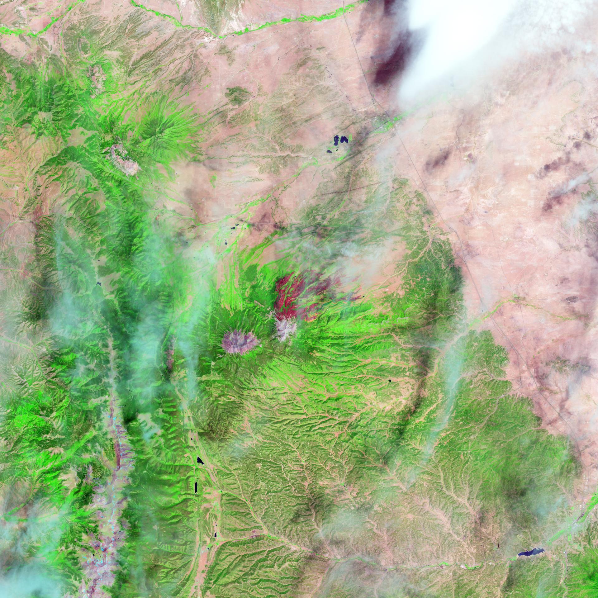
 A powerful mid-latitude storm fueled dust storms, tornadoes, blizzards, and downpours across the country.Credits: NASA Earth Observatory image by Michala Garrison
BreezoMeter’s products leverage NASA data to provide global, real-time, and hyper-local information on air quality, pollen, and wildfire smoke.
Steve Moran
Former Senior Strategic Partnerships Development Manager at Google
NASA Commercial Impact In Action
Expanded AI Model with Global Data Enhances Earth Science Applications
NASA-developed Technology Supports Ocean Wind Speed Measurements from Commercial Satellite

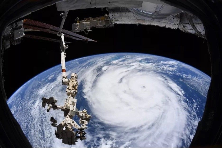
Floods Swamp Tennessee
A storm system that swept through the U.S. Southeast brought damaging winds, torrential rain, and destructive flash floods to several communities in the region.

NASA Data Helps Beavers Build Back Streams
Nature's engineers, beavers, get help from NASA to mitigate drought and wildfire.
NASA AI, Open Science Advance Disaster Research and Recovery
Where the Wildfires Are
Simulation, prediction, and response software helps businesses and communities cope with disaster.

NASA Selects Companies for Commercial SmallSat Services Award
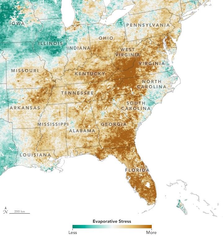
Tracking Deluge and Drought through Soil Moisture
From soaked to dry, the variable state of U.S. soils has implications for farmers and crop production.