Earth Science Missions: Upcoming
TROPICS
A pathfinder satellite, which tests the technology that will be used later for the full mission, was launched in June 2021 and has provided important data, including from Hurricane Ida in August 2021. This success has led to great excitement for the success of the CubeSats of the Time-Resolved Observations of Precipitation Structure and Storm Intensity with a Constellation of SmallSats (TROPICS) mission, slated to launch in the first half of 2022. The six CubeSat constellation will orbit Earth in three planes, collecting temperature, water vapor, precipitation, and cloud ice measurements on a frequent, near-global scale to study storms and other meteorological events. These multiple satellites in spread out orbits will collect more frequent measurements around the globe, allowing scientists to study storms as they develop and then use the newly-acquired knowledge to improve forecasting capabilities. The TROPICS research team includes researchers from NASA, the National Oceanic and Atmospheric Administration (NOAA), and several universities and commercial partners.
NISAR
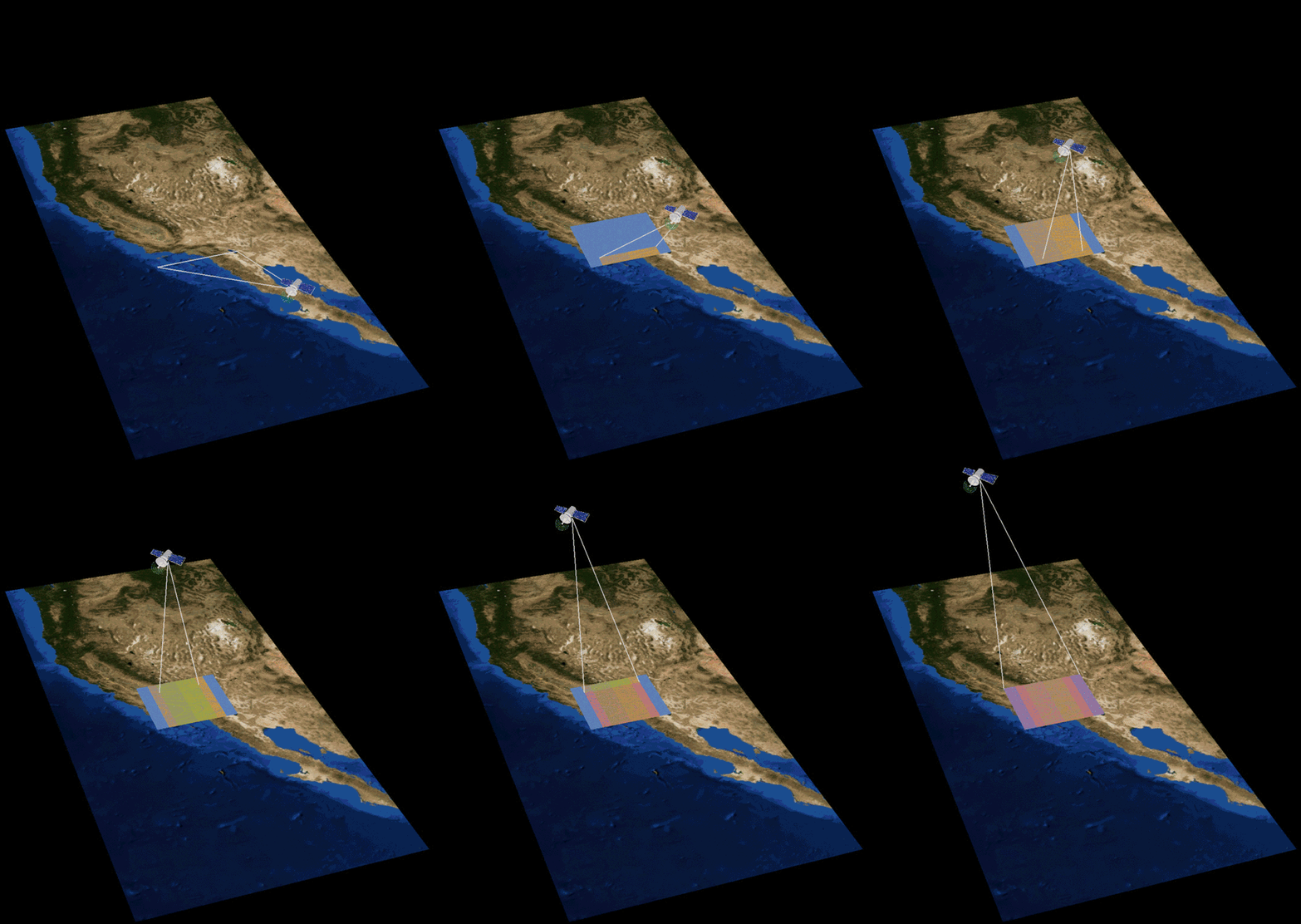
The trailblazer for NASA’s Earth System Observatory, the NASA-ISRO Synthetic Aperture Radar (NISAR) will be the first radar of its kind in space to systematically map Earth, using two different radar frequencies (L-band and S-band) to measure changes in our planet's surface less than a centimeter across. The mission, being developed by NASA and the Indian Space Research Organisation (ISRO), will measure Earth’s changing ecosystems, dynamic surfaces, and ice masses providing information about biomass, natural hazards, sea level rise, and groundwater, and will support a host of other applications. Planned launch is 2023.
SWOT
U.S. and French oceanographers and hydrologists and international partners have joined forces to develop the Surface Water and Topography (SWOT) satellite mission to make the first global survey of Earth's surface water, observe the fine details of the ocean's surface topography, and measure how water bodies change over time. The data will help with monitoring changes in floodplains and wetlands, measure how much fresh water flows into and out of lakes and rivers and back to the ocean, and track regional shifts in sea level. SWOT is being jointly developed by NASA and Centre National D'Etudes Spatiales (CNES) with contributions from the Canadian Space Agency (CSA) and United Kingdom Space Agency. SWOT is scheduled to launch in 2023.
MAIA
The Multi-Angle Imager for Aerosols (MAIA) investigation is the first time NASA has partnered with epidemiologists and health organizations on a satellite mission to study human health and improve lives. MAIA’s observations of small, atmospheric aerosols will be combined with ground-based pollution monitors and computer models, to create daily maps of particulate amounts in 12 Primary Target Areas in large metropolitan areas around the world. Epidemiologists will then compare the data with health records to provide information about which types of particulate matter air pollution are most harmful to human health. MAIA is expected to launch on a commercial satellite no earlier than 2023.
TEMPO
Slated to launch in early 2023 aboard a commercial satellite to a geostationary orbit about 22,000 miles above the equator, the Tropospheric Emissions: Monitoring of Pollution (TEMPO) instrument is a UV-visible spectrometer, and will be the first ever space-based instrument to monitor air pollutants hourly across the North American continent during daytime. It will collect high-resolution measurements of ozone, nitrogen dioxide and other pollutants, data which will revolutionize air quality forecasts. The instrument will resolve pollution levels to regions of several square miles, a significant improvement over existing limits of about 100 square miles. The TEMPO mission is a collaboration between NASA and the Smithsonian Astrophysical Observatory.
PREFIRE
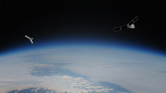
The Polar Radiant Energy in the Far Infrared Experiment (PREFIRE) mission consists of a pair of CubeSats in polar orbits that will make the first spectral measurements of Far InfraRed (FIR) radiation throughout the day and over seasons, which will expand our knowledge of the Arctic energy budget and the role of FIR radiation in Arctic warming, sea ice loss, ice sheet melt, and sea level rise. PREFIRE’s sensors are based on technology previously flown on the Mars Climate Sounder, an instrument on NASA's Mars Reconnaissance Orbiter. Mission partners are NASA and the Space Dynamics Laboratory of North Logan, Utah. PREFIRE will launch in 2023.
TSIS-2
The Total and Spectral Solar Irradiance Sensor-2 (TSIS-2), the successor to TSIS-1, will collect the most detailed measurements to date of how much radiation the Sun emits to Earth on an hour-by-hour basis. TSIS-2 will add solar irradiance measurements to four decades of continuous data records, but unlike TSIS-1, which operates from the International Space Station, TSIS-2 will ride on a free-flying spacecraft in 2024 or 2025. TSIS-2 has two instruments: the Total Irradiance Monitor (TIM), which measures total brightness; and the spectral Irradiance Monitor (SIM), which measures spectral irradiance over a wavelength range that includes 96% of the energy in the solar spectrum. NASA has responsibility for development and operation of TSIS-2, while the Laboratory for Atmospheric and Space Physics (LASP) at the University of Colorado, Boulder, under contract with NASA, is building the TIM and SIM instruments.
GeoCarb
The Geostationary Carbon Observatory (GeoCarb), targeted for launch in 2024, will build on the success of NASA’s Orbiting Carbon Observatory-2 (OCO-2) mission by placing a similar instrument on a hosted satellite flying in geostationary orbit. Perched above the Americas, this first-of-its-kind mission will collect 10 million daily observations of the concentrations of carbon dioxide, methane, carbon monoxide and solar-induced fluorescence to extend our measurement of greenhouse gasses and vegetation health to advance our understanding of Earth’s natural exchanges of carbon between the land, atmosphere and ocean.
PACE
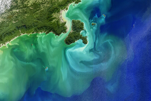
NASA’s Plankton, Aerosol, Cloud, ocean Ecosystem (PACE) mission will study phytoplankton, clouds, and aerosols to provide insights into oceanographic and atmospheric responses to Earth’s changing climate, as well as investigate the diversity of organisms fueling marine food webs. PACE will also continue systematic records of key atmospheric variables associated with air quality and climate, continuing more than two decades of NASA satellite observations of global ocean biology, aerosols, and clouds. One of PACE's primary instruments, the Ocean Color Instrument (OCI), will be the most advanced sensor for observing ocean color in NASA's history, enabling continuous measurement of light at finer wavelength resolution without the blank spots of previous sensors. PACE will launch in 2024.
Sentinel-6B
Sentinel 6-B, the second of two identical satellites in the Sentinel 6/Jason CS mission to measure the height of the ocean, is slated to launch in 2025, 5 years after the launch of the first mission, Sentinel 6-Michael Freilich, named in honor of the former director of NASA’s Earth Science Division. Staggering the launches of these satellites will help continue more than three decades of sea-level observations, which are critical to understanding climate change. The missions also will measure temperature and humidity in the troposphere, the atmospheric layer in which we live, and look at the stratosphere, the layer right above the troposphere. NASA is developing the mission with the European Space Agency, the European Organisation for the Exploitation of Meteorological Satellites, and the National Oceanic and Atmospheric Administration. The European Commission is providing funding support. France's space agency, the Centre National d'Etudes Spatiales, is also supporting the mission.
GLIMR
The Geosynchronous Littoral Imaging and Monitoring Radiometer (GLIMR) instrument will provide unique observations of ocean biology, chemistry, and ecology in a wide area, centered on the Gulf of Mexico and including portions of the southeastern United States coastline, and the Amazon River plume for up to 15 hours a day. GLIMR’s data will help protect ecosystem sustainability, improve resource management, and enhance economic activity. It is being developed with a NASA grant to the University of New Hampshire Institute for the Study of Earth, Oceans and Space. It will be integrated on a NASA-selected platform and launched in the 2026-2027 timeframe into a geosynchronous orbit with observations of a given area each day, a critical capability in studying phenomena such as the lifecycle of coastal phytoplankton blooms and oil spills in a way that would not be possible from a satellite in a low-Earth orbit.
Libera
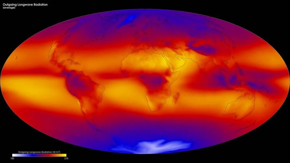
Libera, slated to launch on NOAA’s Joint Polar Satellite System-3 (JPSS-3) satellite in December 2027, will continue more than 40 years of recording the balance between solar radiation entering Earth’s atmosphere and the amount absorbed, reflected, and emitted. The radiation balance is essential to understand climate warming and cooling. Development of the NASA-funded instrument is being led at the University of Colorado, Boulder, Laboratory for Atmospheric and Space Physics. Libera, named for the Roman goddess of agriculture, will measure the radiation budget alongside the Clouds and the Earth's Radiant Energy System (CERES) instruments currently operating on NASA and National Oceanic and Atmospheric Administration (NOAA) satellites.


