


![Request for Information – Potential [Placeholder for Prize]](https://assets.science.nasa.gov/dynamicimage/assets/science/psd/solar/2023/09/s/solarsystem_0.jpg?w=1024)


Earth Science Research News
Earth News and Information
Filters

The color of Adélie penguin droppings reveals what the birds are eating, offering scientists a way to track how sea ice conditions influence their diet.
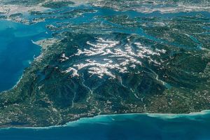
Snow-capped mountains carved by deep river valleys preside over northwestern Washington state.

As of July 20, the public can access data from the two powerful radar instruments aboard the NISAR (NASA-ISRO Synthetic Aperture Radar) satellite. Teams in the United States and India will release files processed from the satellite’s L-band and S-band…
Differences in the underlying bedrock and how rivers distribute sediment make the coastlines west of Portland look unlike those northeast of the city.
The first of six new airborne campaigns will hit the skies this summer.

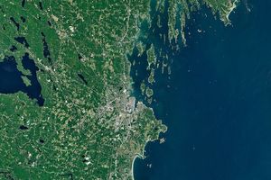
The hills and basins of Seattle, Washington, have been sculpted by glaciers and modified by humans.
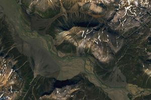
Sediment eroded from ice-capped mountains splays out across a broad river valley on Russia’s Severny Island.
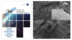
The reports add to the growing documentation on commercial data's contributions to Earth science research and applications.
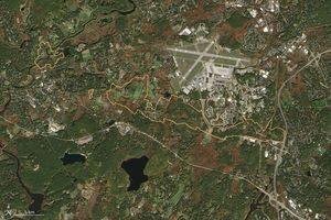
Sites relevant to the start of the American Revolutionary War are interspersed throughout the modern-day Boston metropolitan region.

Marshy, sandy terrain and an impassable inlet helped colonial forces repel British forces during a pivotal battle on the barrier island near Charleston, South Carolina, on June 28, 1776.