


before
after
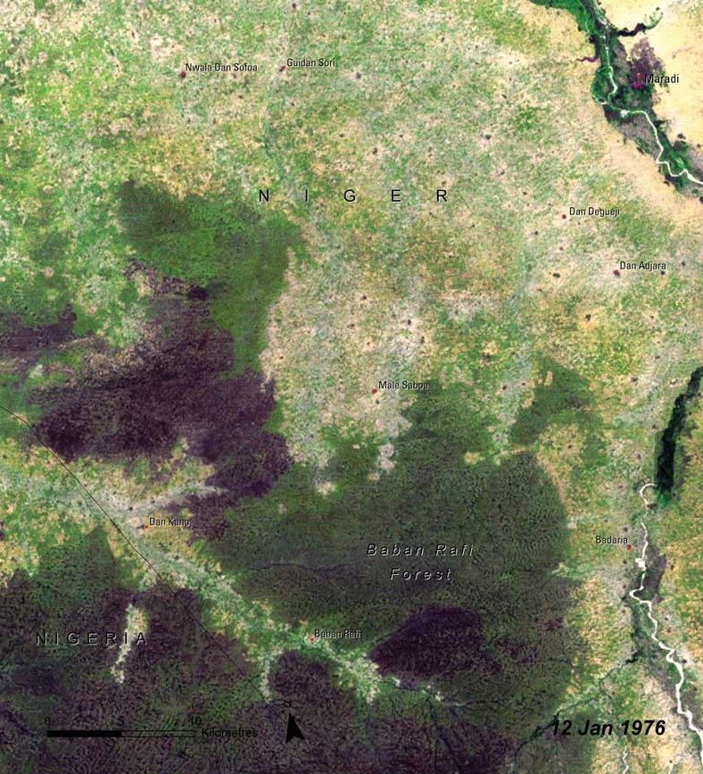
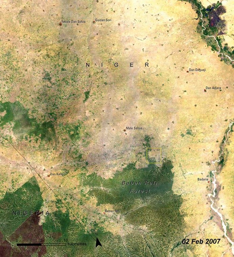
Baban Rafi Forest is the most significant area of woodland in the Maradi Department of Niger, a west African country on the southern edge of the Sahara Desert. Located at the southern extreme of the Sahel, Baban Rafi has areas of both savannah and Sahelian vegetation. These pictures show the loss of a significant fraction of the natural landscape (darker green areas) of the forest to agriculture. Population in this region quadrupled during the 40 years leading up to the 2007 image, and intense demand for agricultural land has led to near-continuous use, with shortened or no fallow period to recover fertility. The remaining woodlands are overly exploited for fuel wood and non-wood forest products. Source: United Nations Environment Programme (UNEP). From Africa Atlas of our Changing Environment (2008); Division of Early Warning and Assessment (DEWA), UNEP, Nairobi, Kenya.
NASA/USGS
Before and After
Baban Rafi deforestation, Niger
January 12, 1976 - February 2, 2007
Baban Rafi Forest is the most significant area of woodland in the Maradi Department of Niger, a west African country on the southern edge of the Sahara Desert. Located at the southern extreme of the Sahel, Baban Rafi has areas of both savannah and Sahelian vegetation. These pictures show the loss of a significant fraction of the natural landscape (darker green areas) of the forest to agriculture. Population in this region quadrupled during the 40 years leading up to the 2007 image, and intense demand for agricultural land has led to near-continuous use, with shortened or no fallow period to recover fertility. The remaining woodlands are overly exploited for fuel wood and non-wood forest products. Source: United Nations Environment Programme (UNEP). From Africa Atlas of our Changing Environment (2008); Division of Early Warning and Assessment (DEWA), UNEP, Nairobi, Kenya.


