February 10, 2014
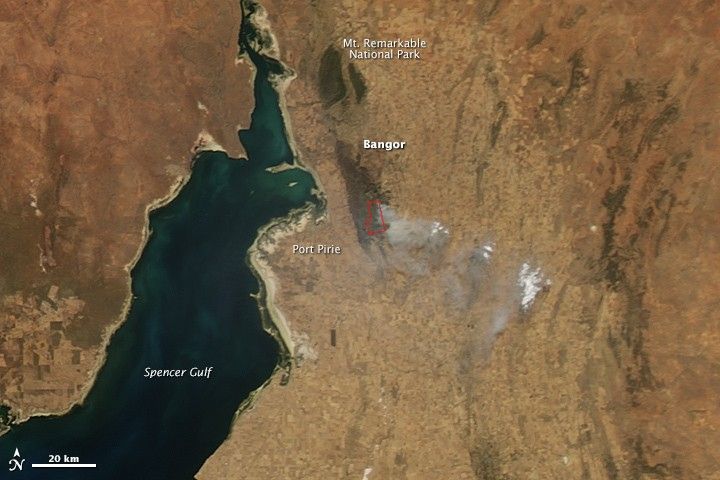
The Bangor fire entered its 23rd day on February 10, 2014, when the Moderate Resolution Imaging Spectroradiometer (MODIS) on NASA’s Aqua satellite acquired this image. Active fire areas are outlined in red, and burned land is charcoal black. The fire is burning quickly through dense scrub in steep, hard-to-access terrain. On February 12 (February 11 US Eastern time), the fire was threatening four communities—Wirrabara Forest, Wirrabara Township, Stone Hut, and Laura Township—prompting the South Australian Country Fire Service to issue a warning.
References & Resources
- Australian Broadcasting Corporation (2014, February 10) Three fire bombers help tackle Bangor blaze in southern Flinders Ranges of SA. Accessed February 11, 2014.
- South Australian Country Fire Service (2014, February 12) Bushfire watch and act. Accessed February 11, 2014 (U.S. Eastern time).
NASA Earth Observatory image by Jesse Allen, using data from the Land Atmosphere Near real-time Capability for EOS (LANCE). Caption by Holli Riebeek.