Suggested Searches

1 min read

Clearcuts in Oregon


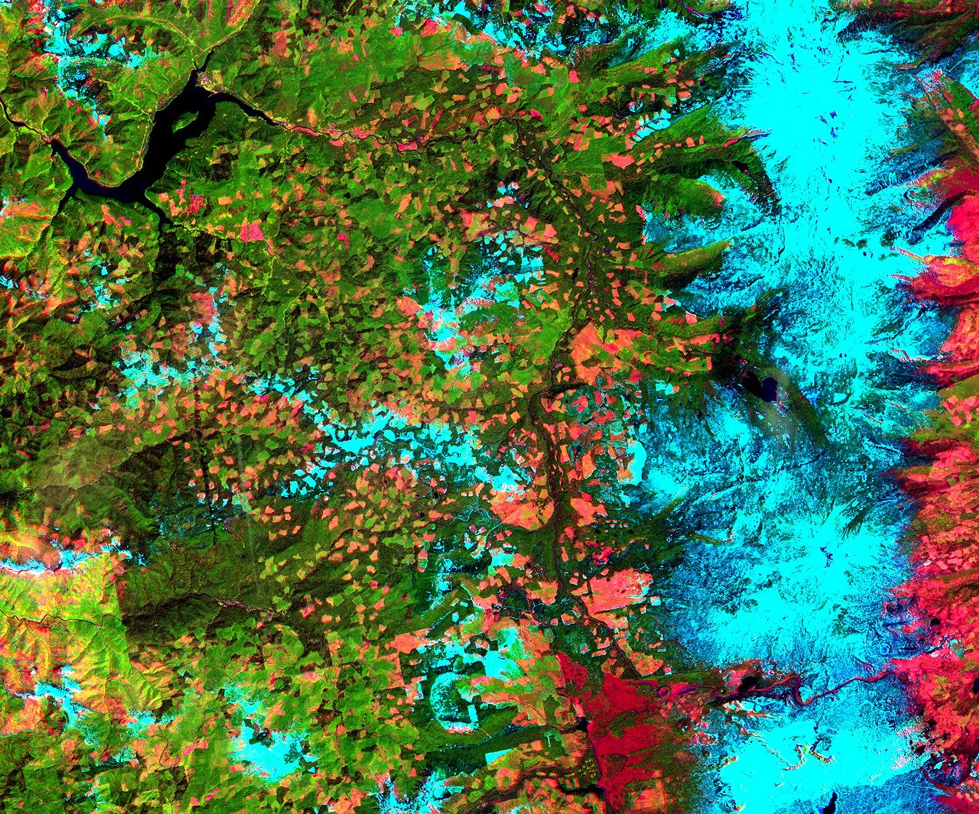
This Advanced Spaceborne Thermal Emission and Reflection Radiometer(ASTER) sub-scene was acquired on May 20, 2000 and shows an area alongthe west side of the Cascade Range in west central Oregon. (the full image measures 39 by47 km) Bands 4 (shortwave infrared), 3 (near infrared), and 2 (red) werecombined as red, green, and blue. In this composite, snow appears blue,forests are green, and clear-cut areas are orange-pink. The magnitude oflogging operations is quite obvious, appearing as a checker boardpattern.

References & Resources

Image courtesy NASA/GSFC/MITI/ERSDAC/JAROS, and U.S./Japan ASTER Science Team

You may also be interested in:

Stay up-to-date with the latest content from NASA as we explore the universe and discover more about our home planet.

Painting the Growing Season in the Maize Triangle
3 min read

Radar data from an agricultural area in South Africa, shown in a vivid color palette, reveal crop types and how…

Article
Seasons Change in Southwest Virginia
3 min read

From autumn color to a winter-white finish, forested areas around Blacksburg trade foliage for snow over the span of two…

Article
The West Faces Snow Drought
4 min read

Very wet—but very warm—weather in the western U.S. has left many mountainous regions looking at substantial snowpack deficits.

Article