
The state of Rondônia, in southern Brazil, is part of the Amazonian “Arc of Deforestation,” a belt of rapidly disappearing tropical forest that follows the southern margin of the Amazon and bends northeastward toward the southern bank of the mouth of the Amazon River. In Rondônia, clearing began with road expansion in the 1970s and 1980s that brought in loggers and mining operations, coupled with government programs to alleviate poverty by encouraging poor farmers to migrate and colonize the new frontier. In recent years, industrial scale agriculture, particularly cattle ranching and soybean farming, have become increasingly important causes of deforestation in the southern Amazon.
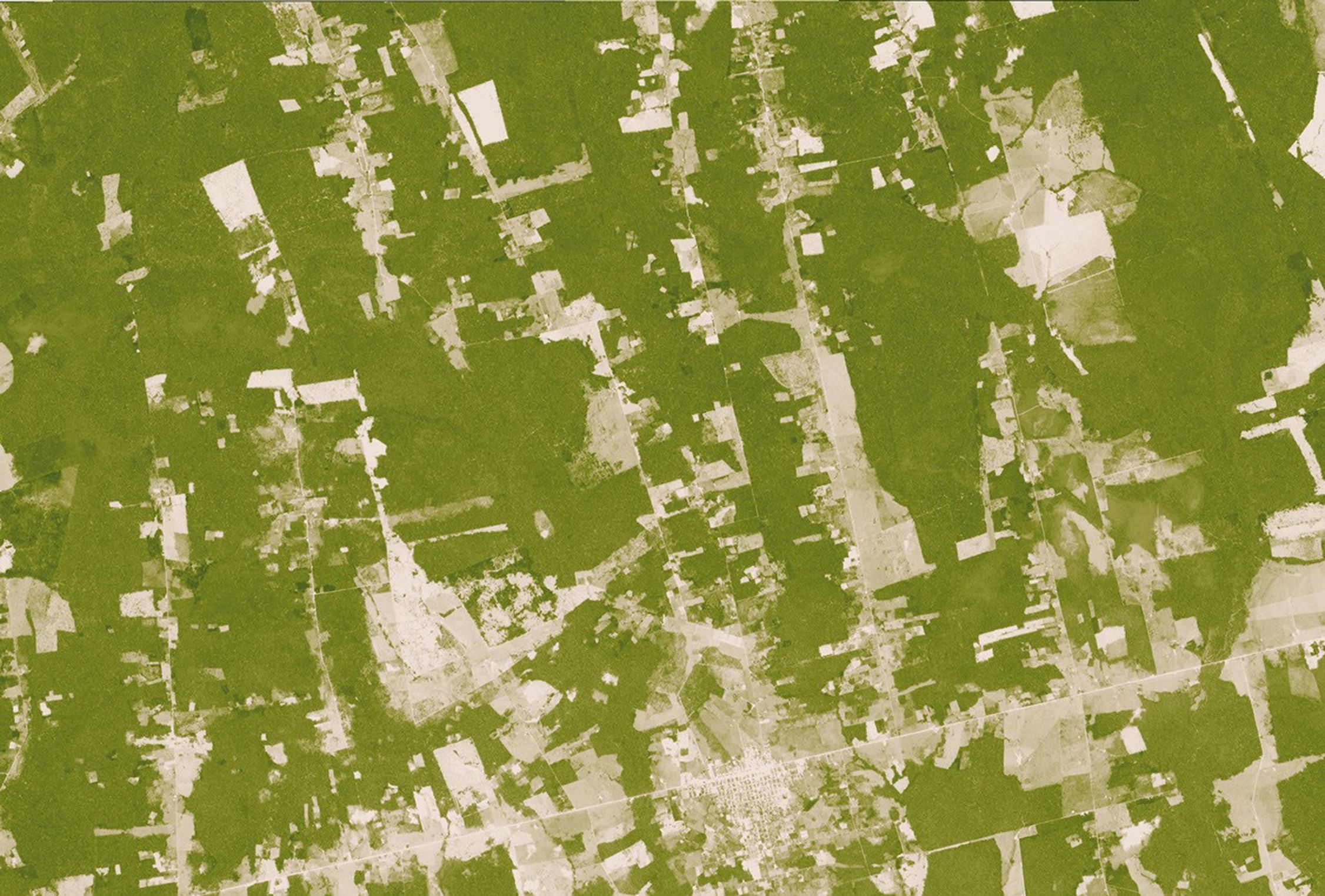
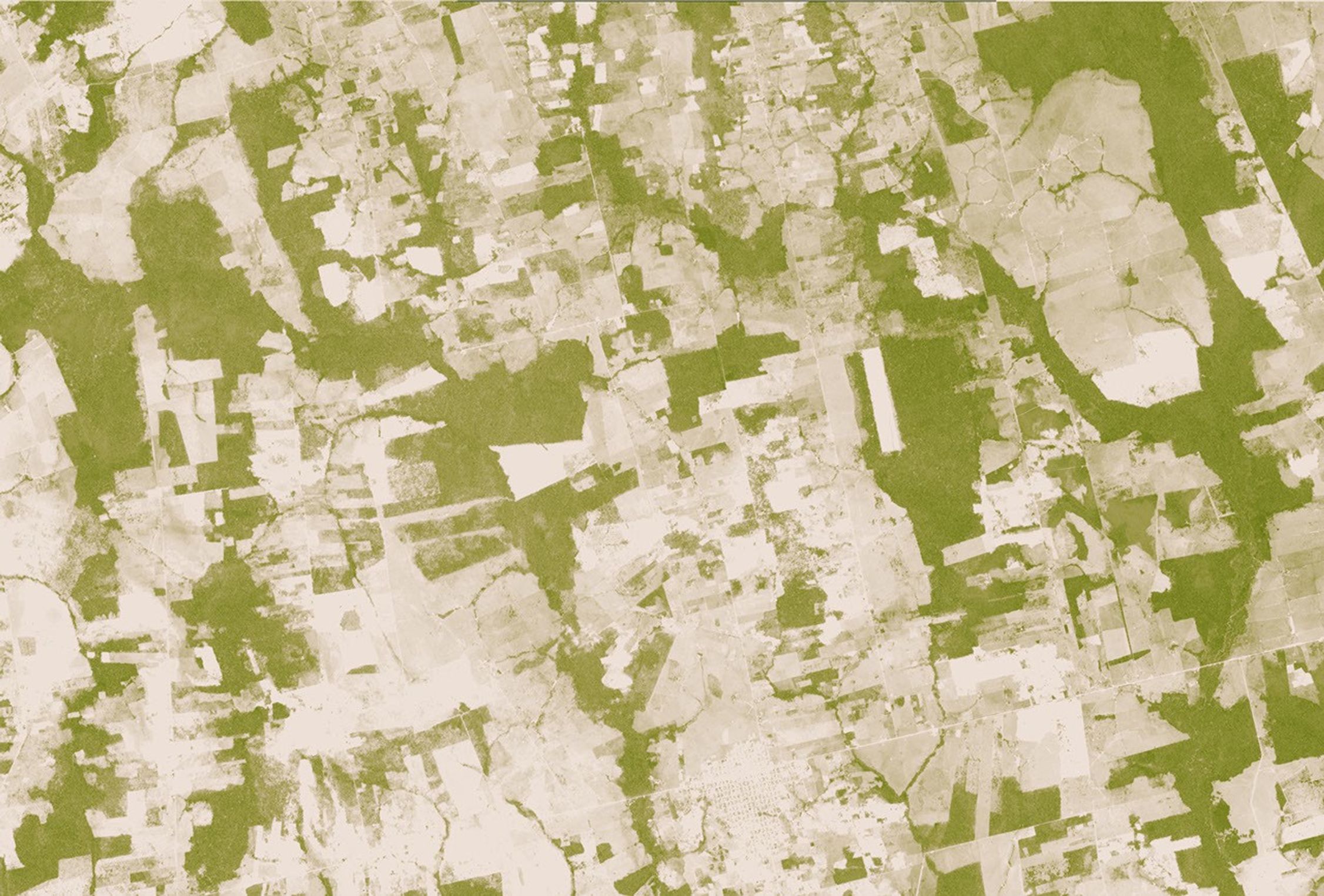
This pair of images reveals how dramatically and rapidly the Amazon can be transformed. Using a scale, or index, of vegetation greenness based on observations made by the Advanced Spaceborne Thermal Emission and Reflection Radiometer (ASTER) on NASA’s Terra satellite, the images compare deforested areas (tan) to forest (green) in 2000 (top) versus 2006 (bottom). The area, which is in southern Rondônia southwest of the Pacaás Novos National Park, was almost completely cleared during the period. The decreased greenness of the remaining forest in 2006 may be from a variety of causes: drought, degradation from logging or accidental fire, or different angles of observation during the two satellite overpasses.
The Amazon isn’t the only tropical forest under human pressure. All major tropical forests—including those in the Americas, Africa, Southeast Asia, and Indonesia—are disappearing, mostly to make way for human food production, including livestock and crops. Although deforestation meets some human needs, it also has profound, sometimes devastating, consequences, including social conflict, extinction of plants and animals, and climate change—challenges that affect the whole world. The Earth Observatory’s recently updated Tropical Deforestation Factsheet provides an overview of causes, consequences, and rates of tropical deforestation, as well as information on NASA contributions to tropical deforestation research.
References & Resources
NASA maps by Robert Simmon, based on ASTER data.