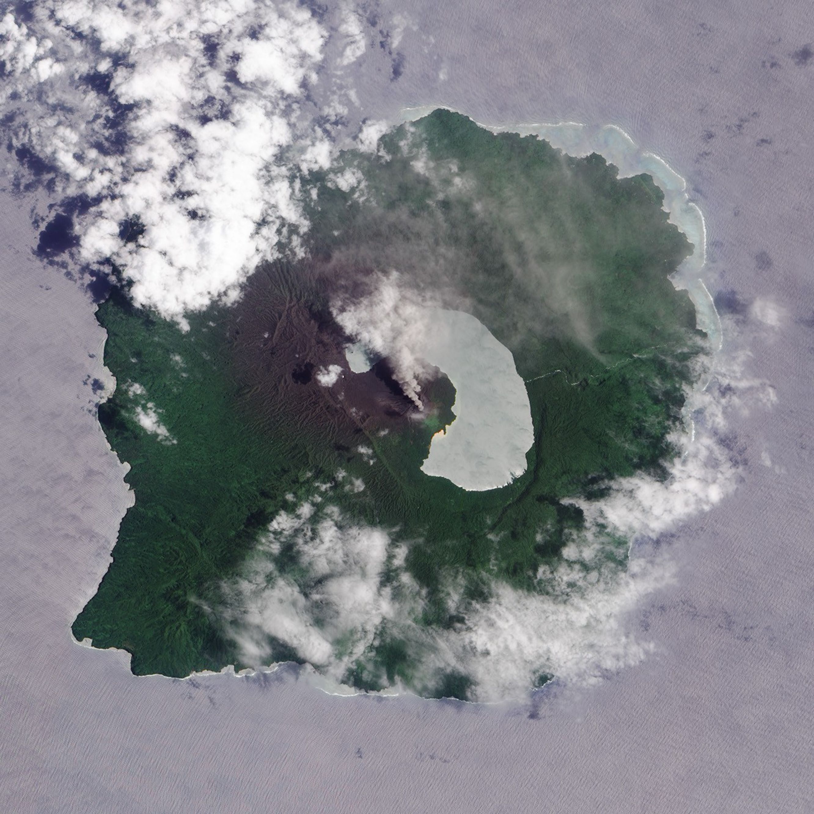
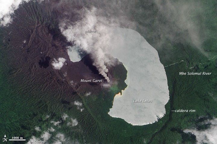
A plume of ash and steam rises from Mount Garet—the summit of Vanuatu’s Gaua Volcano—in this natural-color satellite image. According to the Vanuatu Geohazards Observatory, Gaua’s most recent eruptive phase began on September 27, 2009. Activity has continued since then, intensifying on January 16, 2010.
Dark ash coats much of the vegetation to the northwest of the volcano. The Advanced Land Imager (ALI) aboard NASA’s Earth Observing-1 (EO-1) satellite captured this image on February 14, 2010.
Prehistoric eruptions of Gaua Volcano partially filled Gaua Island’s central caldera lake, creating the crescent-shaped Lake Letas. Water from the lake flows out via the Mbe Solomul River, which cascades over the caldera rim in a 120-meter (390-foot) waterfall.
References & Resources
- Vanuatu Aelan Walkabout. (2009, June.) Gaua, great walking in the Banks Islands. Accessed February 17, 2010.
- Vanuatu Geohazards Observatory. (2010, January 29) Vanuatu Volcanic Activity Bulletin Number 7-Gaua Activity. Accessed February 17, 2010.
NASA Earth Observatory image by Robert Simmon, using EO-1 ALI data provided by the NASA EO-1 team. Caption by Robert Simmon.