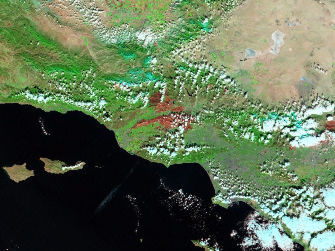
This Moderate Resolution Imaging Spectroradiometer (MODIS) image from the Terra satellite on November 2, 2003 shows one of the regions in southern California that was severely damaged by raging wildfires in late October 2003. Northwest of Los Angeles, fires roared through the Santa Monica Hills around Simi Valley and Thousand Oaks, leaving behind a burn-scarred landscape, which appears deep red in this image. Unaffected vegetation appears green, while naturally bare soil (low vegetation) appears pinkish. The white rectangle shows the area covered in a high-resolution image acquired by the Advanced Spaceborne Thermal Emission and Reflection Radiometer (ASTER) during the same overpass of the Terra satellite.
References & Resources
Image courtesy Jesse Allen, based on data from the MODIS Rapid Response Team at NASA GSFC