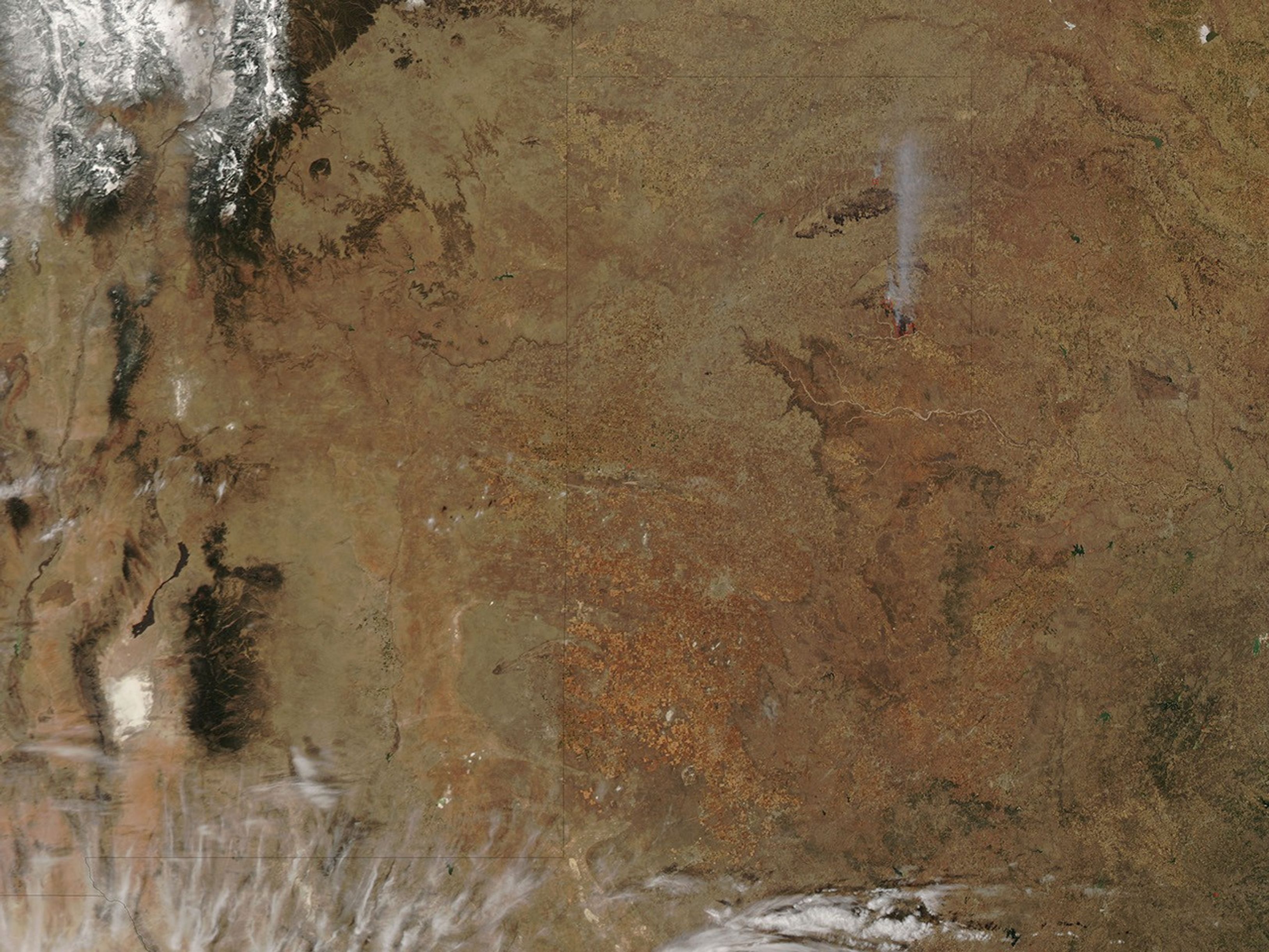
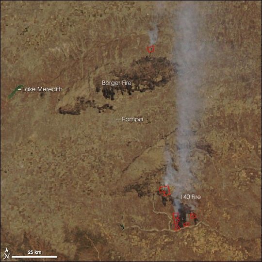
As of Tuesday, March 14, 2006, the East Amarillo Complex Fire in Texas’ northern panhandle had scorched 700,000 acres, according to the morning report from the National Interagency Fire Center. The complex is made of the Borger and I 40 Fires, which are located east of Lake Meredith, straddling the small city of Pampa. Two of the eight evacuated communities in the area were allowed to return to their neighborhoods as firefighters controlled portions of the fast-moving, wind-driven grass fires.
This image of the East Amarillo Complex was captured by the Moderate Resolution Imaging Spectroradiometer (MODIS) on Aqua satellite in the afternoon (1:35 p.m.) of March 14. Places where the MODIS sensor detected actively burning fire are outlined in red. The burned area appears deep brown against the lighter winter-brown landscape.
References & Resources
NASA image courtesy the MODIS Rapid Response Team, Goddard Space Flight Center