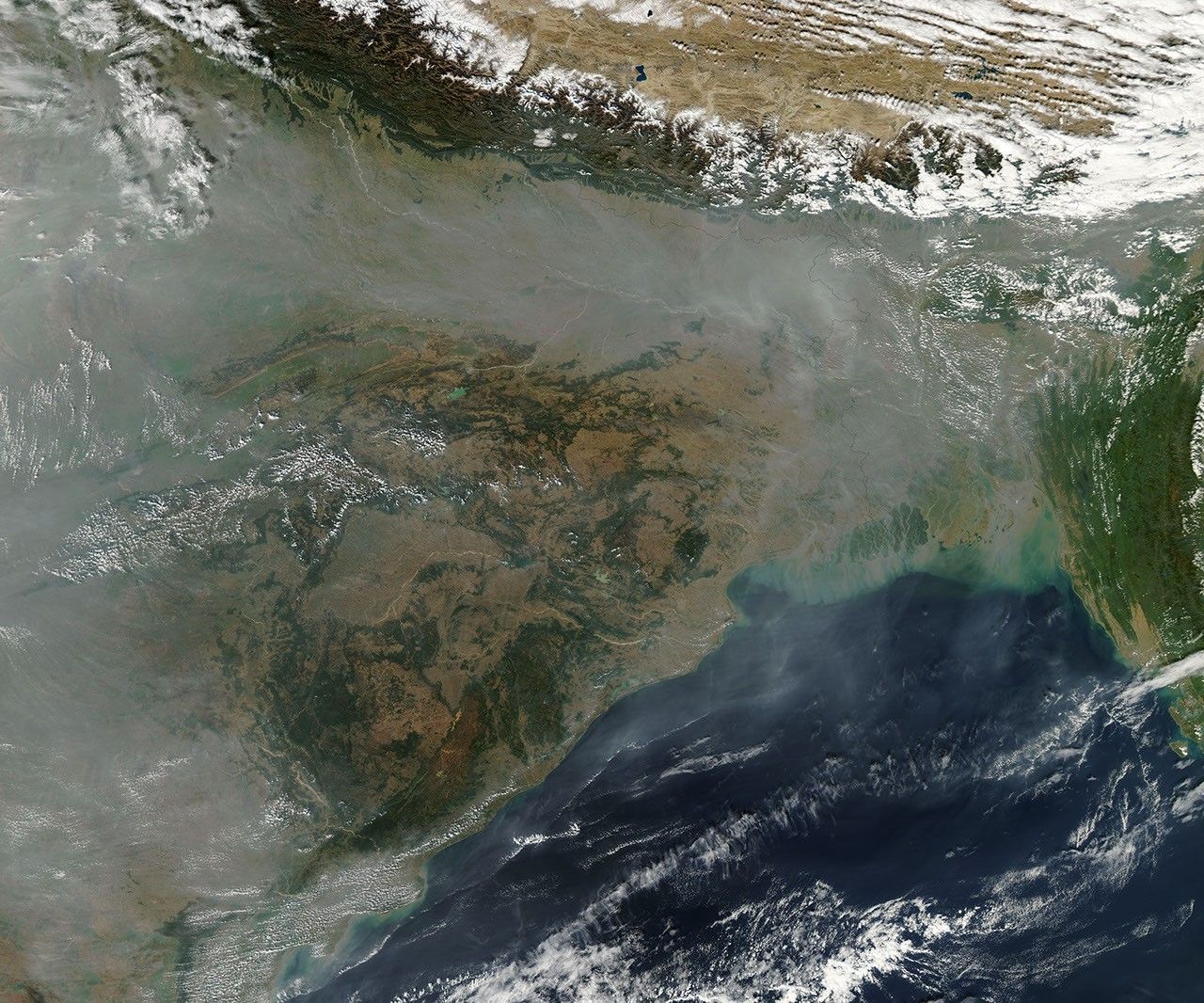




























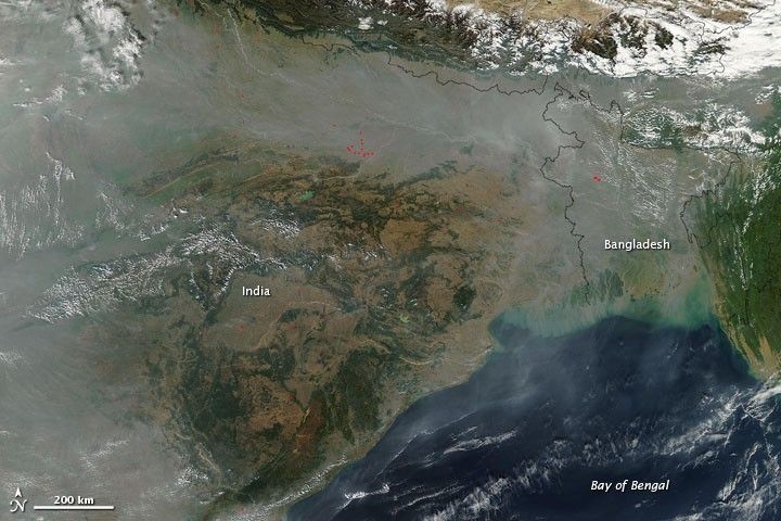
Haze hugged the southern face of the Himalaya in mid-December 2009. The Moderate Resolution Imaging Spectroradiometer (MODIS) on NASA’s Aqua satellite captured this true-color image on December 14. A broad band of gray-beige haze stretches from northern India eastward across Bangladesh and southward toward the southern coast of India. Faint but discernible haze also hovers over the Bay of Bengal. Roughly mimicking the Indian coastline, a string of tiny clouds fringes the southeastern margin of the haze over the bay.
Red dots indicate hotspots likely associated with fires. Although the fires appearing throughout this scene probably contribute to the haze, they can’t account for all of it. Urban and industrial pollution probably plays the major role. A temperature inversion may have added to the build-up of haze by trapping particulate-laden cold air under a layer of warm air. Because the cold air can’t rise above the warm air, haze accumulates.
References & Resources
NASA Earth Observatory image courtesy MODIS Rapid Response Team, Goddard Space Flight Center. Caption by Michon Scott.