![Request for Information – Potential [Placeholder for Prize]](https://assets.science.nasa.gov/dynamicimage/assets/science/psd/solar/2023/09/s/solarsystem_0.jpg?w=1024)


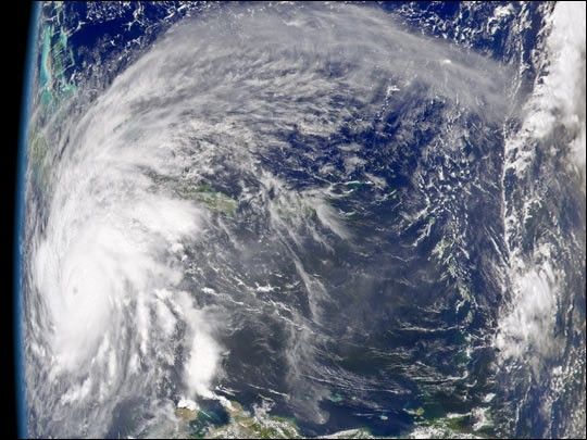
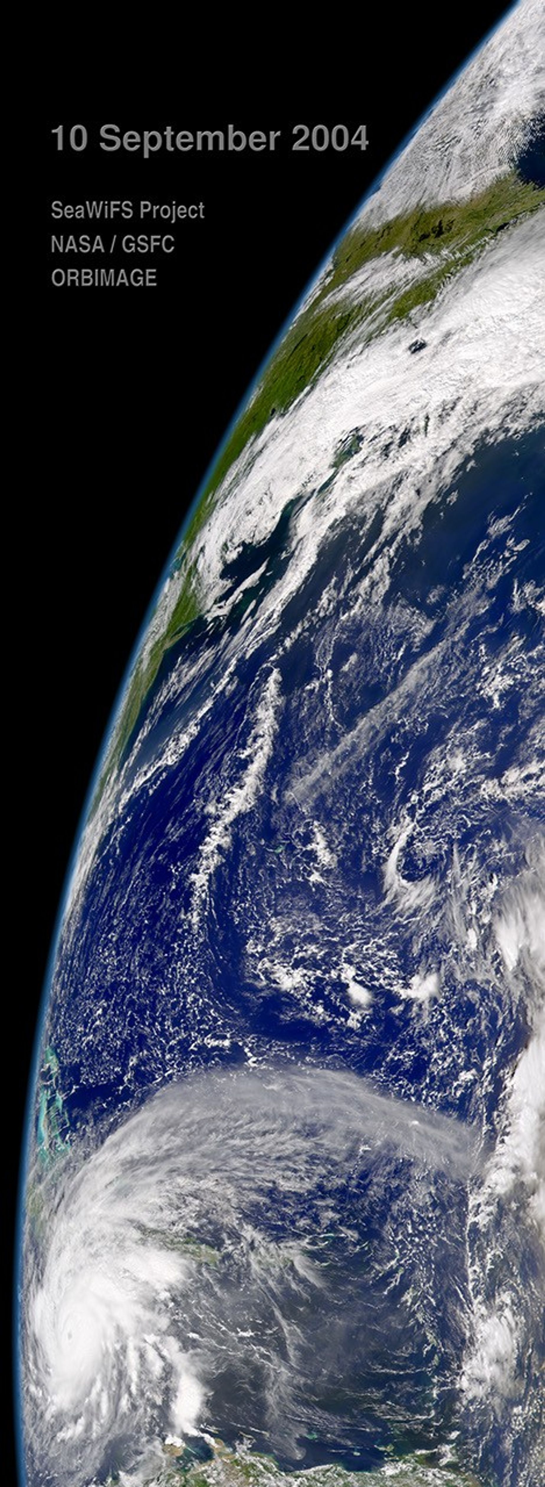
Hurricane Ivan continues to churn quickly across the Caribbean Sea, moving northwest at about 20 kilometers per hour (13 mph). In this image, captured by the Sea-viewing Wide Field of View Sensor (SeaWiFS) on September 10, 2004, the storm is approaching Jamaica and Cuba, seen obliquely on the left edge of the image. At the time this image was taken, Ivanâs winds had decreased to 220 kilometers per hour (140 mph), and the storm was producing 15 to 25 centimeters (6 to 10 inches) of rain. Ivan was expected to hit Jamaica late on September 10, and then move north over Cuba and into Florida. For information about Hurricane Ivan, please visit the National Hurricane Center.
References & Resources
Image provided by the SeaWiFS Project, NASA/Goddard Space Flight Center, and ORBIMAGE