As people convert natural landscapes to human-tailored ones, we change the cycling of water and carbon dramatically. Across the United States, water supplies are under increasing pressure as populations grow. Forests and soils that were once a sink for atmospheric carbon can become sources as the natural landscapes are disturbed.
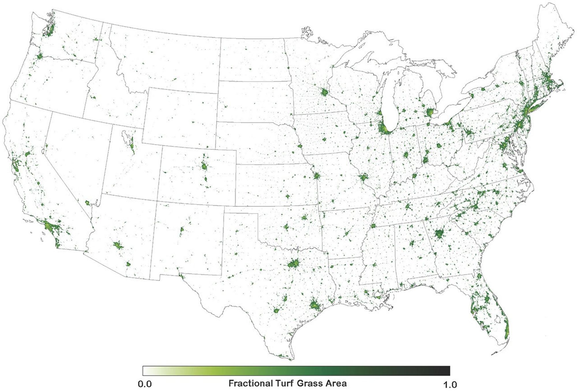
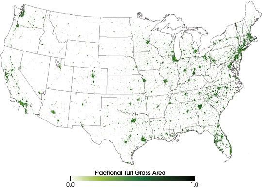
Among the human-tailored landscapes that influence carbon and water cycles in America are lawns. This color-coded map shows satellite-derived estimates of the fractional turf grass (lawn) area across the United States in shades of green. Areas where a large fraction of the land surface is lawn-covered are deepest green, while locations where the lawns cover a very small (or no) fraction of the land surface are lightest green or white.
The map shows how common lawns are across the country, despite a wide variability of climate and soils. Indeed, the scientists who produced the map estimate that more surface area is devoted to lawns than to any other single irrigated crop in the country. For example, lawns appear to cover more than three times the number of acres that irrigated corn covers. The large image shows a more detailed look at fractional lawn surface area in urban areas. In many cities, the urban core—where buildings, parking lots, and roads are densest—appears paler green.
To read more about how NASA-funded scientists developed this map and used it to estimate the impact of lawns on America’s water and carbon cycles, please read Looking for Lawns in the Earth Observatory: Features section.
References & Resources
Map courtesy Cristina Milesi, NASA Ames Research Center