


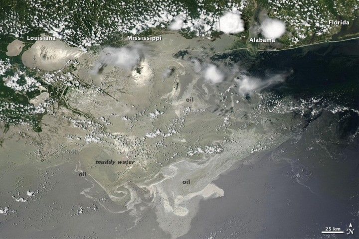
Located squarely in the sunglint part of this photo-like satellite image from Saturday June 26, 2010, the oil leaking from the damaged Deepwater Horizon well in the Gulf of Mexico was easily visible when the Moderate Resolution Imaging Spectroradiometer (MODIS) on NASA’s Terra satellite viewed the area.
Silvery-gray streaks and patches of oil are visible across a wide area. Oil changes the way the water reflects and absorbs sunlight, making the Gulf look brighter in some locations and darker in others. Photo-like images are not a perfect tool for mapping oil slicks, however. Some variations in brightness may have natural causes, such as the muddy, freshwater runoff from the Mississippi River. In addition, oil may be undetectable if it is located outside the sunglint region.
The large image provided above is at MODIS’ maximum spatial resolution (level of detail). Twice-daily images of the Gulf of Mexico are available from the MODIS Rapid Response Team in additional resolutions and formats, including a georeferenced version that can be used with Google Earth.
References & Resources
NASA image courtesy the MODIS Rapid Response Team. Caption by Rebecca Lindsey.


