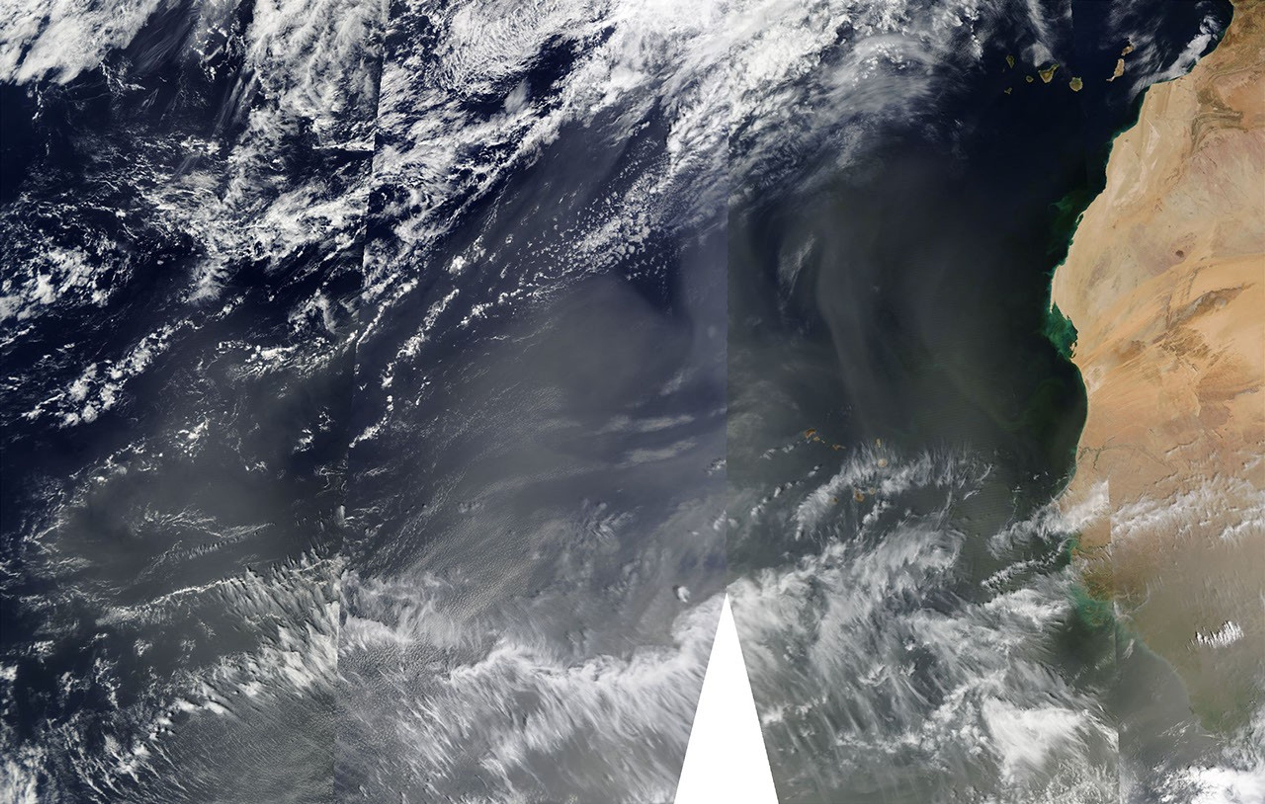




















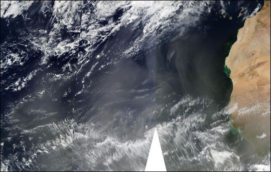
A massive plume of Saharan desert dust (light brown pixels) continued its westward trek across the Atlantic Ocean on March 6, 2003, being held aloft and swept along by strong winds. The plume, which originated on March 2, now covers a vast expanse of ocean and appears bound to reach the other side of the Atlantic. This true-color image of the dust storm was made by stitching together four images acquired on the same day by NASA’s Terra and Aqua satellites.
The image was made using data from the Moderate Resolution Imaging Spectroradiometer (MODIS) sensors flying aboard both spacecraft at hours apart on March 6. Notice the vertical discontinuities running from top to bottom through the center of this scene, indicating the width sensor’s viewing swath on each subsequent overpass. The scene appears a bit different to each satellite not only because the clouds and dust plumes are moving, but also because the relative angle of the sun is changing. The white triangles at the bottom of the image show where no data were acquired due to gaps between subsequent viewing swaths.
References & Resources
Image courtesy Jeffrey Schmaltz, MODIS Rapid Response Team, NASA GSFC