


- May 12, 2005 (3.74 MB)
- April 30, 2005 (4.46 MB)
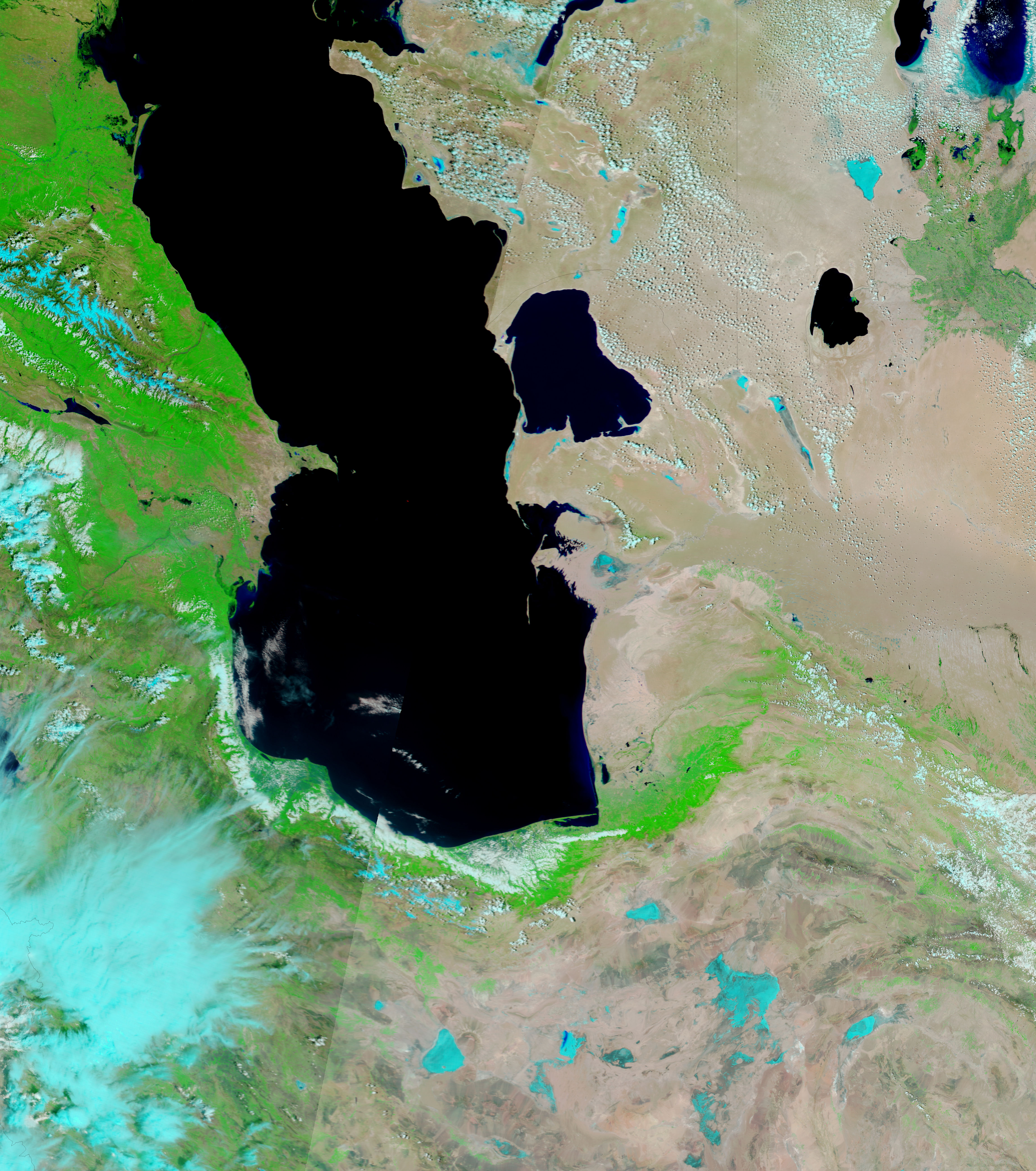
A bulb of water is spread around the mouth of the Terek River in the top Moderate Resolution Imaging Spectroradiometer (MODIS) image, taken on May 12, 2005, by NASAâs Terra satellite. Heavy rains and melting snow in the Caucasus Mountains have taxed the river and caused flash floods across Dagestan and Chechnya in southern Russia, but a broken dam caused the flooding seen here. The Russian news agency, ITAR-TASS, reports that waters flowing from the breech in the dam have covered 13,000 square kilometers of farmland.
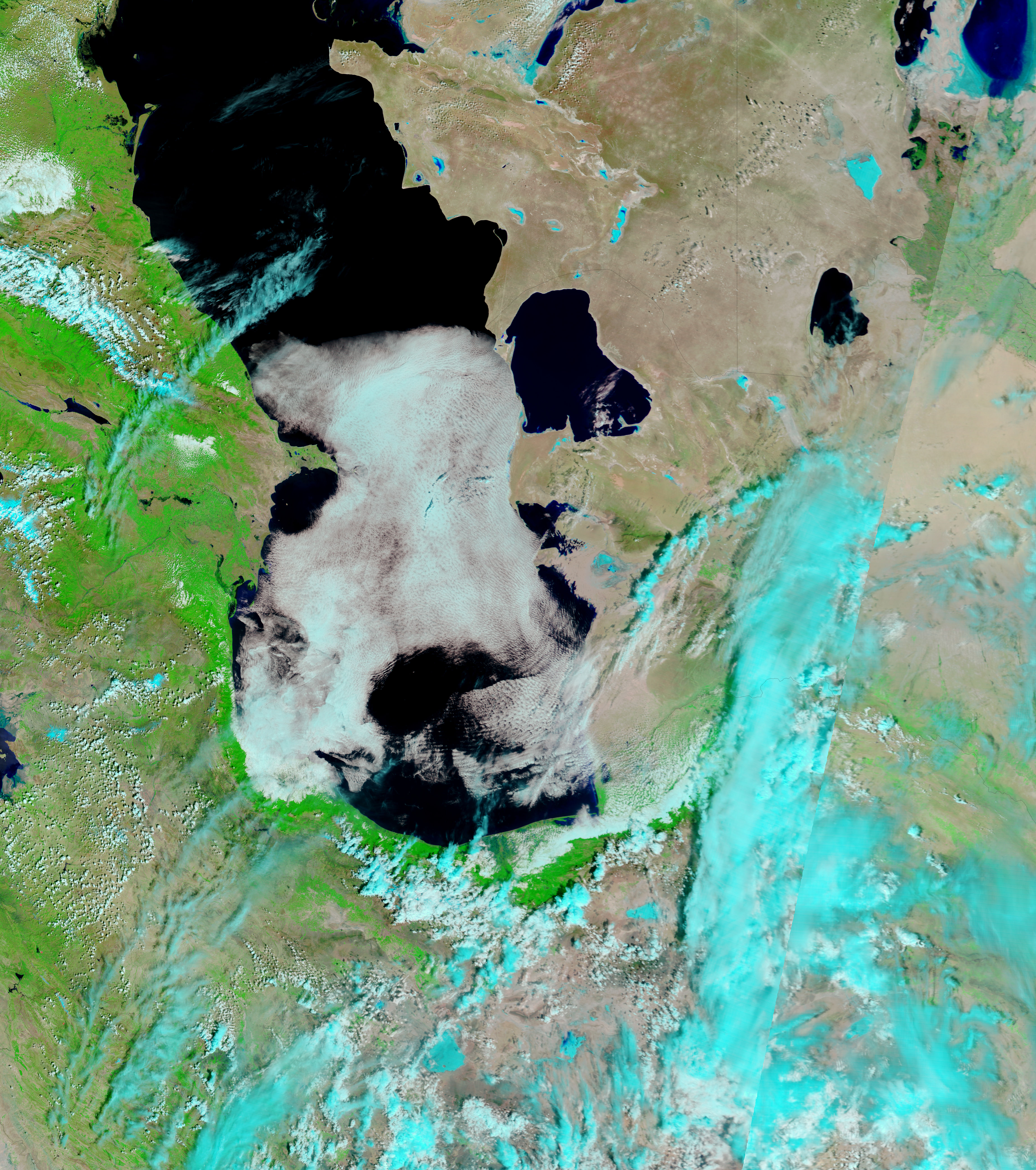
In these images, water is black, but sediment colors the water blue in places. A dense plume of muddy water marks the course of the Terek River through the flood-covered land in the top image. In both images, vegetation is bright green and bare earth is tan or pink. The red box in the lower image shows where MODIS detected a fire on April 30, 2005.
The high resolution images provided above are at MODISâ maximum resolution of 250 meters per pixel. Daily images of this region are available from the MODIS Rapid Response Team.
References & Resources
NASA images courtesy the MODIS Rapid Response Team at NASA GSFC.


