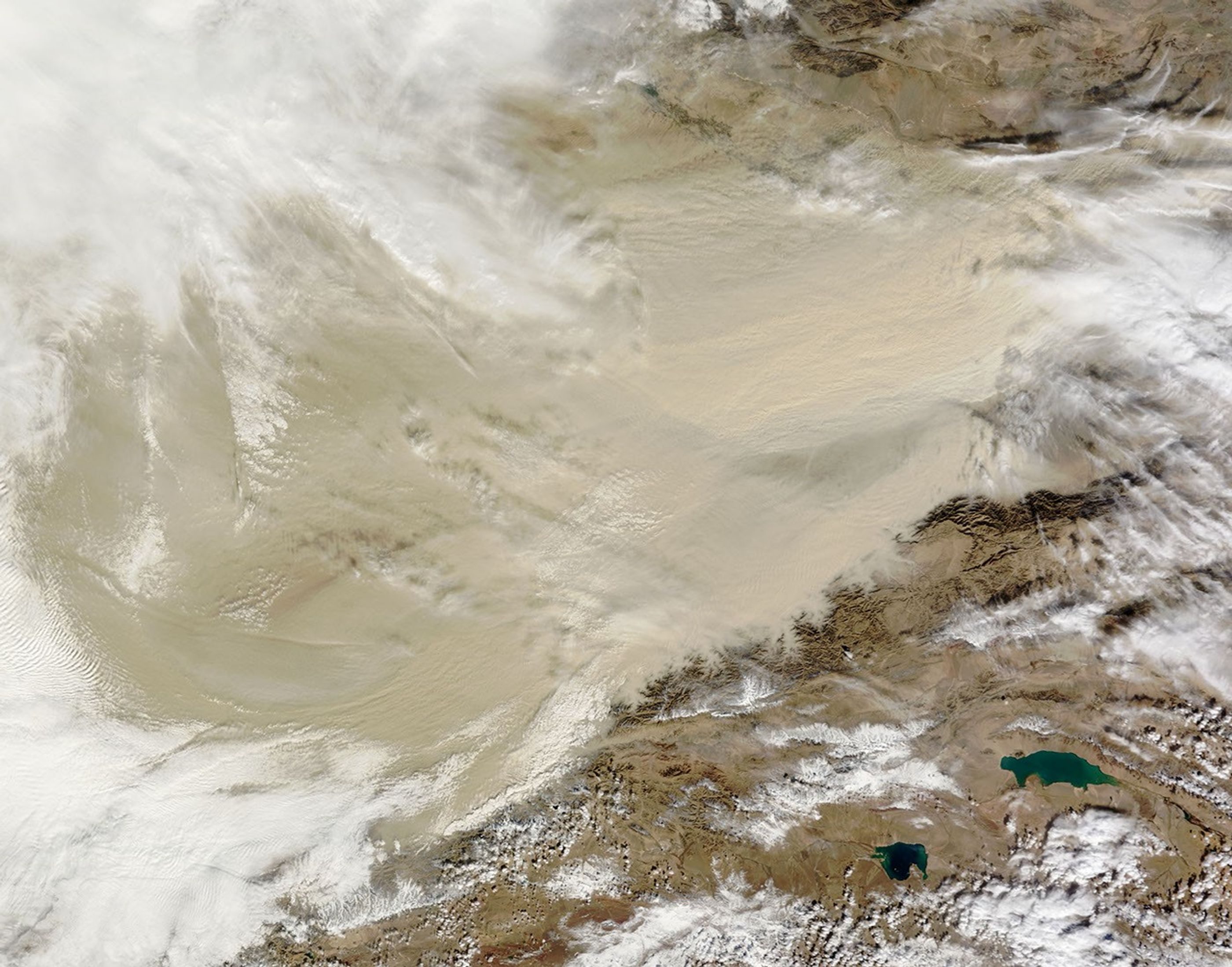





















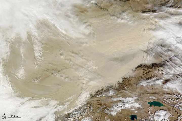
On October 22, 2010, clouds hovered over the western half of the Taklimakan Desert while dust hovered over the eastern half. The Moderate Resolution Imaging Spectroradiometer (MODIS) on NASA’s Terra satellite took this picture the same day. The dust is thick enough to completely obscure the satellite sensor’s view of the desert floor. Thick dust also infiltrates valley floors along the desert’s southeastern rim.
The Taklimakan Desert sits in the Tarim Basin between the Tien Shan Mountains in the north, and Kunlun Mountains in the south. The Taklimakan is the largest desert in China, and the largest shifting-sand desert in the world, providing ample material for dust storms. Because the desert lacks drainage, it has collected large quantities of salt left behind by evaporating water.
References & Resources
- Encyclopedia of Earth. (2007). Taklimakan Desert. Accessed October 22, 2010.
NASA image courtesy of Jeff Schmaltz, MODIS Rapid Response Team , NASA-Goddard Space Flight Center. Caption by Michon Scott.