Suggested Searches

1 min read

The Great Sand Sea

Instruments:
2024-06-05 12:00:00
June 5, 2003

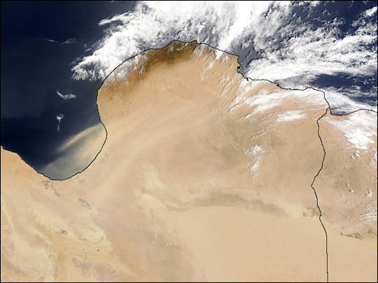
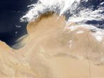
This true-color Moderate Resolution Imaging Spectroradiometer (MODIS) from the Terra satellite on June 5, 2003, shows tan plumes of dust being whisked off the coast of Libya and out over the Mediterranean Sea. This image is centered farther west than the previous image in this series.

The high-resolution image provided above is 500 meters per pixel. The MODIS Rapid Response System provides this image at MODIS’ maximum spatial resolution of 250 meters.

References & Resources

Image courtesy Jeff Schmaltz, MODIS Rapid Response Team, NASA GSFC
You may also be interested in:

Stay up-to-date with the latest content from NASA as we explore the universe and discover more about our home planet.

Signs of Thaw in the Bering Sea
3 min read

Drifting sea ice fragments near Alaska’s Saint Lawrence and Nunivak islands and colorful water around the Yukon Delta heralded the…

Article
Sizing Up the Sargassum Belt
6 min read

Seaweed composing the Great Atlantic Sargassum Belt hit near-record levels in June 2026, with the Caribbean Sea and Gulf of…

Article
Barents Sea Tied to Low Arctic Sea Ice
4 min read

Patches of open water in the region contributed to low sea ice extent across the Arctic in March 2026, which…

Article