


.png?w=1024)


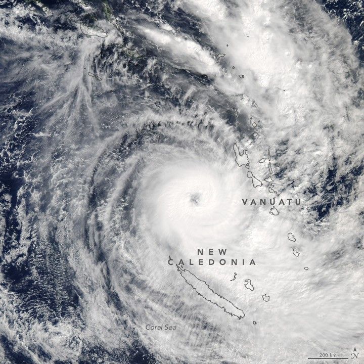
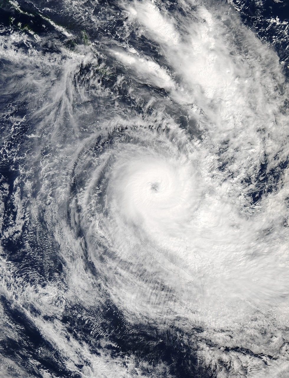
In early May 2017, Tropical Cyclone Donna spun southeastward across the South Pacific, threading the islands of New Caledonia and Vanuatu.
The Moderate Resolution Imaging Spectroradiometer (MODIS) on NASA’s Aqua satellite captured this natural-color image of Donna at 1:50 p.m. local time (02:50 Universal Time) on May 8, 2017. Measurements made around this time showed maximum sustained winds of 115 knots (215 kilometers or 130 miles per hour)—a category 4 storm on the Saffir-Simpson wind scale.
About nine hours later, the storm had weakened to a category 3 storm. Forecasters expected that cooler ocean surface temperatures and the influence of land would cause the storm to weaken as it moved east of New Caledonia.
References & Resources
- Government of the Republic of Vanuatu: National Disaster Management Office (2017, May 8) Tropical Cyclone Donna Situation Reports. Accessed May 8, 2017.
- Joint Typhoon Warning Center (2017, May 8) Tropical Cyclone 18P (Donna) Warning #20. Accessed May 8, 2017.
- Joint Typhoon Warning Center (2017, May 8) Tropical Cyclone 18P (Donna) Warning #20: Graphic. Accessed May 8, 2017.
- Reliefweb (2017, May 7) Vanuatu, New Caledonia - Tropical Cyclone Donna Update (COGIC, National Disaster Management Office, JRC, Météo France) (ECHO Daily Flash of 7 May 2017). Accessed May 8, 2017.
- Unisys (2017, May 8) Cyclone-4 Donna. Accessed May 8, 2017.
NASA image by Jeff Schmaltz, LANCE/EOSDIS Rapid Response. Caption by Kathryn Hansen.


