


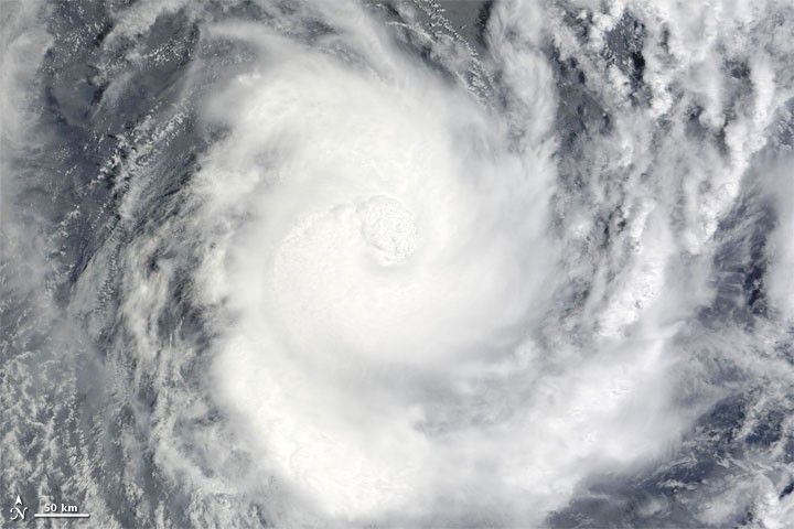
Tropical Cyclone Pat raged over the Southern Pacific Ocean in early February 2010. The Moderate Resolution Imaging Spectroradiometer (MODIS) on NASA’s Terra satellite captured this true-color image at 10:10 a.m. February 10, New Zealand time (21:10 February 9, UTC). Pat shows a discernible eye and extends spiral arms hundreds of kilometers over the open ocean.
At 10:00 p.m. New Zealand time (09:00 UTC) on February 10, 2010, the U.S. Navy’s Joint Typhoon Warning Center reported that Pat was roughly 195 nautical miles (360 kilometers) north of Rarotonga, having traveled toward the south-southwest over the previous several hours. The JTWC reported that Pat was expected to lose intensity as it moved over ocean waters less favorable to cyclone formation.
References & Resources
- Joint Typhoon Warning Center. (2010, February 10). Tropical Cyclone 14P (Pat) Warning. Accessed February 10, 2010.
NASA image image by Jeff Schmaltz, MODIS Rapid Response Team at NASA GSFC. Caption by Michon Scott.


