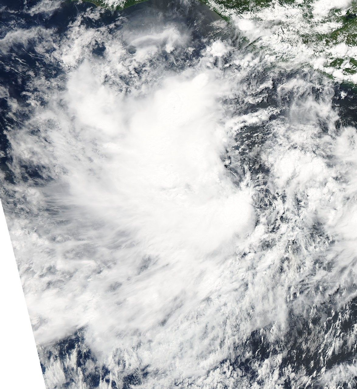
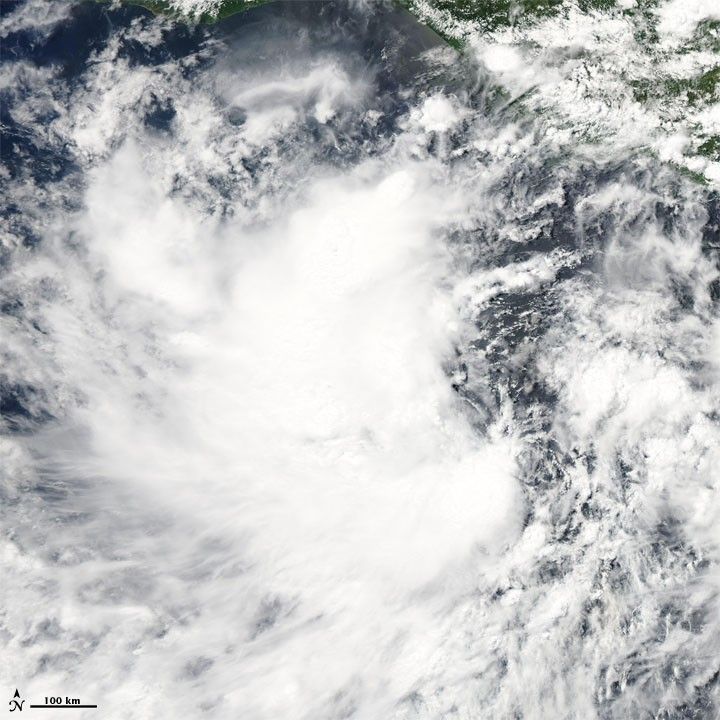
Tropical Storm Darby became the fourth named storm of the 2010 Pacific hurricane season. On June 23, 2010, the U.S. National Hurricane Center (NHC) reported that Tropical Storm Darby was located roughly 305 miles (490 kilometers) south of Salina Cruz, Mexico. Packing maximum sustained winds of 50 miles (85 kilometers) per hour, the storm was headed toward the west-northwest. The NHC forecast that the storm would strengthen over the next 48 hours.
The Moderate Resolution Imaging Spectroradiometer (MODIS) on NASA’s Aqua satellite captured this true-color image of Darby on June 22, 2010. The storm has the comma shape characteristic of cyclones, but it lacks a discernible eye. Part of Central America appears in the upper right.
References & Resources
- National Hurricane Center. (2010, June 23). Tropical Storm Darby Public Advisory. Accessed June 23, 2010.
NASA image courtesy MODIS Rapid Response Team at NASA GSFC. Caption by Michon Scott.