
August 5, 2008
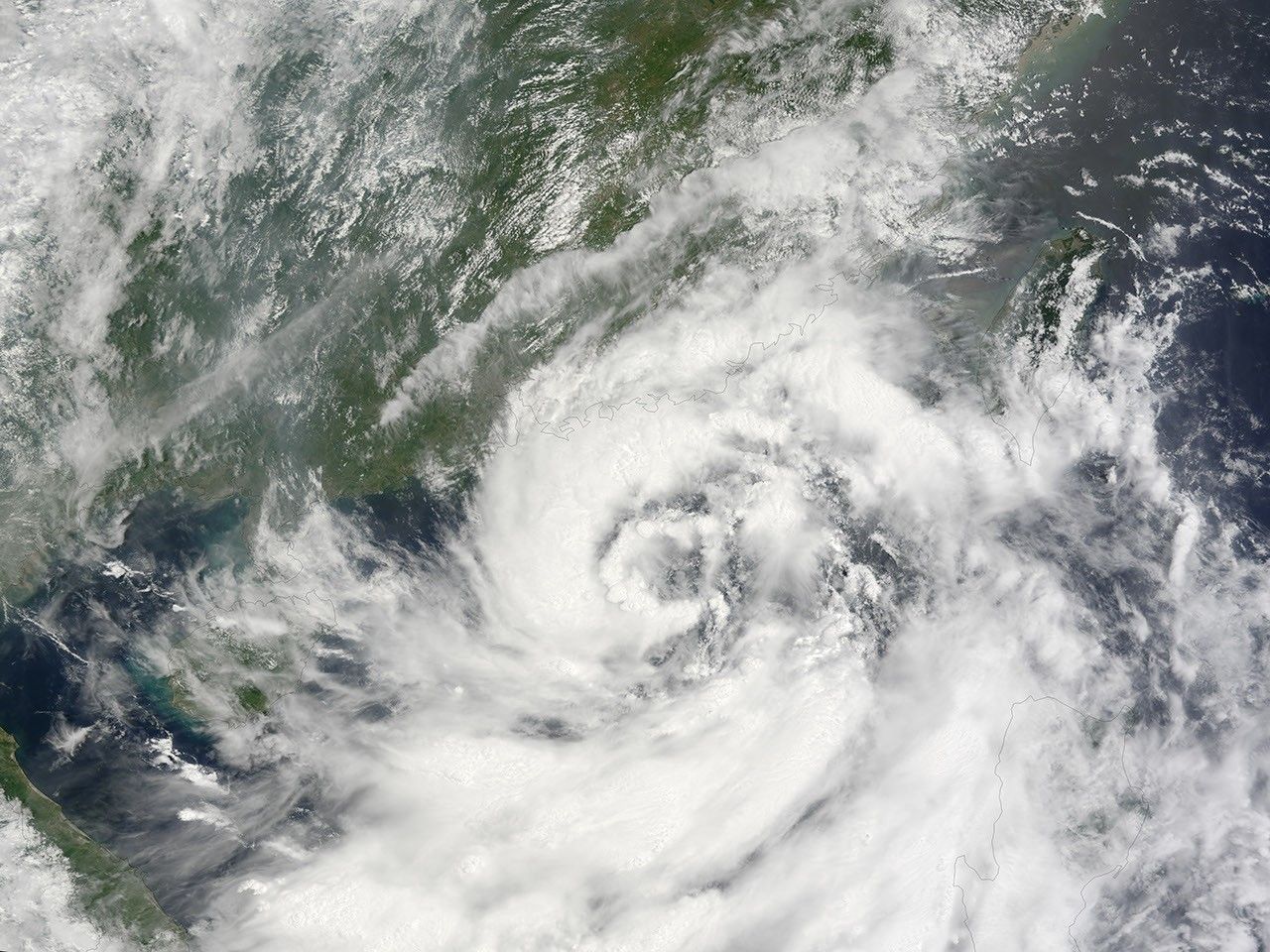
Poised offshore of southern China on August 5, 2008, Tropical Storm Kammuri was a ragged-looking spiral of clouds with only the hint of an eye when the Moderate Resolution Imaging Spectroradiometer (MODIS) on NASA’s Terra satellite passed over head and captured this image. On the day of the image, Kammuri’s winds strengthened from 35 to 45 knots (from 40 to about 52 mph). By August 6, winds had reached 50 knots, and the storm was headed for landfall over Hong Kong, in southern China’s Guangdong Province.
References & Resources
NASA image created by Jesse Allen, using data obtained from the Goddard Land Processes data archives (LAADS). Caption by Rebecca Lindsey.