


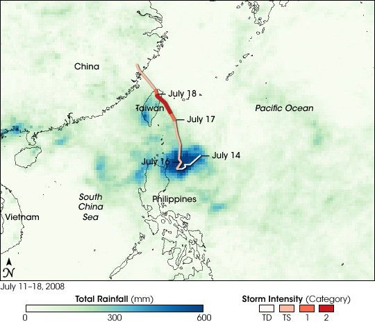
Typhoon Kalmaegi dumped heavy rain (dark blue) off the northeast coast of the Philippines as it was intensifying from a tropical depression (white line segment) to a tropical storm (light orange) between July 14 and July 16, 2008. Kalmaegi intensified to Category 2 typhoon strength (red line) prior to landfall on Taiwan on July 17. Over southern Taiwan, it released another round of heavy rains (light greens and blues).
The rainfall data for this image comes from the Tropical Rainfall Measuring Mission (TRMM) satellite, which measures tropical rainfall using a combination of sensors, including a precipitation radar and a microwave imager. TRMM is a joint mission between NASA and the Japanese Space Agency, JAXA.
References & Resources
NASA image by Jesse Allen, using near-real-time data provided courtesy of TRMM Science Data and Information System at Goddard Space Flight Center.


