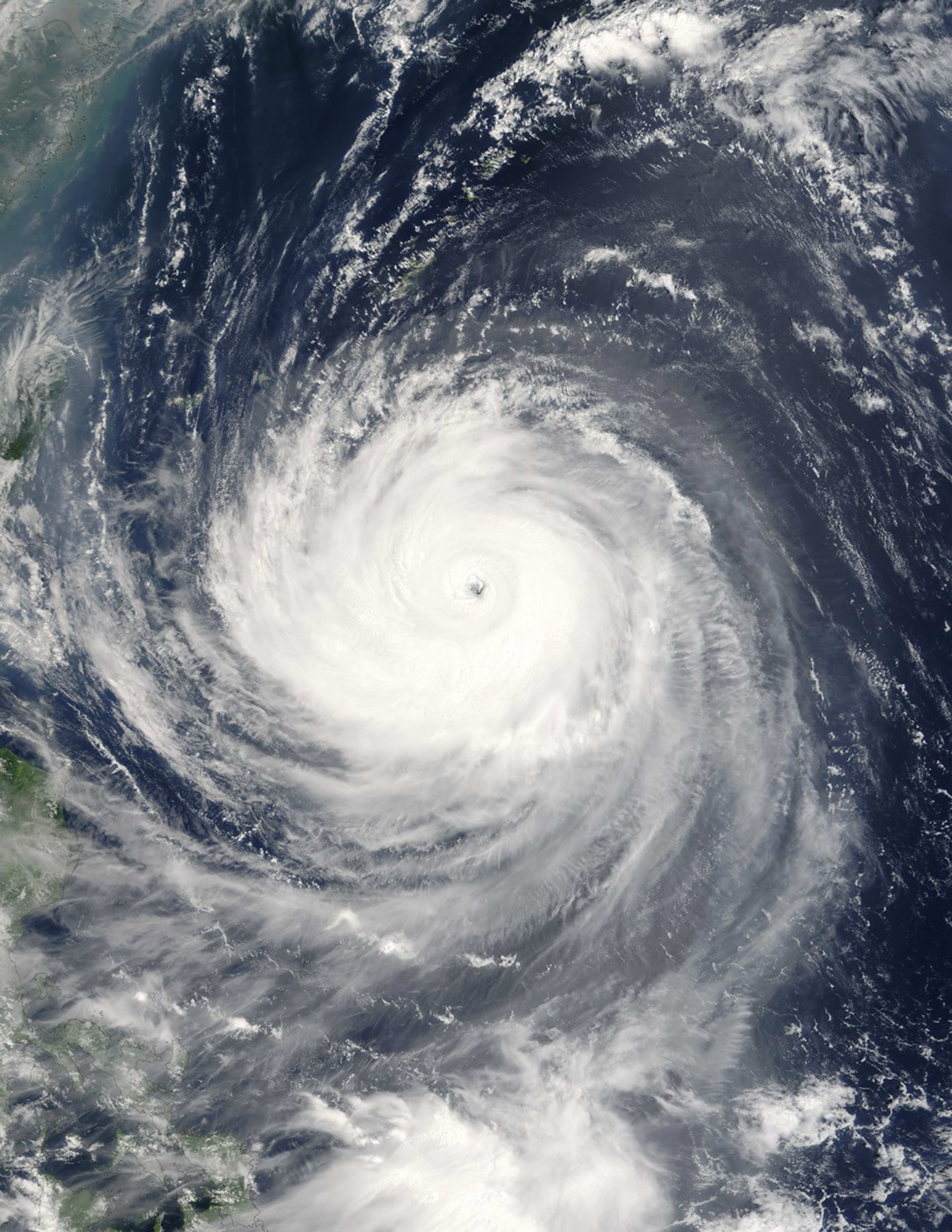
Typhoon Talim was a powerful super typhoon in the western Pacific when the Moderate Resolution Imaging Spectroradiometer (MODIS) on NASA’s Terra satellite captured this image on August 30, 2005. At this time, 11:00 a.m. Tokyo time, it had sustained winds of around 250 kilometers an hour (155 miles per hour) and was heading towards Taiwan at around 15 miles per hour. It was predicted to continue to build strength and strike Taiwan on September 2, and then to continue across the Taiwan Strait to make landfall again on mainland China perhaps a day later. The typhoon was at Category 4 strength as of August 30, making it another super typhoon. It should be a weaker Category 1 regular typhoon when it comes ashore on the mainland. It is the 13th named storm of the Pacific typhoon season, which has seen a record number of storms, and in particular, super typhoons.
The large image provided above has a resolution of 500 meters per pixel. The MODIS Rapid Response Team provides the image in additional resolutions, including MODIS’ maximum resolution of 250 meters per pixel.
References & Resources
NASA image courtesy Jeff Schmaltz, MODIS Land Rapid Response Team at NASA GSFC