![Request for Information – Potential [Placeholder for Prize]](https://assets.science.nasa.gov/dynamicimage/assets/science/missions/a-step/FFR_Earth_Background_20251120%20.png?w=1024)


Earth Science at Work
NASA Earth Science helps Americans respond to challenges and societal needs — such as wildland fires, hurricanes, and water supplies for farming — by putting actionable satellite information into the hands of decisionmakers. NASA conceives, builds, and flies cutting-edge satellites and instruments; harvests data from those tools and from commercial partners; combines it with expert insights and the world’s most advanced models — all to advance solutions for monitoring, prediction, and management.
Why it matters
Using the power of space-based observations, innovative technologies, engineering, science, and partnerships, NASA can offer a comprehensive, digital view of Earth as a system. NASA works across commercial and industrial sectors and federal and international agencies to:
- generate the scientific data necessary to inform decisions from the local to state to federal to international level
- leverage innovation from academia and the private sector to develop novel applications of Earth science information
- create products and analyses that directly address societal needs
- link technology, research & development, and actionable science to ensure rapid transfer from innovation to impact.
- advance America's space exploration goals, using our Earth tools and insights to better prepare us for a sustainable presence on the Moon and Mars.
NASA Earth: Powering America's Future
Did you know the very same cutting-edge technology NASA uses to study other planets is exactly what we use to study our own?
From the ground, air, and skies, NASA gathers information crucial to life here on Earth, and we build instruments and technologies and programs that equip the US to meet critical, real-world challenges.

By 2030, the potential economic value of EO (Earth observations) could exceed $700 billion globally...better data can inform decision-making, optimize solutions and enable innovation.
Amplifying the Global Value of Earth Observation
World Economic Forum report
What We Do
-
NASA's research and data provide a competitive advantage to American businesses and support the U.S. economy.
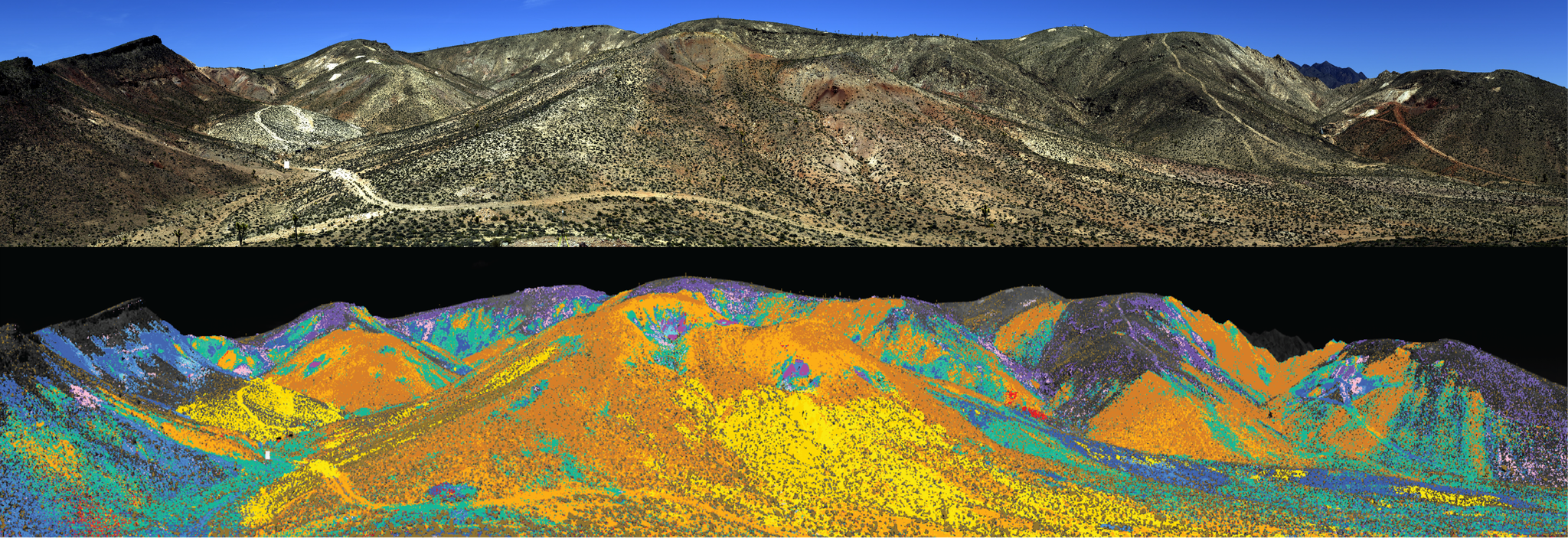
Mapping rare Earth minerals for use in domestic, technology-dominant industries such as telecommunications, energy generation, and aerospace.
Aiding U.S. agriculture with continuous measurements of water resources, crop health, and global production that inform business decisions, improve farm and ranch efficiency, and reduce input costs, resulting in a positive impact from the commodity-trading floor to the grocery store. In FY24, NASA’s Earth science data was downloaded by more than 8.3 million distinct users from a wide variety of fields and industries.NASA, BLM, USGS/Yolanda Fong-Sam
 -
NASA Earth supports national security with valuable information and tools.
Gathering data and establishing parameters that underpin the position, navigation, and timing accuracy of satellites and GPS.
Providing data needed to forecast extreme events like floods -- through the Global HydroIntelligence System.
Enhancing situational awareness of ice cover and other conditions around Arctic seas.
Supplying land surface monitoring capabilities through the Land Information System.
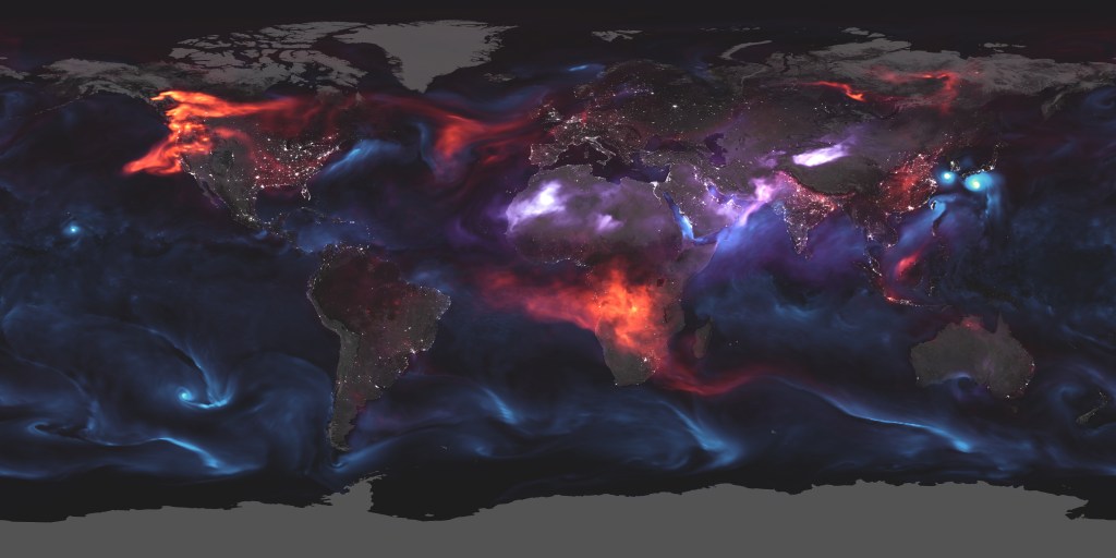
Providing sea level data applicable to U.S. coastal military installations and operations around the world. Satellite observations at night indicate that oil, gas, and mining have expanded across Earth’s northern latitudes.
Data is the key. If we can measure it, we can quantify it, we can solve it.

Dwane Roth
Farmer and OpenET Data User, Finney County, Kansas
-
NASA is improving the nation’s ability to forecast and respond to severe storms, droughts, wildland fires, and other natural hazards.
Offering near real-time data products, early warning tools, and disaster mapping portals.
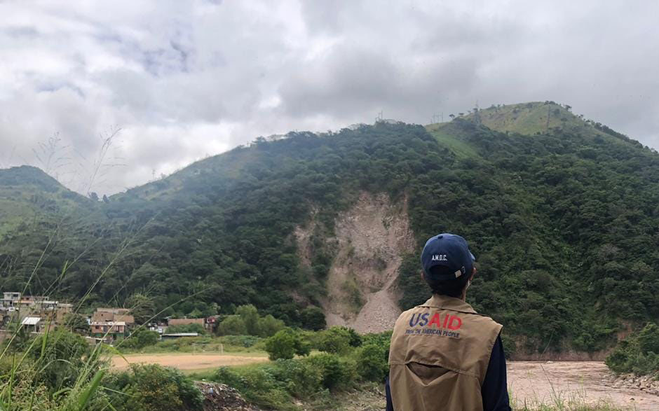
Developing an advanced landslide forecast model.
Improving our understanding of hurricanes and sharing those insights and tools with NOAA’s National Hurricane Center and the Joint Typhoon Warning Center
Working with the U.S. Forest Service and other agencies to provide key observations of conditions before, during, and after wildland fires - such as estimating fuel loads and soil moisture. A selection of four images showing a volcano erupting, flooded streets in Vermont, a hurricane seen from space, and fires burning a hillside.NASA Earth Science Division
 -
Our data supports decision-making that affects human health and quality of life.
Satellite measurements of temperature, humidity, and precipitation help predict outbreaks of mosquito-borne illnesses.
Satellite observations and models help assess freshwater resources from the surface through the root zone to the deep aquifer. Observations of the amount of freshwater stored on land and underground (left) contribute to our understanding of how water availability puts a strain on farmers and communities, potentially leading to famine, conflicts, poverty, and an increased risk of disease, including those transmitted by mosquitoes (right).NASA Earth Observatory, CDC
NASA's consistent sea level rise data is the best way and the best tool for us to make sure that we spend our money carefully and wisely so that the future generations get to enjoy our beaches and bays and rivers just as much as I did.

Casi Callaway
Chief Resilience Officer, City of Mobile, Alabama
Studying Earth from Space
Since the 1960s, we have been observing our own planet because it is the one we need to know best. NASA applies ingenuity and expertise gained from decades of planetary and deep-space exploration to the study of our home planet.
- From Headquarters and multiple NASA centers and labs, the Earth Science Division operates more than 20 satellites in orbit, sponsors hundreds of research programs and studies, and funds opportunities to put data to use for societal needs.
- We develop new ways to observe the oceans, land, ice, atmosphere, and life, and we measure how changes in one drive changes in others over the short and long term.
- While listening to and collaborating with industry leaders, international partners, academic institutions, and other users of our data, we deepen knowledge of our planet, drive innovations, and deliver science to help inform decisions that benefit the nation and the world.
NASA Research and Data in Action
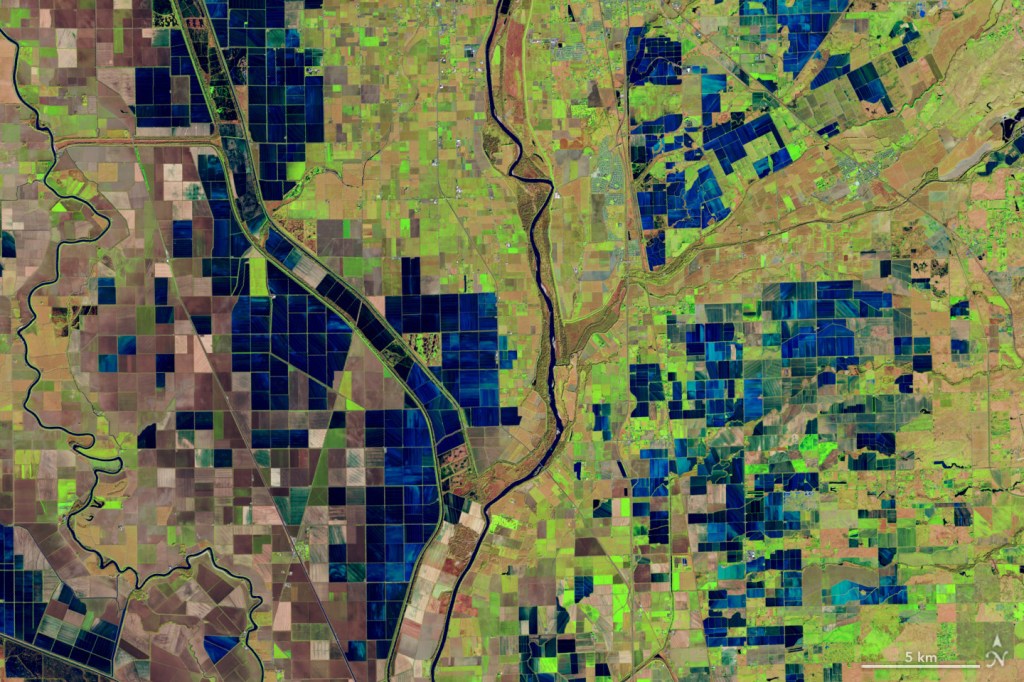
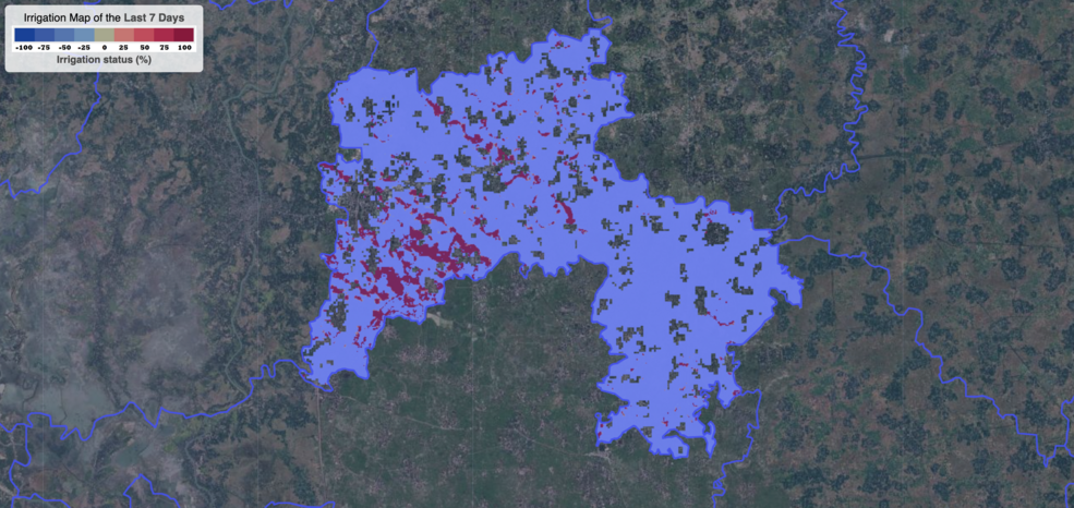
OpenET Study Helps Water Managers and Farmers Put NASA Data to Work
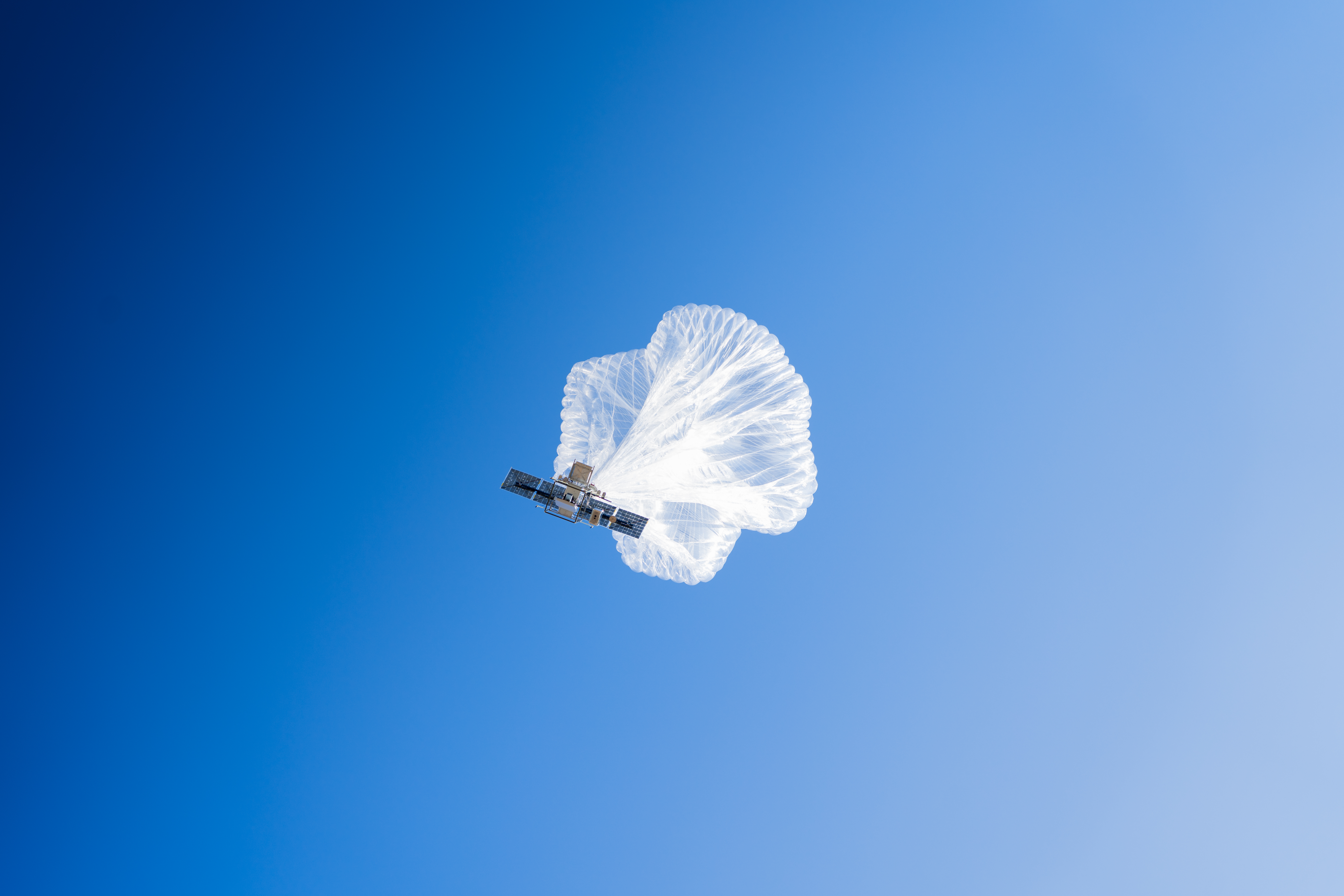
NASA and Forest Service Use Balloon to Help Firefighters Communicate
NASA Flights Map Critical Minerals from Skies Above Western US
NASA Data Helps Protect US Embassy Staff from Polluted Air
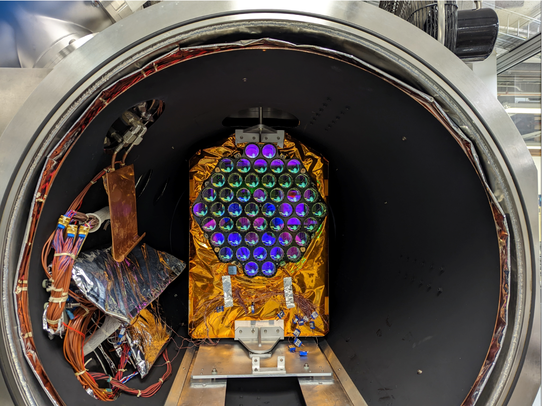
NASA Laser Reflecting Instruments to Help Pinpoint Earth Measurements
NASA, Pacific Disaster Center Increase Landslide Hazard Awareness
NASA Data Helps Bangladeshi Farmers Save Water, Money, Energy
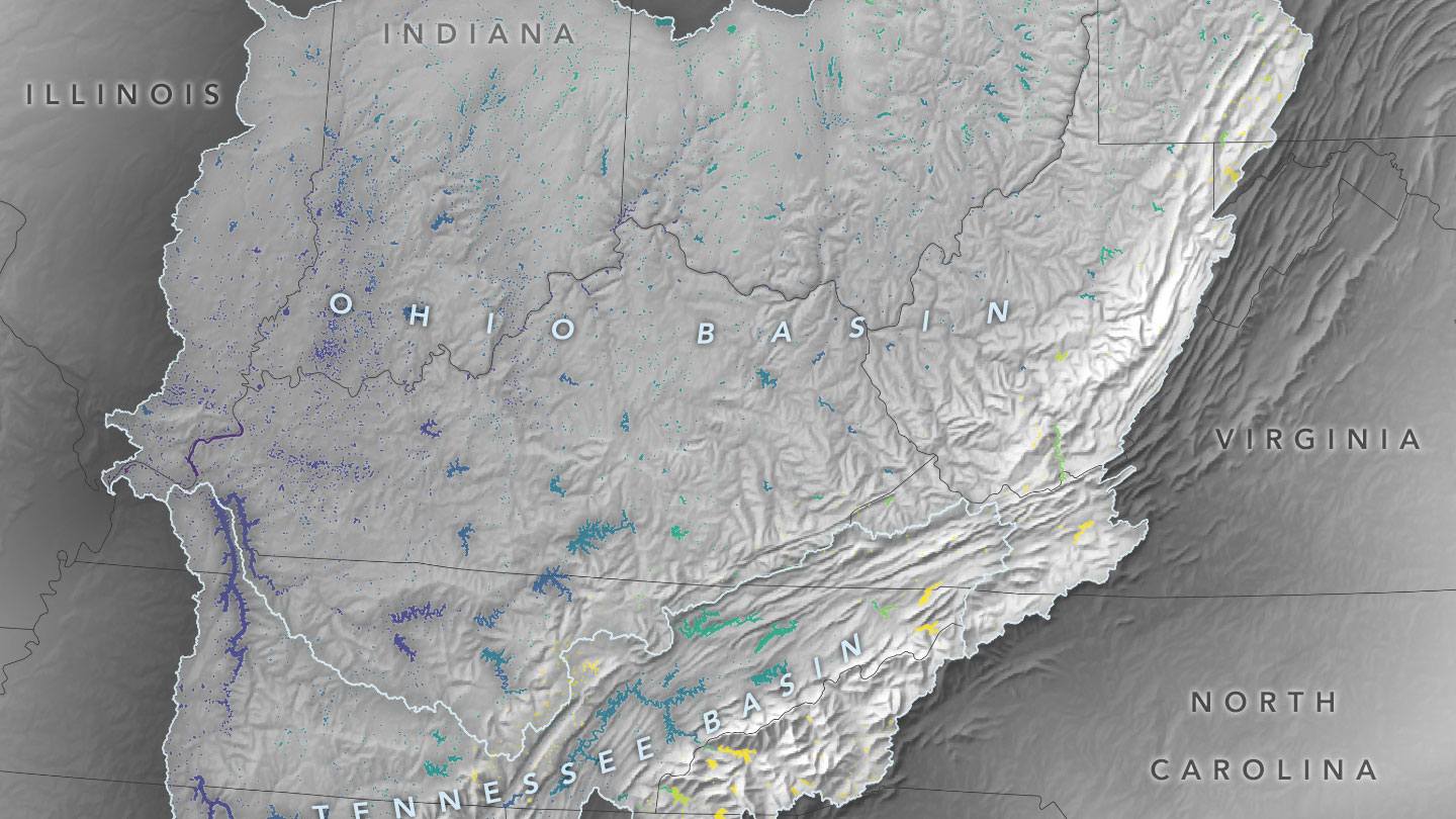
Cutting-Edge Satellite Tracks Lake Water Levels in Ohio River Basin