


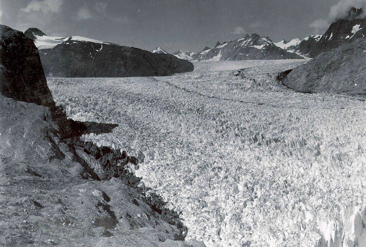

before
after

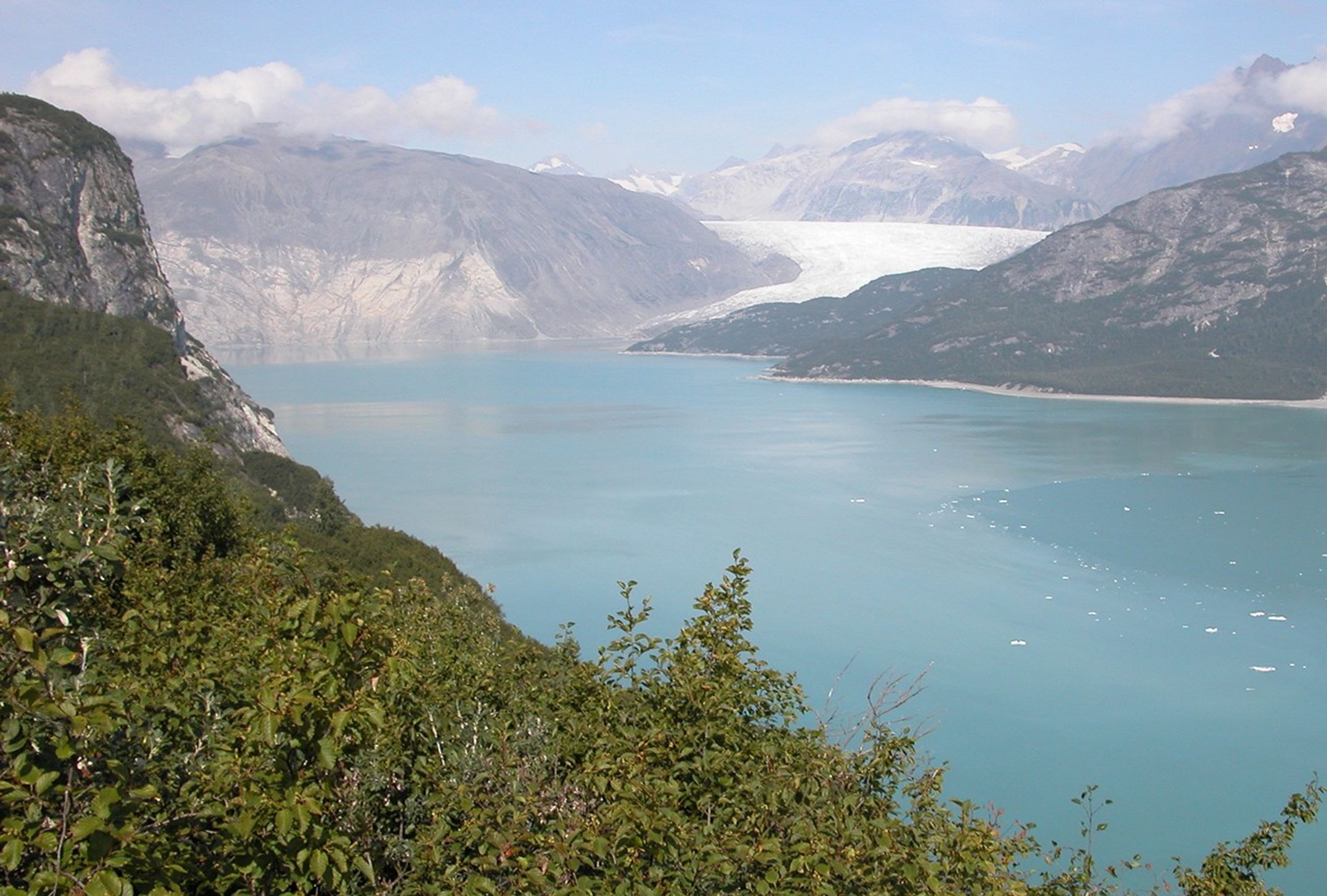
Before and After
Muir Glacier melt, Alaska
August 13, 1941 - August 31, 2004
The 1941 photograph shows the lower reaches of Muir Glacier and its tributary, Riggs Glacier. The two glaciers filled Muir Inlet. In the 2004 photograph, Muir Glacier, continuing a retreat nearly two centuries long, is located about 4 miles (7 kilometers) to the northwest, out of the field of view. Riggs Glacier has retreated some 0.4 miles (0.6 kilometers). Both glaciers have thinned substantially. U.S. Geological Survey, Department of the Interior. Earlier image by W. O. Field, courtesy of the National Snow and Ice Data Center and Glacier Bay National Park and Preserve Archive. Later image is a USGS photograph by Bruce F. Molina.


