


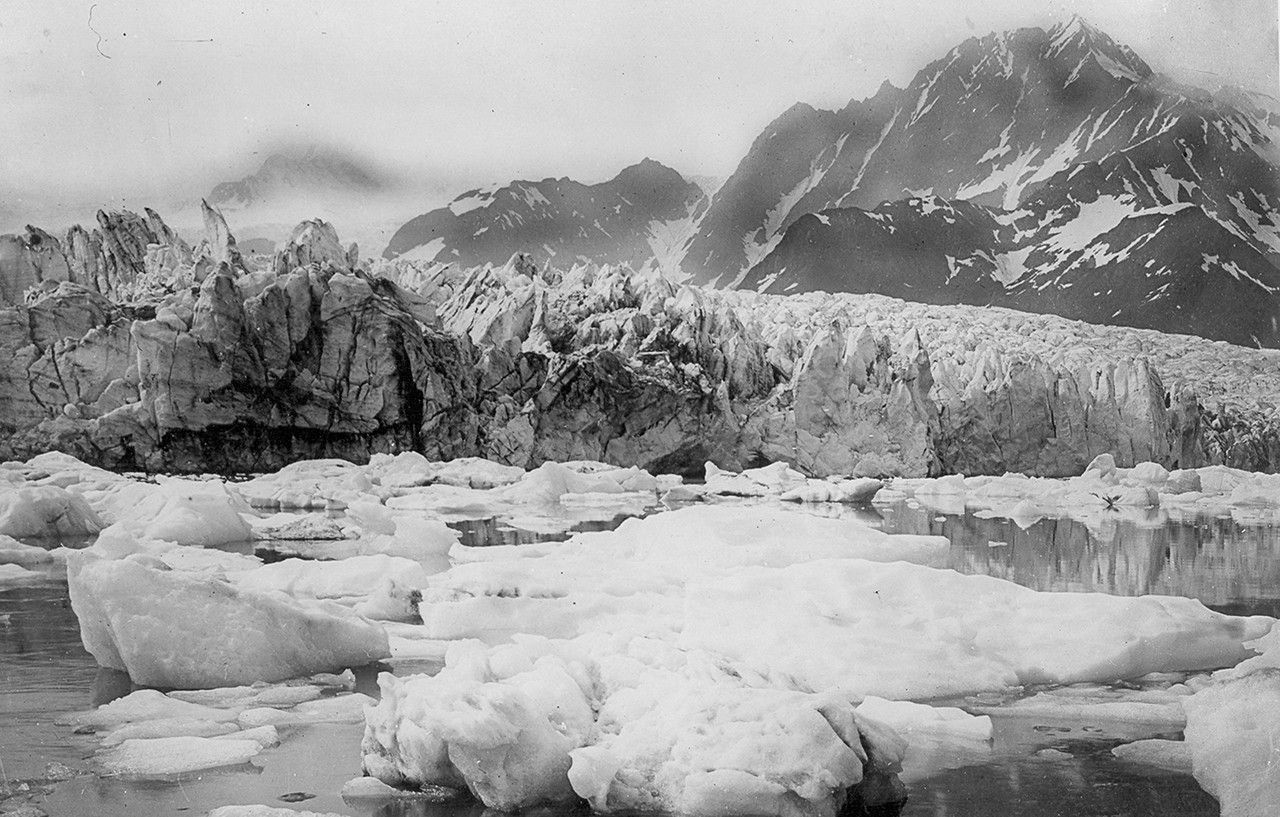
before
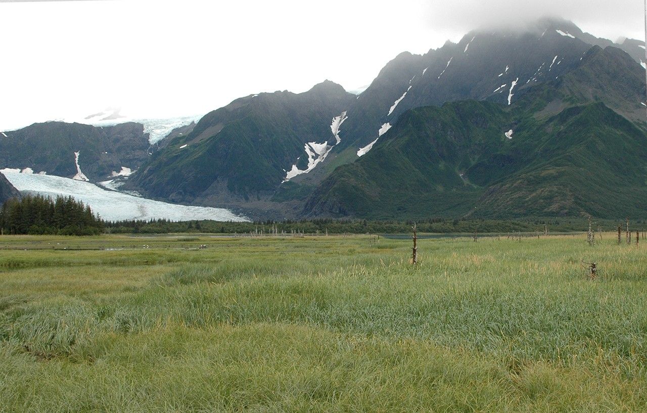
after


Before and After
Pedersen Glacier Melt, Alaska
Summer, mid-1920s to early 1940s - August 10, 2005
The foreground water in the earlier image is part of a lagoon, adjacent to Aialik Bay, into which Pedersen Glacier was calving icebergs. In the 2005 photograph, most of the lagoon has filled with sediment and supports grasses, shrubs and aquatic plants. The dead trees visible among the grasses are remnants of a forest that was drowned when the coast sank by some 10 feet (3 meters) during the 1964 Alaskan Earthquake. Pedersen Glacier’s terminus has retreated more than a mile (2 kilometers) and stands of trees have grown between the wetland and the glacier. The tributary high above Pedersen Glacier separated from it sometime during the third quarter of the 20th century. Credit: U.S. Geological Survey, Department of the Interior. Earlier image is from a postcard by an unknown photographer, courtesy of Kenai Fjords National Park. Later image is a USGS photograph by Bruce F. Molina.


