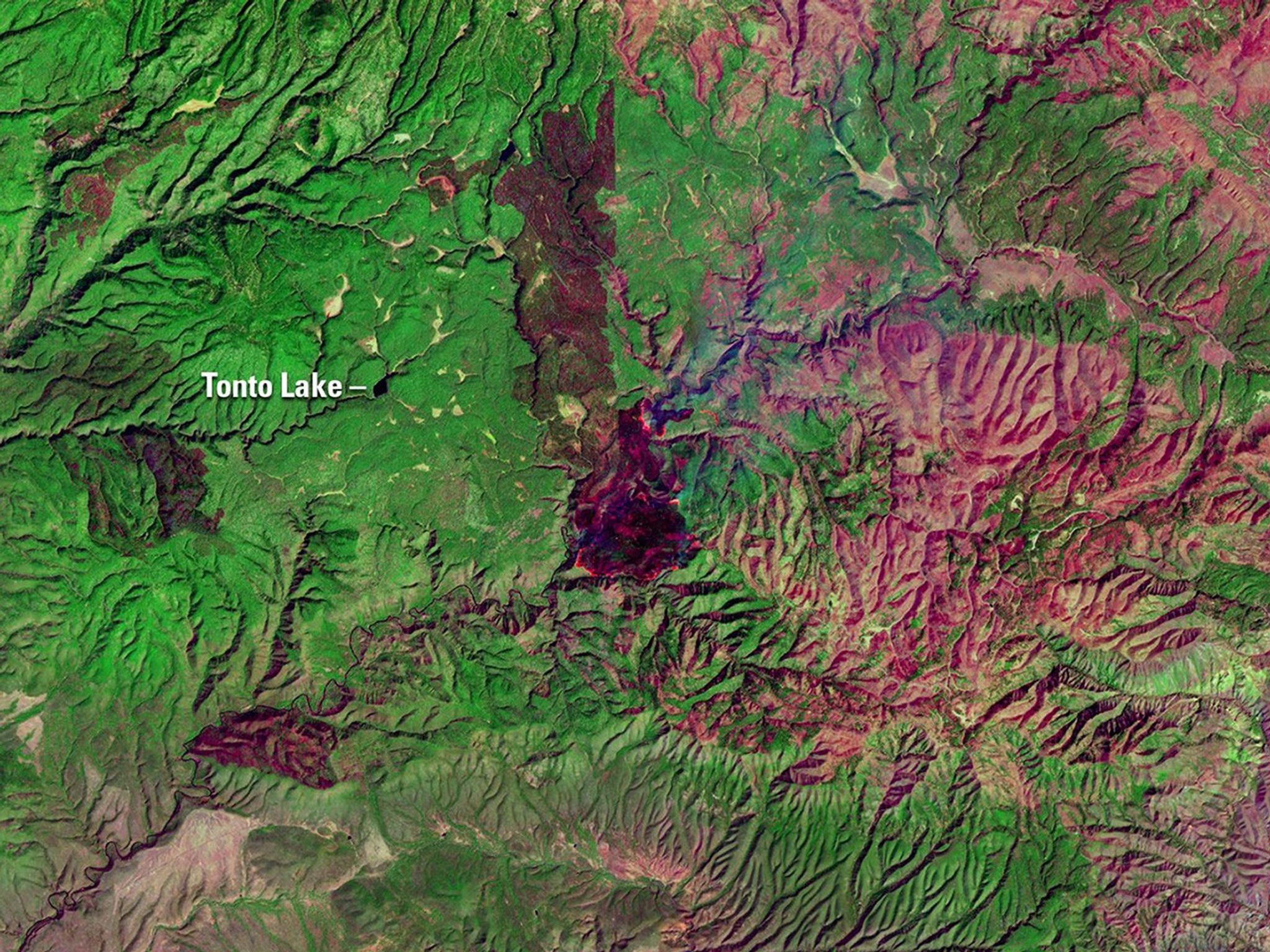
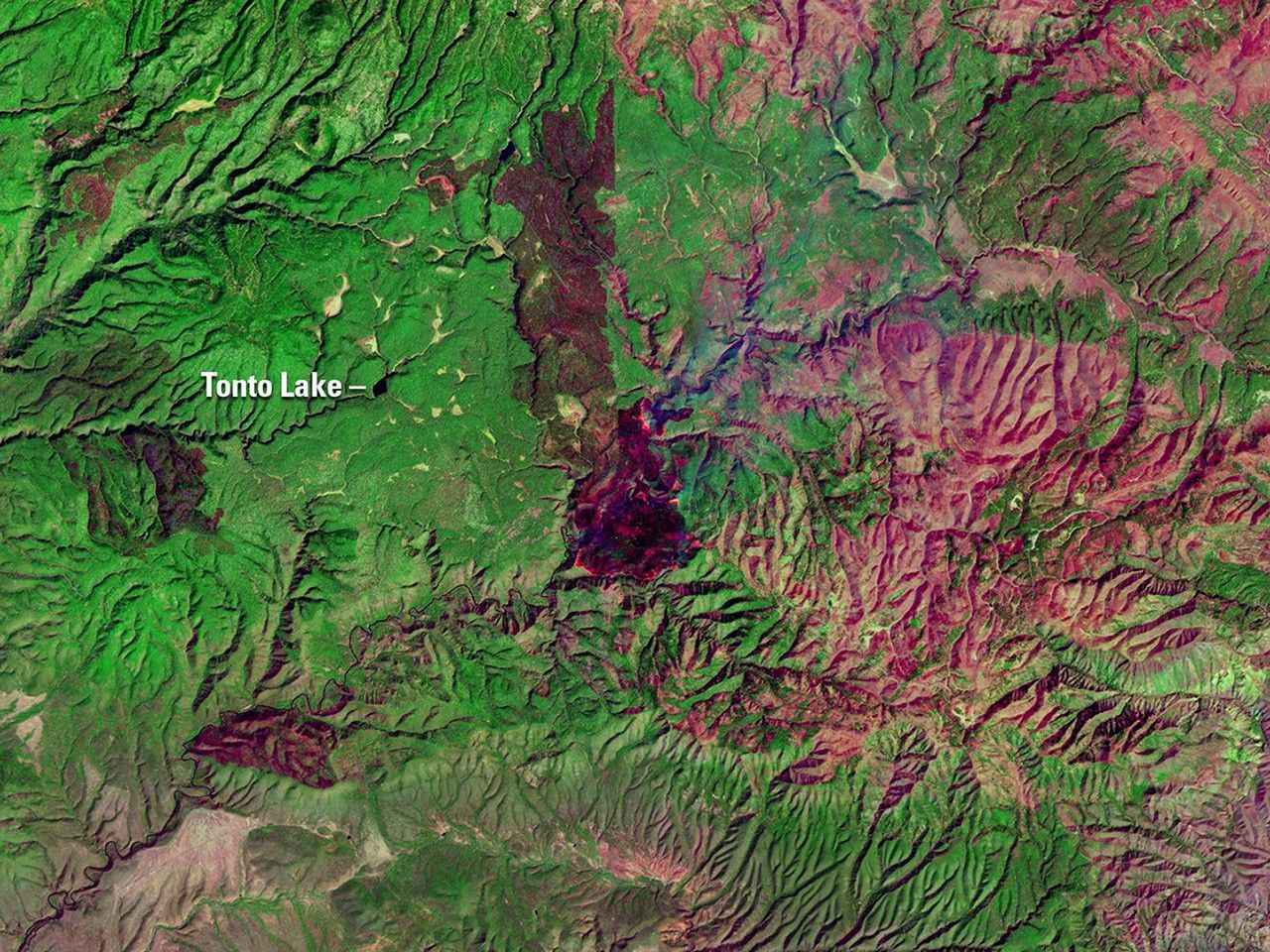
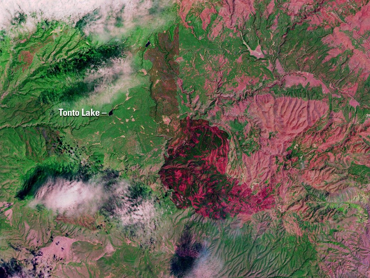
Due to the lapse in federal government funding, NASA is not updating this website.

Suggested Searches

1 min read

Rattlesnake Fire, Arizona

before
after
The Rattlesnake Fire in eastern Arizona, which ignited on April 11, 2018, scorched more than 26,000 acres of the Fort Apache Indian Reservation, San Carlos Indian Reservation, and the Apache-Sitgreaves National Forests. The April image shows the fire emerging from the White Mountains. By the time of the May image, the fire had spread but was mostly contained. These false-color images were taken at infrared wavelengths that clearly distinguish between unburned vegetation (green) and the soil and ash in burned areas (red).   Images taken by Landsat 8. Source: U.S. Geological Survey’s Land Remote Sensing Image Collections

Before and After

Rattlesnake Fire, Arizona

April 15, 2018 - May 1, 2018

The Rattlesnake Fire in eastern Arizona, which ignited on April 11, 2018, scorched more than 26,000 acres of the Fort Apache Indian Reservation, San Carlos Indian Reservation, and the Apache-Sitgreaves National Forests. The April image shows the fire emerging from the White Mountains. By the time of the May image, the fire had spread but was mostly contained. These false-color images were taken at infrared wavelengths that clearly distinguish between unburned vegetation (green) and the soil and ash in burned areas (red). Images taken by Landsat 8. Source: U.S. Geological Survey’s Land Remote Sensing Image Collections

Downloads

Image 1

JPEG

(1 MB)

Image 2

JPEG

(1 MB)