


![Request for Information – Potential [Placeholder for Prize]](https://assets.science.nasa.gov/dynamicimage/assets/science/psd/solar/2023/09/s/solarsystem_0.jpg?w=1024)


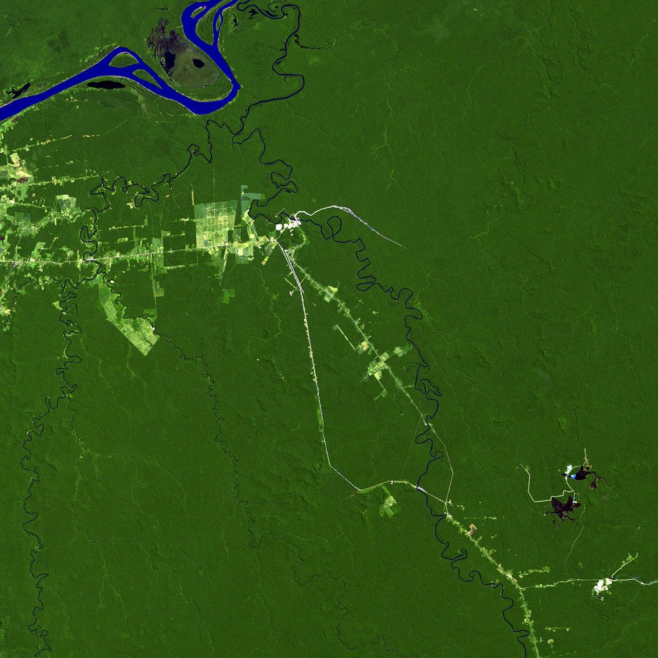
before
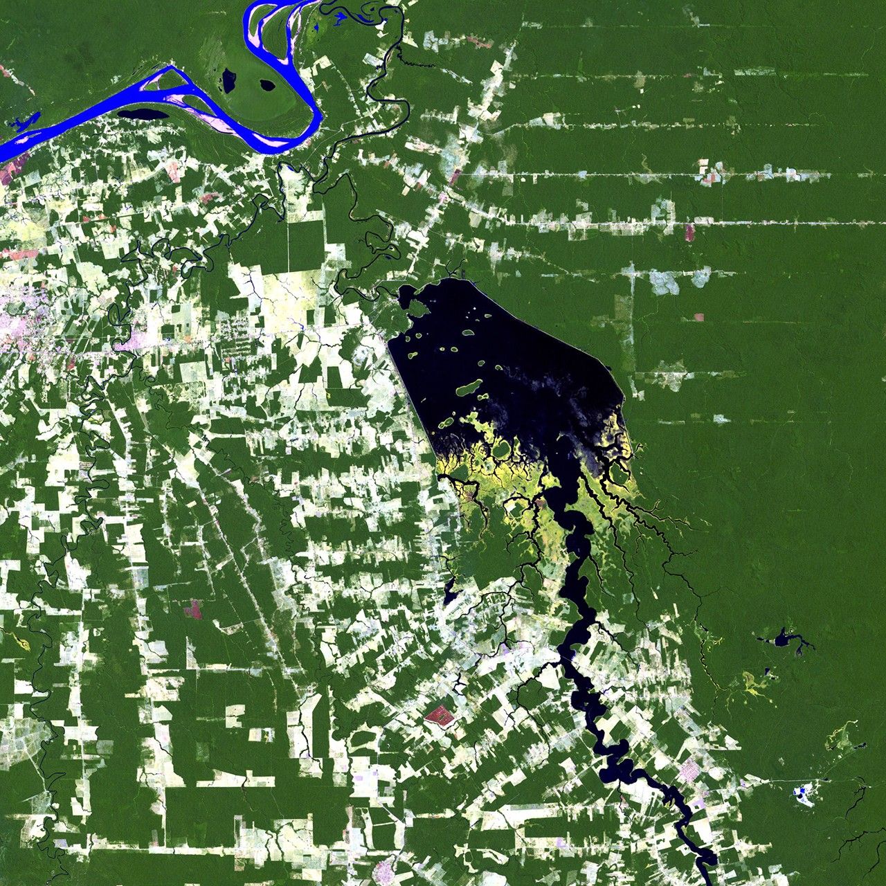
after


Before and After
Samuel Dam impact / Deforestation in Rondonia, Brazil
April 30, 2011 - July 3, 2011
The Samuel Dam is located along the Jamari River in Rondonia, Brazil. These images show the area in 1984, shortly after construction of the hydroelectric dam began, and in 2011. The reservoir created by the dam flooded the upstream forest and displaced many people. Also evident in the images is the deforestation that has affected much of the region. Images taken by the Thematic Mapper sensor aboard Landsat 5. Source: USGS Landsat Missions Gallery, "Samuel Dam, Rondonia, Brazil," U.S. Department of the Interior / U.S. Geological Survey.


